Turda elevation
Turda (Cluj, Municipiul Turda), Romania elevation is 324 meters and Turda elevation in feet is 1063 ft above sea level [src 1]. Turda is a populated place (feature code) with elevation that is 72 meters (236 ft) bigger than average city elevation in Romania.
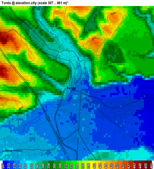
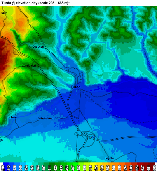
Below is the Elevation map of Turda, which displays elevation range with different colors. Scale of the first map is from 307 to 461 m (1007 to 1512 ft) with average elevation of 350.5 meters (=1150 ft) [note 1]
These maps also provides idea of topography and contour of this city, they are displayed at different zoom levels. More info about maps, scale and edge coordinates you can find below images.
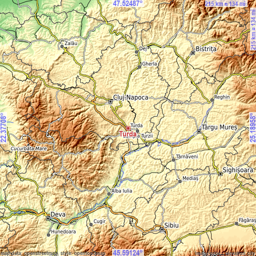
| \ | Map #1 | Map #2 | Topo.Map |
| Scale [m] | 307..461 m | 298..665 m | × |
| Scale [ft] | 1007..1512 ft | 978..2182 ft | × |
| Average | 350.5 m = 1150 ft | 377.1 m = 1237 ft | × |
| Width | 6.72 km = 4.2 mi | 13.44 km = 8.4 mi | 215 km = 133.6 mi |
| Height | 6.72 km = 4.2 mi | 13.44 km = 8.4 mi | 215 km = 133.6 mi |
| ↑Max Latitude | 46.596874° | 46.627062° | 47.52487° |
| Latitude at center | 46.56667° | 46.56667° | 46.56667° |
| ↓Min Latitude | 46.536449° | 46.506211° | 45.59124° |
| ← Min Longitude | 23.739385° | 23.695439° | 22.37708° |
| Longitude center | 23.78333° | 23.78333° | 23.78333° |
| →Max Longitude | 23.827275° | 23.871221° | 25.18958° |
Nearby cities:
Cities around Turda sort by population:
• Câmpia Turzii elevation 299 m
7.9 km,  103°
103°
• Viişoara 340 m
10.4 km, 100°
• Mihai Viteazu 330 m
4.5 km,  214°
214°
• Moldoveneşti 505 m
12.6 km,  233°
233°
• Tureni 521 m
9.3 km,  318°
318°
• Călăraşi 336 m
11.2 km,  145°
145°
• Luna 297 m
12.4 km,  122°
122°
• Petreştii de Jos 471 m
10.4 km,  280°
280°
• Sănduleşti 459 m
5.4 km,  289°
289°
• Aiton 628 m
13.5 km,  343°
343°
• Copăceni 384 m
4.8 km,  314°
314°
• Ploscoș 350 m
9.8 km,  29°
29°
Multilingual:
 En español:
Turda elevación 324 m.
 En France:
Turda élévation 324 m.


Sources and notes:
- [note 1] Map square and city borders are not equal. Map elevation data is calculated only from area inside that square.
- [src 1] Elevation data from geonames database provided with same terms of usage.
- [src 2] The elevation map of Turda is generated using elevation data from NASA's 3 arcsec (90m) resolution SRTM data.
- [src 3] Base (background) map © OpenStreetMap contributors tiles are generated by Geofabrik and OpenTopoMap.
Copyright & License:
This Turda Elevation Map is licensed under CC BY-SA. You may reuse any part from this page, if you give a proper credit by linking to this URL:
 More info on terms of use page.