Ungheni elevation
Ungheni (Arges, Comuna Ungheni), Romania elevation is 189 meters and Ungheni elevation in feet is 620 ft above sea level [src 1]. Ungheni is a seat of a second-order administrative division (feature code) with elevation that is 63 meters (207 ft) smaller than average city elevation in Romania.
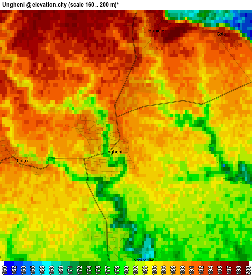
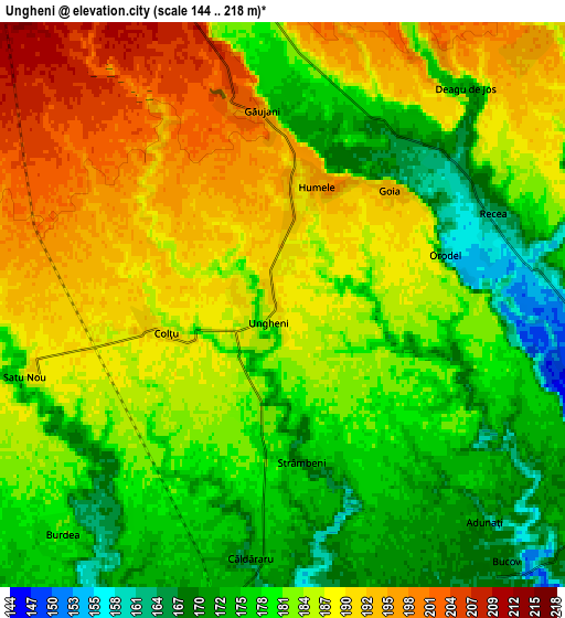
Below is the Elevation map of Ungheni, which displays elevation range with different colors. Scale of the first map is from 160 to 200 m (525 to 656 ft) with average elevation of 186.1 meters (=611 ft) [note 1]
These maps also provides idea of topography and contour of this city, they are displayed at different zoom levels. More info about maps, scale and edge coordinates you can find below images.
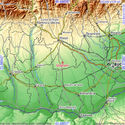
| \ | Map #1 | Map #2 | Topo.Map |
| Scale [m] | 160..200 m | 144..218 m | × |
| Scale [ft] | 525..656 ft | 472..715 ft | × |
| Average | 186.1 m = 611 ft | 183.1 m = 601 ft | × |
| Width | 6.97 km = 4.3 mi | 13.94 km = 8.7 mi | 223 km = 138.6 mi |
| Height | 6.97 km = 4.3 mi | 13.94 km = 8.7 mi | 223 km = 138.6 mi |
| ↑Max Latitude | 44.531336° | 44.562654° | 45.49438° |
| Latitude at center | 44.5° | 44.5° | 44.5° |
| ↓Min Latitude | 44.468648° | 44.437278° | 43.48837° |
| ← Min Longitude | 24.922725° | 24.878779° | 23.56042° |
| Longitude center | 24.96667° | 24.96667° | 24.96667° |
| →Max Longitude | 25.010615° | 25.054561° | 26.37292° |
Nearby cities:
Cities around Ungheni sort by population:
• Buzoeşti elevation 219 m
10.1 km,  336°
336°
• Recea 167 m
5.4 km,  46°
46°
• Căldăraru 175 m
5.7 km,  193°
193°
• Izvoru 169 m
7.8 km,  94°
94°
• Miroşi 158 m
9.6 km,  195°
195°
• Siliștea Gumești 154 m
13.2 km,  168°
168°
• Strâmbeni 169 m
3.5 km, 171°
• Surdulești 161 m
12 km,  183°
183°
• Cornățel 211 m
8.9 km,  353°
353°
• Humele 195 m
3 km,  15°
15°
• Râca 166 m
9.5 km,  140°
140°
• Popeşti 134 m
12.4 km,  121°
121°
Multilingual:
 En español:
Ungheni elevación 189 m.
 En France:
Ungheni élévation 189 m.


Sources and notes:
- [note 1] Map square and city borders are not equal. Map elevation data is calculated only from area inside that square.
- [src 1] Elevation data from geonames database provided with same terms of usage.
- [src 2] The elevation map of Ungheni is generated using elevation data from NASA's 3 arcsec (90m) resolution SRTM data.
- [src 3] Base (background) map © OpenStreetMap contributors tiles are generated by Geofabrik and OpenTopoMap.
Copyright & License:
This Ungheni Elevation Map is licensed under CC BY-SA. You may reuse any part from this page, if you give a proper credit by linking to this URL:
 More info on terms of use page.