Ungureni-Jianu elevation
Ungureni-Jianu (Botoşani, Comuna Ungureni), Romania elevation is 110 meters and Ungureni-Jianu elevation in feet is 361 ft above sea level [src 1]. Ungureni-Jianu is a section of populated place (feature code) with elevation that is 142 meters (466 ft) smaller than average city elevation in Romania.
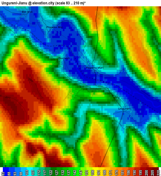
Below is the Elevation map of Ungureni-Jianu, which displays elevation range with different colors. Scale of the first map is from 83 to 210 m (272 to 689 ft) with average elevation of 139.4 meters (=457 ft) [note 1]
These maps also provides idea of topography and contour of this city, they are displayed at different zoom levels. More info about maps, scale and edge coordinates you can find below images.

| \ | Map #1 | Map #2 | Topo.Map |
| Scale [m] | 83..210 m | 82..243 m | × |
| Scale [ft] | 272..689 ft | 269..797 ft | × |
| Average | 139.4 m = 457 ft | 158.8 m = 521 ft | × |
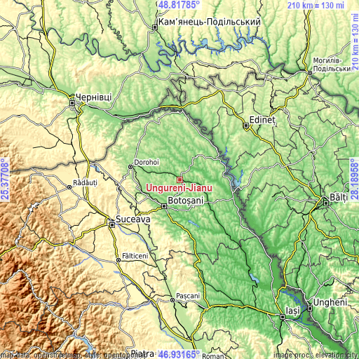
| Width | 6.55 km = 4.1 mi | 13.11 km = 8.1 mi | 209.7 km = 130.3 mi |
| Height | 6.55 km = 4.1 mi | 13.11 km = 8.1 mi | 209.7 km = 130.3 mi |
| ↑Max Latitude | 47.912793° | 47.94224° | 48.81785° |
| Latitude at center | 47.88333° | 47.88333° | 47.88333° |
| ↓Min Latitude | 47.85385° | 47.824353° | 46.93165° |
| ← Min Longitude | 26.739385° | 26.695439° | 25.37708° |
| Longitude center | 26.78333° | 26.78333° | 26.78333° |
| →Max Longitude | 26.827275° | 26.871221° | 28.18958° |
Nearby cities:
Cities around Ungureni-Jianu sort by population:
• Săveni elevation 83 m
9.7 km,  39°
39°
• Vorniceni 199 m
14.1 km,  321°
321°
• Gorbăneşti 213 m
12.2 km,  155°
155°
• Vlăsineşti 116 m
9.3 km,  53°
53°
• Unţeni 107 m
9.3 km,  180°
180°
• Nicşeni 138 m
11.3 km,  260°
260°
• Ştiubieni 106 m
9.3 km,  0°
0°
• Ungureni 99 m
1.2 km,  98°
98°
• Dorobanți 187 m
10.1 km,  269°
269°
• Costești 123 m
12.2 km,  220°
220°
• Sârbi 102 m
12 km,  56°
56°
• Iacobeni 94 m
10 km, 104°
Multilingual:
 En español:
Ungureni-Jianu elevación 110 m.
 En France:
Ungureni-Jianu élévation 110 m.
 Auf Deutsch:
Ungureni-Jianu höhe über dem Meeresspiegel ist 110 m.

Sources and notes:
- [note 1] Map square and city borders are not equal. Map elevation data is calculated only from area inside that square.
- [src 1] Elevation data from geonames database provided with same terms of usage.
- [src 2] The elevation map of Ungureni-Jianu is generated using elevation data from NASA's 3 arcsec (90m) resolution SRTM data.
- [src 3] Base (background) map © OpenStreetMap contributors tiles are generated by Geofabrik and OpenTopoMap.
Copyright & License:
This Ungureni-Jianu Elevation Map is licensed under CC BY-SA. You may reuse any part from this page, if you give a proper credit by linking to this URL:
 More info on terms of use page.