Veţel elevation
Veţel (Hunedoara, Comuna Veţel), Romania elevation is 211 meters and Veţel elevation in feet is 692 ft above sea level [src 1]. Veţel is a seat of a second-order administrative division (feature code) with elevation that is 41 meters (135 ft) smaller than average city elevation in Romania.
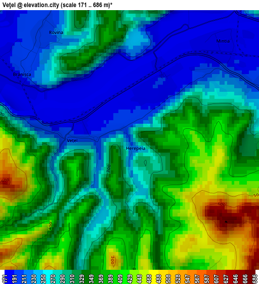
Below is the Elevation map of Veţel, which displays elevation range with different colors. Scale of the first map is from 171 to 686 m (561 to 2251 ft) with average elevation of 313.9 meters (=1030 ft) [note 1]
These maps also provides idea of topography and contour of this city, they are displayed at different zoom levels. More info about maps, scale and edge coordinates you can find below images.
| \ | Map #1 | Topo.Map |
| Scale [m] | 171..686 m | × |
| Scale [ft] | 561..2251 ft | × |
| Average | 313.9 m = 1030 ft | × |
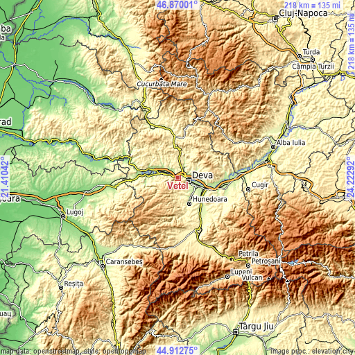
| Width | 6.8 km = 4.2 mi | 217.6 km = 135.2 mi |
| Height | 6.8 km = 4.2 mi | 217.6 km = 135.2 mi |
| ↑Max Latitude | 45.930574° | 46.87001° |
| Latitude at center | 45.9° | 45.9° |
| ↓Min Latitude | 45.869409° | 44.91275° |
| ← Min Longitude | 22.772725° | 21.41042° |
| Longitude center | 22.81667° | 22.81667° |
| →Max Longitude | 22.860615° | 24.22292° |
Nearby cities:
Cities around Veţel sort by population:
• Deva elevation 196 m
6.7 km,  106°
106°
• Băiţa 280 m
16.2 km,  23°
23°
• Ilia 171 m
13.4 km,  286°
286°
• Şoimuş 194 m
6.7 km,  73°
73°
• Certeju de Sus 279 m
13.8 km,  57°
57°
• Hărău 182 m
10.3 km,  90°
90°
• Brănişca 204 m
3.2 km,  305°
305°
• Cristur 202 m
12.6 km,  128°
128°
• Peștișu Mare 209 m
13.9 km,  141°
141°
• Peştişu Mic 245 m
12.3 km,  155°
155°
• Cârjiţi 463 m
5.7 km,  166°
166°
• Cerbăl 746 m
15.1 km,  210°
210°
Multilingual:
 En español:
Veţel elevación 211 m.
 En France:
Veţel élévation 211 m.


Sources and notes:
- [note 1] Map square and city borders are not equal. Map elevation data is calculated only from area inside that square.
- [src 1] Elevation data from geonames database provided with same terms of usage.
- [src 2] The elevation map of Veţel is generated using elevation data from NASA's 3 arcsec (90m) resolution SRTM data.
- [src 3] Base (background) map © OpenStreetMap contributors tiles are generated by Geofabrik and OpenTopoMap.
Copyright & License:
This Veţel Elevation Map is licensed under CC BY-SA. You may reuse any part from this page, if you give a proper credit by linking to this URL:
 More info on terms of use page.