Zăpodeni elevation
Zăpodeni (Vaslui, Comuna Zăpodeni), Romania elevation is 160 meters and Zăpodeni elevation in feet is 525 ft above sea level [src 1]. Zăpodeni is a seat of a second-order administrative division (feature code) with elevation that is 92 meters (302 ft) smaller than average city elevation in Romania.
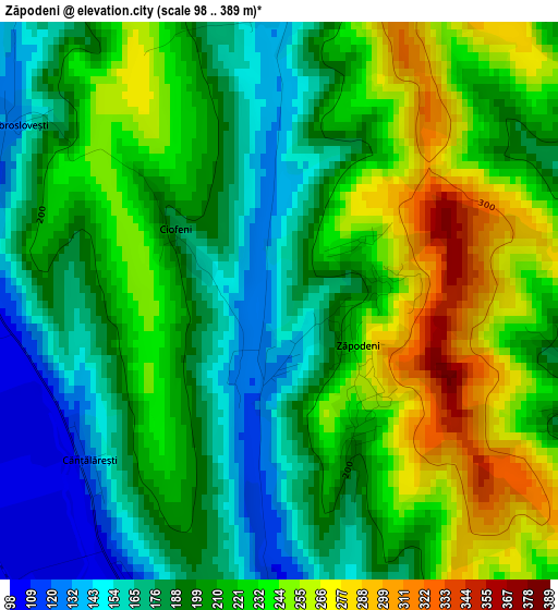
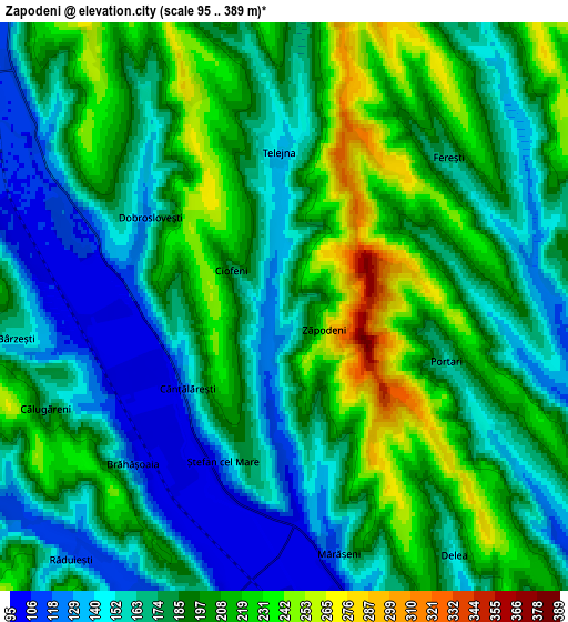
Below is the Elevation map of Zăpodeni, which displays elevation range with different colors. Scale of the first map is from 98 to 389 m (322 to 1276 ft) with average elevation of 209.4 meters (=687 ft) [note 1]
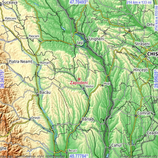
These maps also provides idea of topography and contour of this city, they are displayed at different zoom levels. More info about maps, scale and edge coordinates you can find below images.
| \ | Map #1 | Map #2 | Topo.Map |
| Scale [m] | 98..389 m | 95..389 m | × |
| Scale [ft] | 322..1276 ft | 312..1276 ft | × |
| Average | 209.4 m = 687 ft | 183.9 m = 603 ft | × |
| Width | 6.7 km = 4.2 mi | 13.39 km = 8.3 mi | 214.3 km = 133.2 mi |
| Height | 6.7 km = 4.2 mi | 13.39 km = 8.3 mi | 214.3 km = 133.2 mi |
| ↑Max Latitude | 46.780102° | 46.810188° | 47.70493° |
| Latitude at center | 46.75° | 46.75° | 46.75° |
| ↓Min Latitude | 46.719881° | 46.689745° | 45.77784° |
| ← Min Longitude | 27.606055° | 27.562109° | 26.24375° |
| Longitude center | 27.65° | 27.65° | 27.65° |
| →Max Longitude | 27.693945° | 27.737891° | 29.05625° |
Nearby cities:
Cities around Zăpodeni sort by population:
• Deleşti elevation 216 m
9.4 km,  233°
233°
• Soleşti 108 m
10.3 km,  79°
79°
• Ştefan cel Mare 106 m
4 km,  203°
203°
• Văleni 175 m
8.4 km,  92°
92°
• Dăneşti 216 m
11.2 km,  6°
6°
• Ferești 168 m
5.2 km,  47°
47°
• Satu Nou 109 m
9.6 km,  128°
128°
• Brodoc 100 m
11.2 km,  169°
169°
• Bălteni 188 m
9.6 km, 195°
• Moara Domnească 105 m
9.2 km,  115°
115°
• Bârzești 190 m
7.6 km,  270°
270°
• Sauca 171 m
11.3 km, 197°
Multilingual:
 En español:
Zăpodeni elevación 160 m.
 En France:
Zăpodeni élévation 160 m.
 Auf Deutsch:
Zăpodeni höhe über dem Meeresspiegel ist 160 m.

Sources and notes:
- [note 1] Map square and city borders are not equal. Map elevation data is calculated only from area inside that square.
- [src 1] Elevation data from geonames database provided with same terms of usage.
- [src 2] The elevation map of Zăpodeni is generated using elevation data from NASA's 3 arcsec (90m) resolution SRTM data.
- [src 3] Base (background) map © OpenStreetMap contributors tiles are generated by Geofabrik and OpenTopoMap.
Copyright & License:
This Zăpodeni Elevation Map is licensed under CC BY-SA. You may reuse any part from this page, if you give a proper credit by linking to this URL:
 More info on terms of use page.