Brito elevation
Brito (Braga, Guimarães), Portugal elevation is 149 meters and Brito elevation in feet is 489 ft above sea level [src 1]. Brito is a populated place (feature code) with elevation that is 19 meters (62 ft) smaller than average city elevation in Portugal.
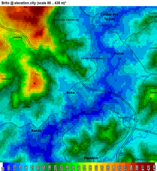
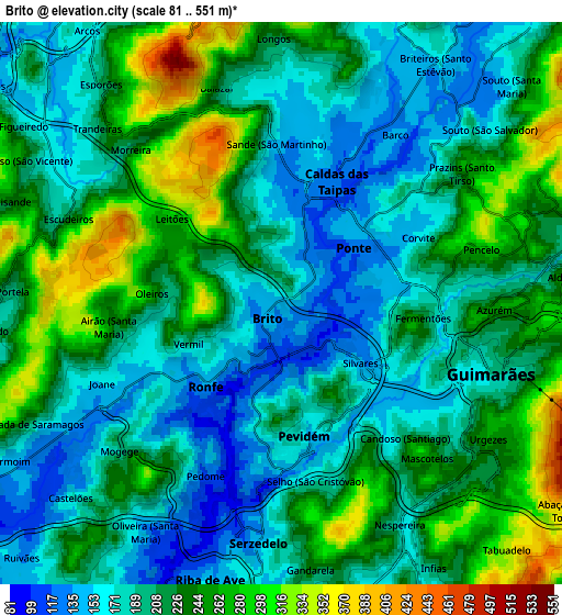
Below is the Elevation map of Brito, which displays elevation range with different colors. Scale of the first map is from 88 to 438 m (289 to 1437 ft) with average elevation of 177.1 meters (=581 ft) [note 1]
These maps also provides idea of topography and contour of this city, they are displayed at different zoom levels. More info about maps, scale and edge coordinates you can find below images.
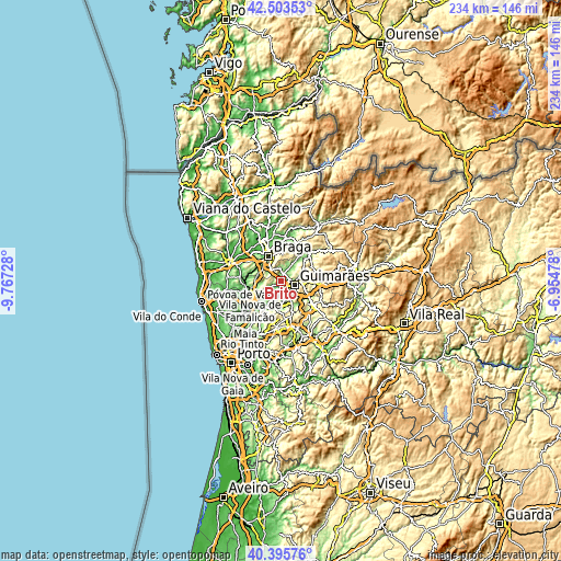
| \ | Map #1 | Map #2 | Topo.Map |
| Scale [m] | 88..438 m | 81..551 m | × |
| Scale [ft] | 289..1437 ft | 266..1808 ft | × |
| Average | 177.1 m = 581 ft | 213.7 m = 701 ft | × |
| Width | 7.32 km = 4.5 mi | 14.65 km = 9.1 mi | 234.4 km = 145.6 mi |
| Height | 7.32 km = 4.5 mi | 14.65 km = 9.1 mi | 234.4 km = 145.6 mi |
| ↑Max Latitude | 41.491136° | 41.524045° | 42.50353° |
| Latitude at center | 41.45821° | 41.45821° | 41.45821° |
| ↓Min Latitude | 41.425267° | 41.392308° | 40.39576° |
| ← Min Longitude | -8.404975° | -8.448921° | -9.76728° |
| Longitude center | -8.36103° | -8.36103° | -8.36103° |
| →Max Longitude | -8.317085° | -8.273139° | -6.95478° |
Nearby cities:
Cities around Brito sort by population:
• Guimarães elevation 189 m
5.6 km,  105°
105°
• Selho 180 m
4.5 km,  163°
163°
• Joane 139 m
4.5 km,  241°
241°
• Ponte 133 m
2.9 km,  62°
62°
• Caldas das Taipas 131 m
3.1 km,  19°
19°
• Urgeses 252 m
6.3 km,  123°
123°
• Ronfe 153 m
2.7 km,  225°
225°
• Serzedelo 149 m
6.4 km,  185°
185°
• Candoso 205 m
4.7 km,  135°
135°
• Riba de Ave 113 m
7.2 km,  197°
197°
• Esporões 221 m
7.4 km,  320°
320°
• Guisande 238 m
7.6 km,  291°
291°
Multilingual:
 En español:
Brito elevación 149 m.
 En France:
Brito élévation 149 m.


Sources and notes:
- [note 1] Map square and city borders are not equal. Map elevation data is calculated only from area inside that square.
- [src 1] Elevation data from geonames database provided with same terms of usage.
- [src 2] The elevation map of Brito is generated using elevation data from NASA's 3 arcsec (90m) resolution SRTM data.
- [src 3] Base (background) map © OpenStreetMap contributors tiles are generated by Geofabrik and OpenTopoMap.
Copyright & License:
This Brito Elevation Map is licensed under CC BY-SA. You may reuse any part from this page, if you give a proper credit by linking to this URL:
 More info on terms of use page.