Melres elevation
Melres (Porto, Gondomar), Portugal elevation is 44 meters and Melres elevation in feet is 144 ft above sea level [src 1]. Melres is a populated place (feature code) with elevation that is 124 meters (407 ft) smaller than average city elevation in Portugal.
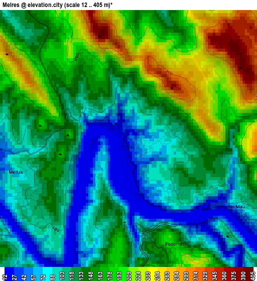
Below is the Elevation map of Melres, which displays elevation range with different colors. Scale of the first map is from 12 to 405 m (39 to 1329 ft) with average elevation of 144.1 meters (=473 ft) [note 1]
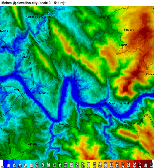
These maps also provides idea of topography and contour of this city, they are displayed at different zoom levels. More info about maps, scale and edge coordinates you can find below images.
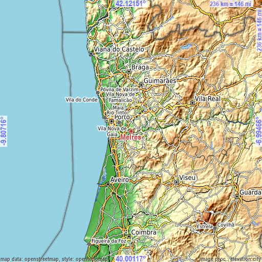
| \ | Map #1 | Map #2 | Topo.Map |
| Scale [m] | 12..405 m | 0..511 m | × |
| Scale [ft] | 39..1329 ft | 0..1677 ft | × |
| Average | 144.1 m = 473 ft | 179.7 m = 590 ft | × |
| Width | 7.37 km = 4.6 mi | 14.74 km = 9.2 mi | 235.8 km = 146.5 mi |
| Height | 7.37 km = 4.6 mi | 14.74 km = 9.2 mi | 235.8 km = 146.5 mi |
| ↑Max Latitude | 41.103012° | 41.136118° | 42.12151° |
| Latitude at center | 41.06989° | 41.06989° | 41.06989° |
| ↓Min Latitude | 41.036751° | 41.003595° | 40.00117° |
| ← Min Longitude | -8.444855° | -8.488801° | -9.80716° |
| Longitude center | -8.40091° | -8.40091° | -8.40091° |
| →Max Longitude | -8.356965° | -8.313019° | -6.99466° |
Nearby cities:
Cities around Melres sort by population:
• São Pedro da Cova elevation 73 m
11.7 km,  314°
314°
• Moreira 75 m
1.8 km,  147°
147°
• Argoncilhe 167 m
12.6 km,  246°
246°
• Alpendurada 216 m
13.1 km,  80°
80°
• Jovim 87 m
10.9 km,  294°
294°
• Sandim 179 m
9.7 km, 246°
• Foz do Sousa 48 m
9 km, 289°
• Lobão 213 m
11.7 km,  217°
217°
• Olival 184 m
12.2 km,  259°
259°
• Recarei 85 m
9.3 km,  354°
354°
• Rio Mau 32 m
3.1 km,  120°
120°
• Castelo de Paiva 31 m
11.4 km,  93°
93°
Multilingual:
 En español:
Melres elevación 44 m.
 En France:
Melres élévation 44 m.


Sources and notes:
- [note 1] Map square and city borders are not equal. Map elevation data is calculated only from area inside that square.
- [src 1] Elevation data from geonames database provided with same terms of usage.
- [src 2] The elevation map of Melres is generated using elevation data from NASA's 3 arcsec (90m) resolution SRTM data.
- [src 3] Base (background) map © OpenStreetMap contributors tiles are generated by Geofabrik and OpenTopoMap.
Copyright & License:
This Melres Elevation Map is licensed under CC BY-SA. You may reuse any part from this page, if you give a proper credit by linking to this URL:
 More info on terms of use page.