Miranda do Corvo elevation
Miranda do Corvo (Coimbra), Portugal elevation is 102 meters and Miranda do Corvo elevation in feet is 335 ft above sea level [src 1]. Miranda do Corvo is a seat of a second-order administrative division (feature code) with elevation that is 66 meters (217 ft) smaller than average city elevation in Portugal.
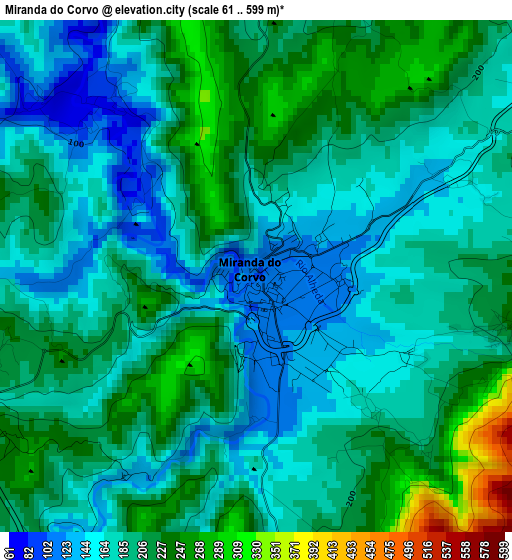
Below is the Elevation map of Miranda do Corvo, which displays elevation range with different colors. Scale of the first map is from 61 to 599 m (200 to 1965 ft) with average elevation of 194.3 meters (=637 ft) [note 1]
These maps also provides idea of topography and contour of this city, they are displayed at different zoom levels. More info about maps, scale and edge coordinates you can find below images.
| \ | Map #1 | Map #2 | Topo.Map |
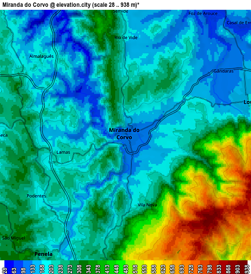
| Scale [m] | 61..599 m | 28..938 m | × |
| Scale [ft] | 200..1965 ft | 92..3077 ft | × |
| Average | 194.3 m = 637 ft | 275.5 m = 904 ft | × |
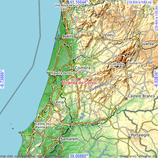
| Width | 7.48 km = 4.6 mi | 14.95 km = 9.3 mi | 239.2 km = 148.6 mi |
| Height | 7.48 km = 4.6 mi | 14.95 km = 9.3 mi | 239.2 km = 148.6 mi |
| ↑Max Latitude | 40.12679° | 40.160383° | 41.16044° |
| Latitude at center | 40.09318° | 40.09318° | 40.09318° |
| ↓Min Latitude | 40.059554° | 40.025911° | 39.00892° |
| ← Min Longitude | -8.376555° | -8.420501° | -9.73886° |
| Longitude center | -8.33261° | -8.33261° | -8.33261° |
| →Max Longitude | -8.288665° | -8.244719° | -6.92636° |
Nearby cities:
Cities around Miranda do Corvo sort by population:
• Coimbra elevation 98 m
14.5 km,  329°
329°
• Santo António dos Olivais 122 m
15.2 km,  336°
336°
• Condeixa-a-Nova 109 m
14.2 km,  278°
278°
• Lousã 150 m
7.6 km,  69°
69°
• Santa Clara 14 m
15 km,  322°
322°
• Poiares 136 m
14.5 km,  26°
26°
• Assafarge 171 m
11.2 km,  310°
310°
• Lorvão 174 m
18.5 km,  4°
4°
• Castanheira de Pêra 478 m
14.1 km,  132°
132°
• Penacova 143 m
20 km,  12°
12°
• Góis 201 m
20.2 km, 69°
• Penela 164 m
7.9 km,  212°
212°
Multilingual:
 En español:
Miranda do Corvo elevación 102 m.
 En France:
Miranda do Corvo élévation 102 m.
 Auf Deutsch:
Miranda do Corvo höhe über dem Meeresspiegel ist 102 m.

Sources and notes:
- [note 1] Map square and city borders are not equal. Map elevation data is calculated only from area inside that square.
- [src 1] Elevation data from geonames database provided with same terms of usage.
- [src 2] The elevation map of Miranda do Corvo is generated using elevation data from NASA's 3 arcsec (90m) resolution SRTM data.
- [src 3] Base (background) map © OpenStreetMap contributors tiles are generated by Geofabrik and OpenTopoMap.
Copyright & License:
This Miranda do Corvo Elevation Map is licensed under CC BY-SA. You may reuse any part from this page, if you give a proper credit by linking to this URL:
 More info on terms of use page.