Ponte de Lima elevation
Ponte de Lima (Viana do Castelo), Portugal elevation is 13 meters and Ponte de Lima elevation in feet is 43 ft above sea level [src 1]. Ponte de Lima is a seat of a second-order administrative division (feature code) with elevation that is 155 meters (509 ft) smaller than average city elevation in Portugal.
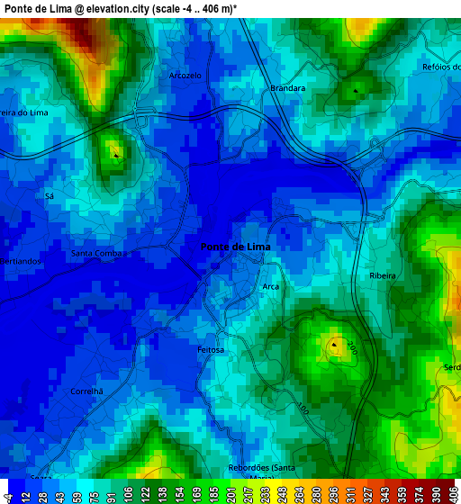
Below is the Elevation map of Ponte de Lima, which displays elevation range with different colors. Scale of the first map is from -4 to 406 m (-13 to 1332 ft) with average elevation of 75.9 meters (=249 ft) [note 1]
These maps also provides idea of topography and contour of this city, they are displayed at different zoom levels. More info about maps, scale and edge coordinates you can find below images.
| \ | Map #1 | Map #2 | Topo.Map |
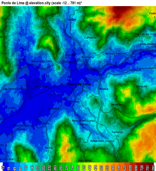
| Scale [m] | -4..406 m | -12..781 m | × |
| Scale [ft] | -13..1332 ft | -39..2562 ft | × |
| Average | 75.9 m = 249 ft | 173.2 m = 568 ft | × |
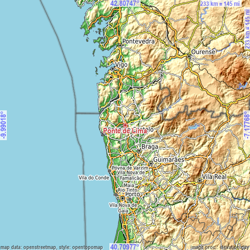
| Width | 7.29 km = 4.5 mi | 14.58 km = 9.1 mi | 233.2 km = 144.9 mi |
| Height | 7.29 km = 4.5 mi | 14.58 km = 9.1 mi | 233.2 km = 144.9 mi |
| ↑Max Latitude | 41.799959° | 41.83271° | 42.80747° |
| Latitude at center | 41.76719° | 41.76719° | 41.76719° |
| ↓Min Latitude | 41.734405° | 41.701603° | 40.70977° |
| ← Min Longitude | -8.627875° | -8.671821° | -9.99018° |
| Longitude center | -8.58393° | -8.58393° | -8.58393° |
| →Max Longitude | -8.539985° | -8.496039° | -7.17768° |
Nearby cities:
Cities around Ponte de Lima sort by population:
• Arcos de Valdevez elevation 42 m
16.3 km,  57°
57°
• Meadela 6 m
18.9 km,  249°
249°
• Darque 9 m
17.8 km,  238°
238°
• Sande 195 m
17.5 km,  114°
114°
• Mozelos 108 m
19.1 km,  54°
54°
• Caldelas 78 m
19.9 km,  122°
122°
• Prado 30 m
20.9 km,  151°
151°
• Vila Verde 77 m
18.1 km,  137°
137°
• Ponte da Barca 58 m
14.6 km,  73°
73°
• Lago 72 m
21.6 km, 138°
• Rendufe 87 m
21.2 km, 136°
• Paredes de Coura 392 m
16 km,  6°
6°
Multilingual:
 En español:
Ponte de Lima elevación 13 m.
 En France:
Ponte de Lima élévation 13 m.
 Auf Deutsch:
Ponte de Lima höhe über dem Meeresspiegel ist 13 m.

Sources and notes:
- [note 1] Map square and city borders are not equal. Map elevation data is calculated only from area inside that square.
- [src 1] Elevation data from geonames database provided with same terms of usage.
- [src 2] The elevation map of Ponte de Lima is generated using elevation data from NASA's 3 arcsec (90m) resolution SRTM data.
- [src 3] Base (background) map © OpenStreetMap contributors tiles are generated by Geofabrik and OpenTopoMap.
Copyright & License:
This Ponte de Lima Elevation Map is licensed under CC BY-SA. You may reuse any part from this page, if you give a proper credit by linking to this URL:
 More info on terms of use page.