Sande elevation
Sande (Braga, Vila Verde), Portugal elevation is 195 meters and Sande elevation in feet is 640 ft above sea level [src 1]. Sande is a populated place (feature code) with elevation that is 27 meters (89 ft) bigger than average city elevation in Portugal.
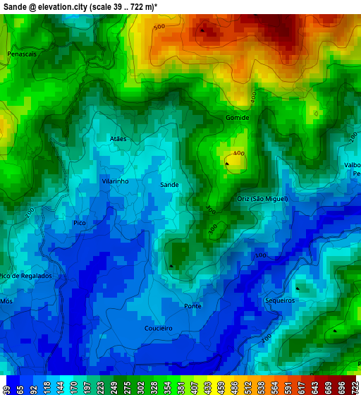
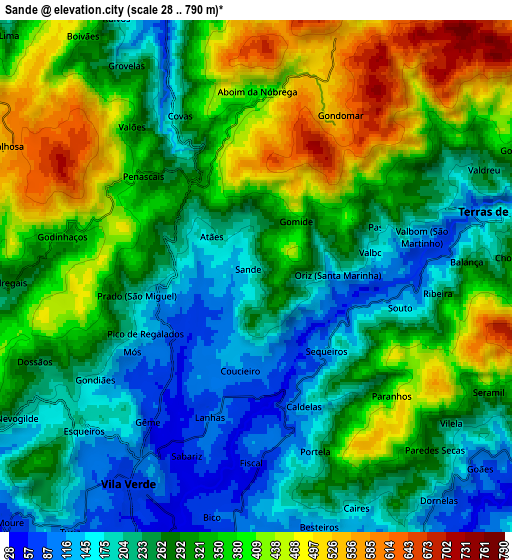
Below is the Elevation map of Sande, which displays elevation range with different colors. Scale of the first map is from 39 to 722 m (128 to 2369 ft) with average elevation of 232.4 meters (=762 ft) [note 1]
These maps also provides idea of topography and contour of this city, they are displayed at different zoom levels. More info about maps, scale and edge coordinates you can find below images.
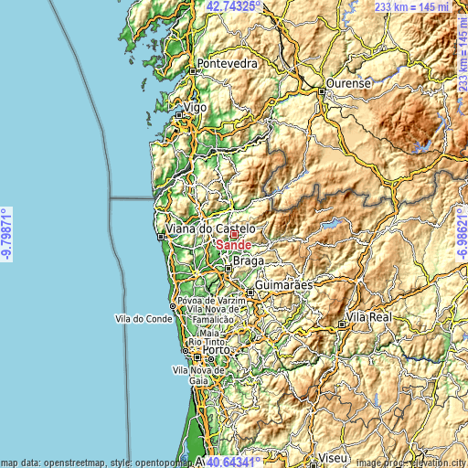
| \ | Map #1 | Map #2 | Topo.Map |
| Scale [m] | 39..722 m | 28..790 m | × |
| Scale [ft] | 128..2369 ft | 92..2592 ft | × |
| Average | 232.4 m = 762 ft | 303.4 m = 995 ft | × |
| Width | 7.3 km = 4.5 mi | 14.59 km = 9.1 mi | 233.5 km = 145.1 mi |
| Height | 7.3 km = 4.5 mi | 14.59 km = 9.1 mi | 233.5 km = 145.1 mi |
| ↑Max Latitude | 41.734702° | 41.767487° | 42.74325° |
| Latitude at center | 41.7019° | 41.7019° | 41.7019° |
| ↓Min Latitude | 41.669081° | 41.636246° | 40.64341° |
| ← Min Longitude | -8.436405° | -8.480351° | -9.79871° |
| Longitude center | -8.39246° | -8.39246° | -8.39246° |
| →Max Longitude | -8.348515° | -8.304569° | -6.98621° |
Nearby cities:
Cities around Sande sort by population:
• Caldelas elevation 78 m
3.6 km,  165°
165°
• Merelim 57 m
14.3 km,  205°
205°
• Prado 30 m
12.5 km, 207°
• Vila Verde 77 m
7.1 km, 211°
• Ponte da Barca 58 m
11.6 km,  350°
350°
• Adaúfe 115 m
12.7 km,  182°
182°
• Frossos 56 m
15.9 km,  197°
197°
• Ferreiros 110 m
8.2 km,  163°
163°
• Lago 72 m
9.1 km,  190°
190°
• Rendufe 87 m
8.2 km, 189°
• Amares 92 m
8.6 km, 156°
• Terras de Bouro 149 m
7.2 km,  75°
75°
Multilingual:
 En español:
Sande elevación 195 m.
 En France:
Sande élévation 195 m.


Sources and notes:
- [note 1] Map square and city borders are not equal. Map elevation data is calculated only from area inside that square.
- [src 1] Elevation data from geonames database provided with same terms of usage.
- [src 2] The elevation map of Sande is generated using elevation data from NASA's 3 arcsec (90m) resolution SRTM data.
- [src 3] Base (background) map © OpenStreetMap contributors tiles are generated by Geofabrik and OpenTopoMap.
Copyright & License:
This Sande Elevation Map is licensed under CC BY-SA. You may reuse any part from this page, if you give a proper credit by linking to this URL:
 More info on terms of use page.