Tocha elevation
Tocha (Coimbra, Cantanhede), Portugal elevation is 66 meters and Tocha elevation in feet is 217 ft above sea level [src 1]. Tocha is a populated place (feature code) with elevation that is 102 meters (335 ft) smaller than average city elevation in Portugal.
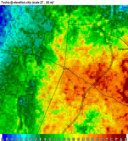
Below is the Elevation map of Tocha, which displays elevation range with different colors. Scale of the first map is from 27 to 83 m (89 to 272 ft) with average elevation of 55.2 meters (=181 ft) [note 1]
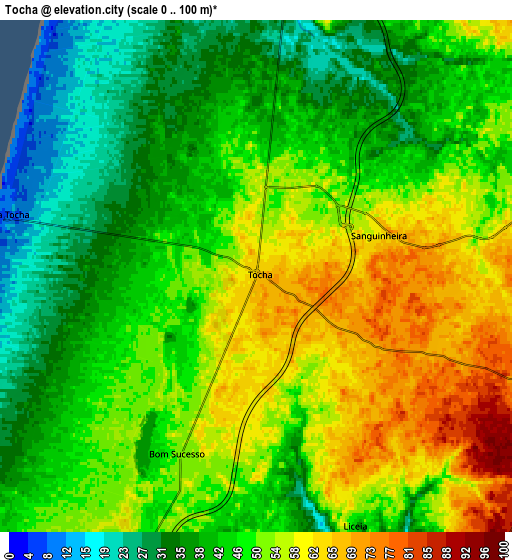
These maps also provides idea of topography and contour of this city, they are displayed at different zoom levels. More info about maps, scale and edge coordinates you can find below images.
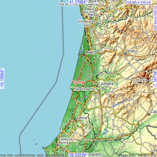
| \ | Map #1 | Map #2 | Topo.Map |
| Scale [m] | 27..83 m | 0..100 m | × |
| Scale [ft] | 89..272 ft | 0..328 ft | × |
| Average | 55.2 m = 181 ft | 47.5 m = 156 ft | × |
| Width | 7.45 km = 4.6 mi | 14.9 km = 9.3 mi | 238.5 km = 148.2 mi |
| Height | 7.45 km = 4.6 mi | 14.9 km = 9.3 mi | 238.4 km = 148.1 mi |
| ↑Max Latitude | 40.346581° | 40.380065° | 41.37684° |
| Latitude at center | 40.31308° | 40.31308° | 40.31308° |
| ↓Min Latitude | 40.279562° | 40.246028° | 39.23229° |
| ← Min Longitude | -8.797335° | -8.841281° | -10.15964° |
| Longitude center | -8.75339° | -8.75339° | -8.75339° |
| →Max Longitude | -8.709445° | -8.665499° | -7.34714° |
Nearby cities:
Cities around Tocha sort by population:
• Figueira da Foz elevation 15 m
20.2 km,  207°
207°
• Tavarede 41 m
18 km, 205°
• Buarcos 25 m
19.4 km, 212°
• Mira 32 m
13 km,  5°
5°
• Cantanhede 63 m
14 km,  74°
74°
• Arazede 89 m
9.3 km,  108°
108°
• Lavos 58 m
25.2 km,  194°
194°
• Alhadas 76 m
14.5 km, 192°
• Montemor-o-Velho 20 m
16.6 km,  159°
159°
• Carapinheira 34 m
14.9 km,  143°
143°
• Ançã 48 m
20.2 km,  103°
103°
• Alfarelos 59 m
20 km,  154°
154°
Multilingual:
 En español:
Tocha elevación 66 m.
 En France:
Tocha élévation 66 m.


Sources and notes:
- [note 1] Map square and city borders are not equal. Map elevation data is calculated only from area inside that square.
- [src 1] Elevation data from geonames database provided with same terms of usage.
- [src 2] The elevation map of Tocha is generated using elevation data from NASA's 3 arcsec (90m) resolution SRTM data.
- [src 3] Base (background) map © OpenStreetMap contributors tiles are generated by Geofabrik and OpenTopoMap.
Copyright & License:
This Tocha Elevation Map is licensed under CC BY-SA. You may reuse any part from this page, if you give a proper credit by linking to this URL:
 More info on terms of use page.