Alcabideche elevation
Alcabideche (Lisbon, Cascais), Portugal elevation is 122 meters and Alcabideche elevation in feet is 400 ft above sea level [src 1]. Alcabideche is a populated place (feature code) with elevation that is 46 meters (151 ft) smaller than average city elevation in Portugal.
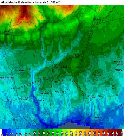
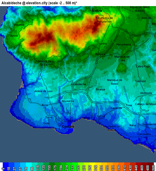
Below is the Elevation map of Alcabideche, which displays elevation range with different colors. Scale of the first map is from 0 to 392 m (0 to 1286 ft) with average elevation of 114.1 meters (=374 ft) [note 1]
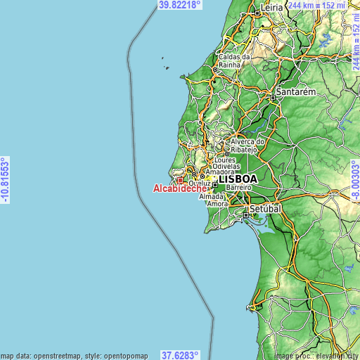
These maps also provides idea of topography and contour of this city, they are displayed at different zoom levels. More info about maps, scale and edge coordinates you can find below images.
| \ | Map #1 | Map #2 | Topo.Map |
| Scale [m] | 0..392 m | -2..508 m | × |
| Scale [ft] | 0..1286 ft | -7..1667 ft | × |
| Average | 114.1 m = 374 ft | 144.2 m = 473 ft | × |
| Width | 7.62 km = 4.7 mi | 15.25 km = 9.5 mi | 243.9 km = 151.6 mi |
| Height | 7.62 km = 4.7 mi | 15.25 km = 9.5 mi | 243.9 km = 151.6 mi |
| ↑Max Latitude | 38.767932° | 38.802187° | 39.82218° |
| Latitude at center | 38.73366° | 38.73366° | 38.73366° |
| ↓Min Latitude | 38.699372° | 38.665067° | 37.6283° |
| ← Min Longitude | -9.453225° | -9.497171° | -10.81553° |
| Longitude center | -9.40928° | -9.40928° | -9.40928° |
| →Max Longitude | -9.365335° | -9.321389° | -8.00303° |
Nearby cities:
Cities around Alcabideche sort by population:
• Algueirão elevation 170 m
9.1 km,  38°
38°
• Rio de Mouro 127 m
7.9 km,  62°
62°
• São Domingos de Rana 69 m
6.9 km,  120°
120°
• Cascais 20 m
4.2 km,  194°
194°
• Sintra 197 m
8 km,  19°
19°
• Estoril 24 m
3.3 km,  162°
162°
• Monte Estoril 1 m
3 km,  174°
174°
• Carcavelos 30 m
8.9 km, 122°
• Parede 52 m
6.6 km,  133°
133°
• Porto Salvo 105 m
9.1 km,  97°
97°
• Mem Martins 170 m
8.9 km, 40°
• Colares 43 m
8 km,  335°
335°
Multilingual:
 En español:
Alcabideche elevación 122 m.
 En France:
Alcabideche élévation 122 m.
 Auf Deutsch:
Alcabideche höhe über dem Meeresspiegel ist 122 m.

Sources and notes:
- [note 1] Map square and city borders are not equal. Map elevation data is calculated only from area inside that square.
- [src 1] Elevation data from geonames database provided with same terms of usage.
- [src 2] The elevation map of Alcabideche is generated using elevation data from NASA's 3 arcsec (90m) resolution SRTM data.
- [src 3] Base (background) map © OpenStreetMap contributors tiles are generated by Geofabrik and OpenTopoMap.
Copyright & License:
This Alcabideche Elevation Map is licensed under CC BY-SA. You may reuse any part from this page, if you give a proper credit by linking to this URL:
 More info on terms of use page.