Colares elevation
Colares (Lisbon, Sintra), Portugal elevation is 43 meters and Colares elevation in feet is 141 ft above sea level [src 1]. Colares is a populated place (feature code) with elevation that is 125 meters (410 ft) smaller than average city elevation in Portugal.
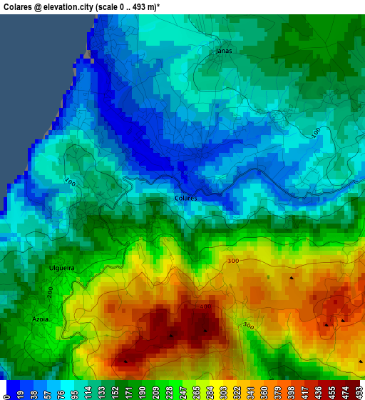
Below is the Elevation map of Colares, which displays elevation range with different colors. Scale of the first map is from 0 to 493 m (0 to 1617 ft) with average elevation of 178.5 meters (=586 ft) [note 1]
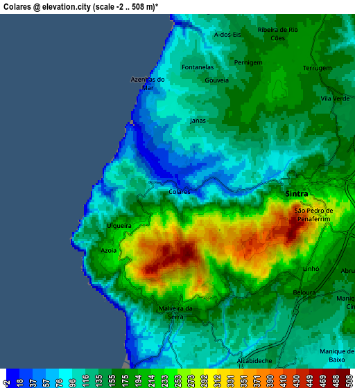
These maps also provides idea of topography and contour of this city, they are displayed at different zoom levels. More info about maps, scale and edge coordinates you can find below images.
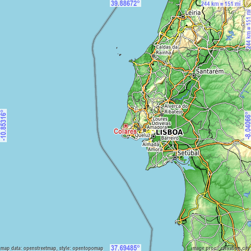
| \ | Map #1 | Map #2 | Topo.Map |
| Scale [m] | 0..493 m | -2..508 m | × |
| Scale [ft] | 0..1617 ft | -7..1667 ft | × |
| Average | 178.5 m = 586 ft | 165.1 m = 542 ft | × |
| Width | 7.62 km = 4.7 mi | 15.23 km = 9.5 mi | 243.7 km = 151.4 mi |
| Height | 7.62 km = 4.7 mi | 15.23 km = 9.5 mi | 243.7 km = 151.4 mi |
| ↑Max Latitude | 38.83345° | 38.867674° | 39.88672° |
| Latitude at center | 38.79921° | 38.79921° | 38.79921° |
| ↓Min Latitude | 38.764953° | 38.73068° | 37.69485° |
| ← Min Longitude | -9.490855° | -9.534801° | -10.85316° |
| Longitude center | -9.44691° | -9.44691° | -9.44691° |
| →Max Longitude | -9.402965° | -9.359019° | -8.04066° |
Nearby cities:
Cities around Colares sort by population:
• Cacém elevation 123 m
13.4 km,  105°
105°
• Algueirão 170 m
8.9 km,  91°
91°
• Rio de Mouro 127 m
10.9 km, 109°
• Cascais 20 m
11.6 km,  169°
169°
• Alcabideche 122 m
8 km,  155°
155°
• Sintra 197 m
6 km, 88°
• Estoril 24 m
11.2 km, 157°
• Monte Estoril 1 m
10.9 km, 161°
• São João das Lampas 154 m
9.3 km,  26°
26°
• Mem Martins 170 m
9 km, 93°
• Fontanelas 129 m
5.5 km,  6°
6°
• Pero Pinheiro 158 m
12.5 km,  58°
58°
Multilingual:
 En español:
Colares elevación 43 m.
 En France:
Colares élévation 43 m.


Sources and notes:
- [note 1] Map square and city borders are not equal. Map elevation data is calculated only from area inside that square.
- [src 1] Elevation data from geonames database provided with same terms of usage.
- [src 2] The elevation map of Colares is generated using elevation data from NASA's 3 arcsec (90m) resolution SRTM data.
- [src 3] Base (background) map © OpenStreetMap contributors tiles are generated by Geofabrik and OpenTopoMap.
Copyright & License:
This Colares Elevation Map is licensed under CC BY-SA. You may reuse any part from this page, if you give a proper credit by linking to this URL:
 More info on terms of use page.