Santana elevation
Santana (Madeira), Portugal elevation is 492 meters and Santana elevation in feet is 1614 ft above sea level [src 1]. Santana is a populated place (feature code) with elevation that is 324 meters (1063 ft) bigger than average city elevation in Portugal.
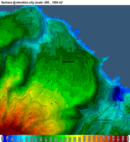
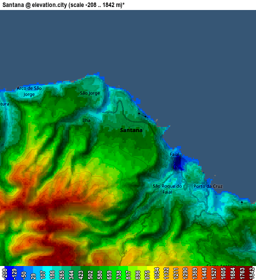
Below is the Elevation map of Santana, which displays elevation range with different colors. Scale of the first map is from -208 to 1654 m (-682 to 5427 ft) with average elevation of 518.5 meters (=1701 ft) [note 1]
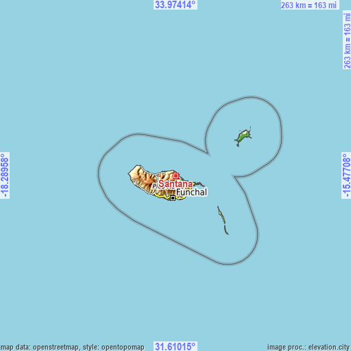
These maps also provides idea of topography and contour of this city, they are displayed at different zoom levels. More info about maps, scale and edge coordinates you can find below images.
| \ | Map #1 | Map #2 | Topo.Map |
| Scale [m] | -208..1654 m | -208..1842 m | × |
| Scale [ft] | -682..5427 ft | -682..6043 ft | × |
| Average | 518.5 m = 1701 ft | 698.6 m = 2292 ft | × |
| Width | 8.21 km = 5.1 mi | 16.43 km = 10.2 mi | 262.9 km = 163.4 mi |
| Height | 8.21 km = 5.1 mi | 16.43 km = 10.2 mi | 262.9 km = 163.4 mi |
| ↑Max Latitude | 32.836931° | 32.873847° | 33.97414° |
| Latitude at center | 32.8° | 32.8° | 32.8° |
| ↓Min Latitude | 32.763053° | 32.726091° | 31.61015° |
| ← Min Longitude | -16.927275° | -16.971221° | -18.28958° |
| Longitude center | -16.88333° | -16.88333° | -16.88333° |
| →Max Longitude | -16.839385° | -16.795439° | -15.47708° |
Nearby cities:
Cities around Santana sort by population:
• Machico elevation 39 m
14.3 km,  130°
130°
• São Roque 294 m
15.1 km,  191°
191°
• Camacha 703 m
13.9 km,  164°
164°
• Nossa Senhora do Monte 350 m
14.9 km, 186°
• São Vicente 111 m
14.9 km,  268°
268°
• Santa Cruz 240 m
15 km,  146°
146°
• Porto da Cruz 220 m
6 km, 128°
• Água de Pena 160 m
14.7 km,  138°
138°
• Curral das Freiras 435 m
12 km,  222°
222°
• Faial -128 m
3.6 km,  120°
120°
• São Jorge 73 m
2.4 km,  319°
319°
• Boaventura 123 m
8.6 km,  283°
283°
Multilingual:
 En español:
Santana elevación 492 m.
 En France:
Santana élévation 492 m.


Sources and notes:
- [note 1] Map square and city borders are not equal. Map elevation data is calculated only from area inside that square.
- [src 1] Elevation data from geonames database provided with same terms of usage.
- [src 2] The elevation map of Santana is generated using elevation data from NASA's 3 arcsec (90m) resolution SRTM data.
- [src 3] Base (background) map © OpenStreetMap contributors tiles are generated by Geofabrik and OpenTopoMap.
Copyright & License:
This Santana Elevation Map is licensed under CC BY-SA. You may reuse any part from this page, if you give a proper credit by linking to this URL:
 More info on terms of use page.