Aţ Ţaybah elevation
Aţ Ţaybah (West Bank, Ramallah), Palestinian Territory elevation is 860 meters and Aţ Ţaybah elevation in feet is 2822 ft above sea level [src 1]. Aţ Ţaybah is a populated place (feature code) with elevation that is 393 meters (1289 ft) bigger than average city elevation in Palestinian Territory.
Below is the Elevation map of Aţ Ţaybah, which displays elevation range with different colors. Scale of the first map is from 391 to 1013 m (1283 to 3323 ft) with average elevation of 750.5 meters (=2462 ft) [note 1]
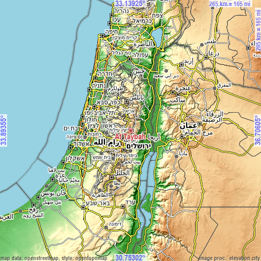
These maps also provides idea of topography and contour of this city, they are displayed at different zoom levels. More info about maps, scale and edge coordinates you can find below images.
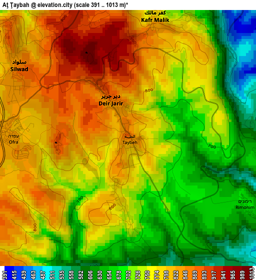
| \ | Map #1 | Topo.Map |
| Scale [m] | 391..1013 m | × |
| Scale [ft] | 1283..3323 ft | × |
| Average | 750.5 m = 2462 ft | × |
| Width | 8.29 km = 5.2 mi | 265.3 km = 164.8 mi |
| Height | 8.29 km = 5.2 mi | 265.3 km = 164.8 mi |
| ↑Max Latitude | 31.991159° | 33.13925° |
| Latitude at center | 31.95388° | 31.95388° |
| ↓Min Latitude | 31.916586° | 30.75302° |
| ← Min Longitude | 35.255855° | 33.89355° |
| Longitude center | 35.2998° | 35.2998° |
| →Max Longitude | 35.343745° | 36.70605° |
Nearby cities:
Cities around Aţ Ţaybah sort by population:
• Silwād elevation 844 m
4.4 km,  304°
304°
• Dayr Dibwān 772 m
5.7 km,  213°
213°
• Al Mazra‘ah ash Sharqīyah 938 m
5.4 km,  341°
341°
• Dayr Jarīr 895 m
1.5 km,  333°
333°
• Khirbat Abū Falāḩ 745 m
7 km,  1°
1°
• Rammūn 760 m
2.3 km,  183°
183°
• ‘Ayn Yabrūd 819 m
4.6 km,  263°
263°
• Baytīn 863 m
6.3 km,  241°
241°
• Kafr Mālik 790 m
3.9 km,  13°
13°
• Dūrā al Qar‘ 725 m
6.9 km,  274°
274°
• Burqah 748 m
7.7 km, 214°
• Jifnā 666 m
8.2 km,  276°
276°
Multilingual:
 En español:
Aţ Ţaybah elevación 860 m.
 En France:
Aţ Ţaybah élévation 860 m.
 Auf Deutsch:
Aţ Ţaybah höhe über dem Meeresspiegel ist 860 m.

Sources and notes:
- [note 1] Map square and city borders are not equal. Map elevation data is calculated only from area inside that square.
- [src 1] Elevation data from geonames database provided with same terms of usage.
- [src 2] The elevation map of Aţ Ţaybah is generated using elevation data from NASA's 3 arcsec (90m) resolution SRTM data.
- [src 3] Base (background) map © OpenStreetMap contributors tiles are generated by Geofabrik and OpenTopoMap.
Copyright & License:
This Aţ Ţaybah Elevation Map is licensed under CC BY-SA. You may reuse any part from this page, if you give a proper credit by linking to this URL:
 More info on terms of use page.