Yuta elevation
Yuta (West Bank, Al Quds), Palestinian Territory elevation is 808 meters and Yuta elevation in feet is 2651 ft above sea level [src 1]. Yuta is a populated place (feature code) with elevation that is 341 meters (1119 ft) bigger than average city elevation in Palestinian Territory.
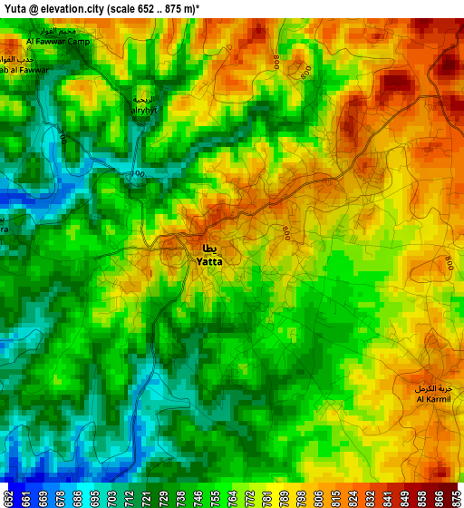
Below is the Elevation map of Yuta, which displays elevation range with different colors. Scale of the first map is from 652 to 875 m (2139 to 2871 ft) with average elevation of 763.1 meters (=2504 ft) [note 1]
These maps also provides idea of topography and contour of this city, they are displayed at different zoom levels. More info about maps, scale and edge coordinates you can find below images.
| \ | Map #1 | Map #2 | Topo.Map |
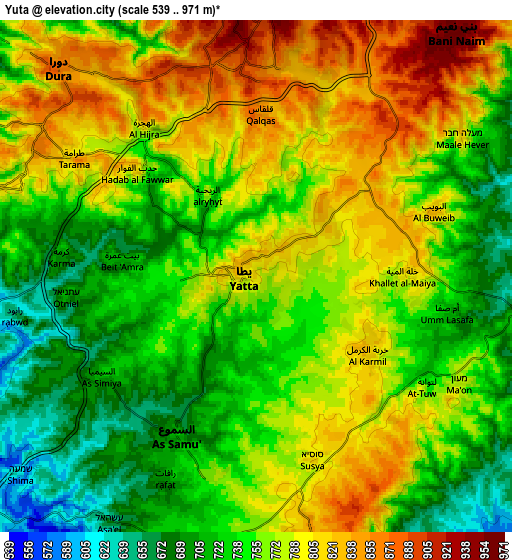
| Scale [m] | 652..875 m | 539..971 m | × |
| Scale [ft] | 2139..2871 ft | 1768..3186 ft | × |
| Average | 763.1 m = 2504 ft | 762.8 m = 2503 ft | × |
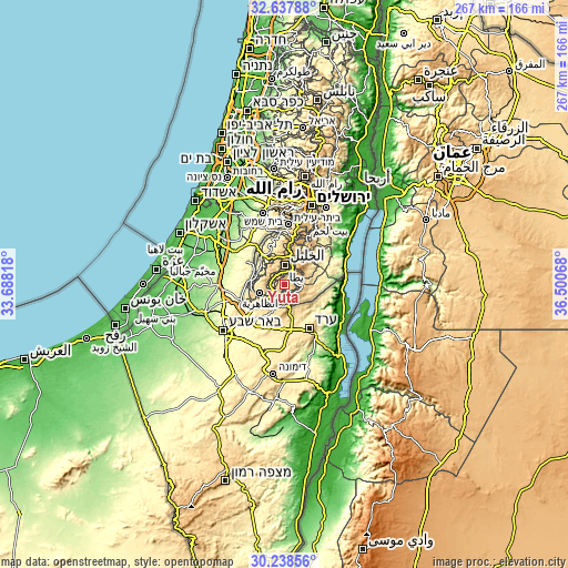
| Width | 8.34 km = 5.2 mi | 16.67 km = 10.4 mi | 266.8 km = 165.8 mi |
| Height | 8.34 km = 5.2 mi | 16.67 km = 10.4 mi | 266.8 km = 165.8 mi |
| ↑Max Latitude | 31.483384° | 31.520852° | 32.63788° |
| Latitude at center | 31.4459° | 31.4459° | 31.4459° |
| ↓Min Latitude | 31.408401° | 31.370888° | 30.23856° |
| ← Min Longitude | 35.050485° | 35.006539° | 33.68818° |
| Longitude center | 35.09443° | 35.09443° | 35.09443° |
| →Max Longitude | 35.138375° | 35.182321° | 36.50068° |
Nearby cities:
Cities around Yuta sort by population:
• As Samū‘ elevation 696 m
6.1 km,  206°
206°
• Al Karmil 822 m
4.4 km,  124°
124°
• Khursā 844 m
8.4 km,  299°
299°
• Ar Rīḩīyah 779 m
3.1 km,  329°
329°
• Rābūd 662 m
7.5 km,  264°
264°
• Khallat ad Dār 880 m
6 km,  17°
17°
• Bayt ‘Amrah 717 m
4.3 km,  276°
276°
• Khallat al Mayyah 779 m
4.6 km,  95°
95°
• Karmah 698 m
6.4 km, 275°
• Al Ḩīlah 790 m
3.4 km, 21°
• Qalqas 860 m
5.1 km,  0°
0°
• Khallat Şāliḩ 770 m
3.5 km,  145°
145°
Multilingual:
 En español:
Yuta elevación 808 m.
 En France:
Yuta élévation 808 m.


Sources and notes:
- [note 1] Map square and city borders are not equal. Map elevation data is calculated only from area inside that square.
- [src 1] Elevation data from geonames database provided with same terms of usage.
- [src 2] The elevation map of Yuta is generated using elevation data from NASA's 3 arcsec (90m) resolution SRTM data.
- [src 3] Base (background) map © OpenStreetMap contributors tiles are generated by Geofabrik and OpenTopoMap.
Copyright & License:
This Yuta Elevation Map is licensed under CC BY-SA. You may reuse any part from this page, if you give a proper credit by linking to this URL:
 More info on terms of use page.