‘Abasān al Jadīdah elevation
‘Abasān al Jadīdah, Palestinian Territory elevation is 82 meters and ‘Abasān al Jadīdah elevation in feet is 269 ft above sea level [src 1]. ‘Abasān al Jadīdah is a populated place (feature code) with elevation that is 385 meters (1263 ft) smaller than average city elevation in Palestinian Territory.
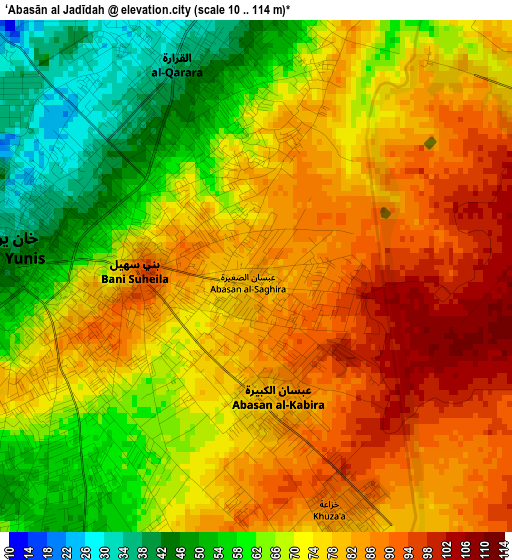
Below is the Elevation map of ‘Abasān al Jadīdah, which displays elevation range with different colors. Scale of the first map is from 10 to 114 m (33 to 374 ft) with average elevation of 73 meters (=240 ft) [note 1]
These maps also provides idea of topography and contour of this city, they are displayed at different zoom levels. More info about maps, scale and edge coordinates you can find below images.
| \ | Map #1 | Map #2 | Topo.Map |
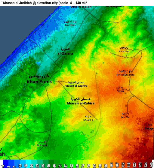
| Scale [m] | 10..114 m | -4..140 m | × |
| Scale [ft] | 33..374 ft | -13..459 ft | × |
| Average | 73 m = 240 ft | 67.4 m = 221 ft | × |
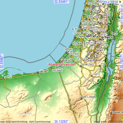
| Width | 8.35 km = 5.2 mi | 16.69 km = 10.4 mi | 267.1 km = 166 mi |
| Height | 8.35 km = 5.2 mi | 16.69 km = 10.4 mi | 267.1 km = 166 mi |
| ↑Max Latitude | 31.379105° | 31.416616° | 32.53491° |
| Latitude at center | 31.34158° | 31.34158° | 31.34158° |
| ↓Min Latitude | 31.30404° | 31.266484° | 30.13292° |
| ← Min Longitude | 34.301975° | 34.258029° | 32.93967° |
| Longitude center | 34.34592° | 34.34592° | 34.34592° |
| →Max Longitude | 34.389865° | 34.433811° | 35.75217° |
Nearby cities:
Cities around ‘Abasān al Jadīdah sort by population:
• Khān Yūnis elevation 55 m
3.8 km,  267°
267°
• Rafaḩ 30 m
10.9 km,  243°
243°
• Dayr al Balaḩ 19 m
8.5 km,  2°
2°
• Banī Suhaylā 82 m
2.2 km,  275°
275°
• Al Qarārah 40 m
3.6 km,  352°
352°
• ‘Abasān al Kabīrah 71 m
2.6 km,  192°
192°
• Shūkat aş Şūfī 92 m
10.9 km,  213°
213°
• Khuzā‘ah 86 m
4.1 km,  159°
159°
• An Naşr 62 m
7.9 km, 211°
• Al Fukhkhārī 68 m
5.6 km,  195°
195°
• Wādī as Salqā 30 m
6.6 km, 353°
• Al Muşaddar 42 m
8.2 km,  21°
21°
Multilingual:
 En español:
‘Abasān al Jadīdah elevación 82 m.
 En France:
‘Abasān al Jadīdah élévation 82 m.
 Auf Deutsch:
‘Abasān al Jadīdah höhe über dem Meeresspiegel ist 82 m.

Sources and notes:
- [note 1] Map square and city borders are not equal. Map elevation data is calculated only from area inside that square.
- [src 1] Elevation data from geonames database provided with same terms of usage.
- [src 2] The elevation map of ‘Abasān al Jadīdah is generated using elevation data from NASA's 3 arcsec (90m) resolution SRTM data.
- [src 3] Base (background) map © OpenStreetMap contributors tiles are generated by Geofabrik and OpenTopoMap.
Copyright & License:
This ‘Abasān al Jadīdah Elevation Map is licensed under CC BY-SA. You may reuse any part from this page, if you give a proper credit by linking to this URL:
 More info on terms of use page.