Bobrowniki elevation
Bobrowniki (Łódź Voivodeship, powiat Łowicki), Poland elevation is 89 meters and Bobrowniki elevation in feet is 292 ft above sea level [src 1]. Bobrowniki is a populated place (feature code) with elevation that is 102 meters (335 ft) smaller than average city elevation in Poland.
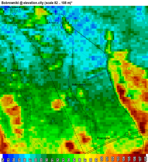
Below is the Elevation map of Bobrowniki, which displays elevation range with different colors. Scale of the first map is from 82 to 108 m (269 to 354 ft) with average elevation of 91.5 meters (=300 ft) [note 1]
These maps also provides idea of topography and contour of this city, they are displayed at different zoom levels. More info about maps, scale and edge coordinates you can find below images.
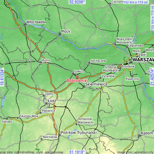
| \ | Map #1 | Topo.Map |
| Scale [m] | 82..108 m | × |
| Scale [ft] | 269..354 ft | × |
| Average | 91.5 m = 300 ft | × |
| Width | 6.01 km = 3.7 mi | 192.3 km = 119.5 mi |
| Height | 6.01 km = 3.7 mi | 192.2 km = 119.4 mi |
| ↑Max Latitude | 52.091428° | 52.9206° |
| Latitude at center | 52.06442° | 52.06442° |
| ↓Min Latitude | 52.037395° | 51.1915° |
| ← Min Longitude | 19.975545° | 18.61324° |
| Longitude center | 20.01949° | 20.01949° |
| →Max Longitude | 20.063435° | 21.42574° |
Nearby cities:
Cities around Bobrowniki sort by population:
• Skierniewice elevation 128 m
15.5 km,  142°
142°
• Łowicz 91 m
6.9 km,  313°
313°
• Maków 138 m
13.2 km,  170°
170°
• Lipce Reymontowskie 192 m
19.2 km,  196°
196°
• Łyszkowice 120 m
11.7 km,  221°
221°
• Bolimów 89 m
9.9 km,  82°
82°
• Godzianów 154 m
18.7 km,  176°
176°
• Domaniewice 127 m
16.2 km,  246°
246°
• Nieborów 90 m
3.7 km,  66°
66°
• Rybno 87 m
20.6 km,  16°
16°
• Kocierzew Południowy 96 m
17 km,  359°
359°
• Chąśno 95 m
15.5 km,  340°
340°
Multilingual:
 En español:
Bobrowniki elevación 89 m.
 En France:
Bobrowniki élévation 89 m.
 Auf Deutsch:
Bobrowniki höhe über dem Meeresspiegel ist 89 m.

Sources and notes:
- [note 1] Map square and city borders are not equal. Map elevation data is calculated only from area inside that square.
- [src 1] Elevation data from geonames database provided with same terms of usage.
- [src 2] The elevation map of Bobrowniki is generated using elevation data from NASA's 3 arcsec (90m) resolution SRTM data.
- [src 3] Base (background) map © OpenStreetMap contributors tiles are generated by Geofabrik and OpenTopoMap.
Copyright & License:
This Bobrowniki Elevation Map is licensed under CC BY-SA. You may reuse any part from this page, if you give a proper credit by linking to this URL:
 More info on terms of use page.