Rybno elevation
Rybno (Mazovia, Powiat sochaczewski), Poland elevation is 87 meters and Rybno elevation in feet is 285 ft above sea level [src 1]. Rybno is a seat of a third-order administrative division (feature code) with elevation that is 104 meters (341 ft) smaller than average city elevation in Poland.
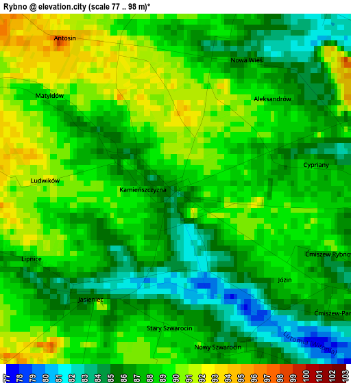
Below is the Elevation map of Rybno, which displays elevation range with different colors. Scale of the first map is from 77 to 98 m (253 to 322 ft) with average elevation of 87.6 meters (=287 ft) [note 1]
These maps also provides idea of topography and contour of this city, they are displayed at different zoom levels. More info about maps, scale and edge coordinates you can find below images.
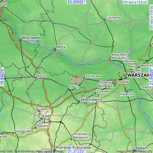
| \ | Map #1 | Topo.Map |
| Scale [m] | 77..98 m | × |
| Scale [ft] | 253..322 ft | × |
| Average | 87.6 m = 287 ft | × |
| Width | 5.98 km = 3.7 mi | 191.5 km = 119 mi |
| Height | 5.98 km = 3.7 mi | 191.5 km = 119 mi |
| ↑Max Latitude | 52.26968° | 53.09552° |
| Latitude at center | 52.24278° | 52.24278° |
| ↓Min Latitude | 52.215863° | 51.37333° |
| ← Min Longitude | 20.059065° | 18.69676° |
| Longitude center | 20.10301° | 20.10301° |
| →Max Longitude | 20.146955° | 21.50926° |
Nearby cities:
Cities around Rybno sort by population:
• Sochaczew elevation 87 m
9.3 km,  99°
99°
• Łowicz 91 m
18.5 km,  215°
215°
• Wyszogród 85 m
17.4 km,  20°
20°
• Słubice 66 m
18 km,  321°
321°
• Sanniki 107 m
18.7 km,  301°
301°
• Młodzieszyn 74 m
9.1 km,  46°
46°
• Kiernozia 102 m
16.1 km,  280°
280°
• Nieborów 90 m
18.5 km,  187°
187°
• Iłów 75 m
11.9 km,  334°
334°
• Brochów 69 m
13.8 km, 51°
• Kocierzew Południowy 96 m
6.4 km,  243°
243°
• Chąśno 95 m
12.1 km, 244°
Multilingual:
 En español:
Rybno elevación 87 m.
 En France:
Rybno élévation 87 m.


Sources and notes:
- [note 1] Map square and city borders are not equal. Map elevation data is calculated only from area inside that square.
- [src 1] Elevation data from geonames database provided with same terms of usage.
- [src 2] The elevation map of Rybno is generated using elevation data from NASA's 3 arcsec (90m) resolution SRTM data.
- [src 3] Base (background) map © OpenStreetMap contributors tiles are generated by Geofabrik and OpenTopoMap.
Copyright & License:
This Rybno Elevation Map is licensed under CC BY-SA. You may reuse any part from this page, if you give a proper credit by linking to this URL:
 More info on terms of use page.