Przemyśl elevation
Przemyśl (Subcarpathian), Poland elevation is 193 meters and Przemyśl elevation in feet is 633 ft above sea level [src 1]. Przemyśl is a seat of a second-order administrative division (feature code) with elevation that is 2 meters (7 ft) bigger than average city elevation in Poland.
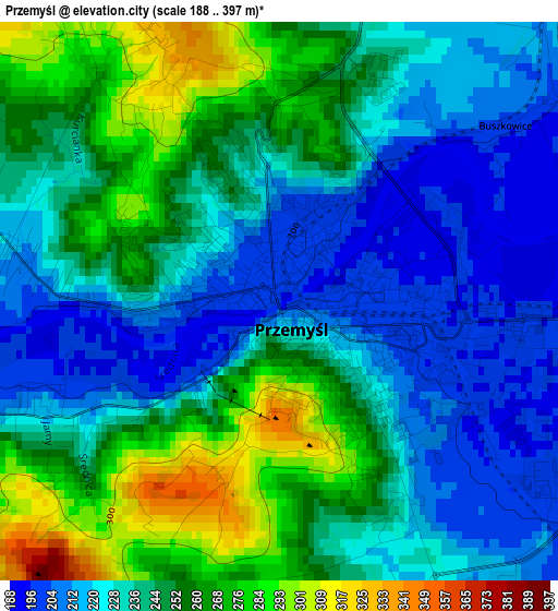
Below is the Elevation map of Przemyśl, which displays elevation range with different colors. Scale of the first map is from 188 to 397 m (617 to 1302 ft) with average elevation of 240.9 meters (=790 ft) [note 1]
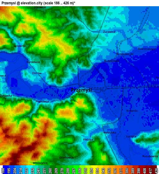
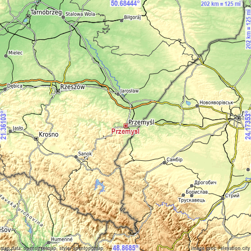
These maps also provides idea of topography and contour of this city, they are displayed at different zoom levels. More info about maps, scale and edge coordinates you can find below images.
| \ | Map #1 | Map #2 | Topo.Map |
| Scale [m] | 188..397 m | 186..426 m | × |
| Scale [ft] | 617..1302 ft | 610..1398 ft | × |
| Average | 240.9 m = 790 ft | 249.8 m = 820 ft | × |
| Width | 6.31 km = 3.9 mi | 12.62 km = 7.8 mi | 201.9 km = 125.5 mi |
| Height | 6.31 km = 3.9 mi | 12.62 km = 7.8 mi | 201.9 km = 125.5 mi |
| ↑Max Latitude | 49.813345° | 49.841694° | 50.68444° |
| Latitude at center | 49.78498° | 49.78498° | 49.78498° |
| ↓Min Latitude | 49.756598° | 49.728199° | 48.8685° |
| ← Min Longitude | 22.723335° | 22.679389° | 21.36103° |
| Longitude center | 22.76728° | 22.76728° | 22.76728° |
| →Max Longitude | 22.811225° | 22.855171° | 24.17353° |
Nearby cities:
Cities around Przemyśl sort by population:
• Radymno elevation 197 m
18.5 km,  12°
12°
• Żurawica 218 m
4.6 km,  20°
20°
• Medyka 191 m
11.4 km,  78°
78°
• Rokietnica 239 m
15.6 km,  324°
324°
• Ostrów 187 m
20.4 km,  3°
3°
• Kramarzówka 279 m
20.8 km,  293°
293°
• Sośnica 199 m
15 km,  30°
30°
• Stubno 188 m
18.5 km,  47°
47°
• Orły 220 m
9.9 km, 14°
• Krzywcza 234 m
16 km,  275°
275°
• Fredropol 254 m
10 km,  188°
188°
• Krasiczyn 215 m
8.3 km,  263°
263°
Multilingual:
 En español:
Przemyśl elevación 193 m.
 En France:
Przemyśl élévation 193 m.
 Auf Deutsch:
Przemyśl höhe über dem Meeresspiegel ist 193 m.
 На русском:
Перемышль, Пшемысль высота над уровнем моря 193 м
Sources and notes:
- [note 1] Map square and city borders are not equal. Map elevation data is calculated only from area inside that square.
- [src 1] Elevation data from geonames database provided with same terms of usage.
- [src 2] The elevation map of Przemyśl is generated using elevation data from NASA's 3 arcsec (90m) resolution SRTM data.
- [src 3] Base (background) map © OpenStreetMap contributors tiles are generated by Geofabrik and OpenTopoMap.
Copyright & License:
This Przemyśl Elevation Map is licensed under CC BY-SA. You may reuse any part from this page, if you give a proper credit by linking to this URL:
 More info on terms of use page.