Radymno elevation
Radymno (Subcarpathian, Powiat jarosławski), Poland elevation is 197 meters and Radymno elevation in feet is 646 ft above sea level [src 1]. Radymno is a populated place (feature code) with elevation that is 6 meters (20 ft) bigger than average city elevation in Poland.
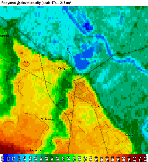
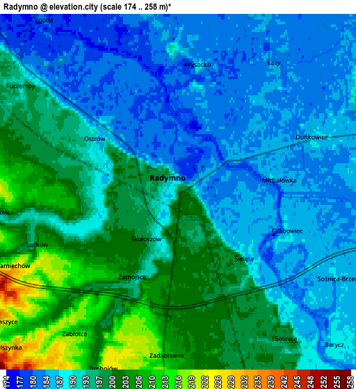
Below is the Elevation map of Radymno, which displays elevation range with different colors. Scale of the first map is from 174 to 213 m (571 to 699 ft) with average elevation of 189.6 meters (=622 ft) [note 1]
These maps also provides idea of topography and contour of this city, they are displayed at different zoom levels. More info about maps, scale and edge coordinates you can find below images.
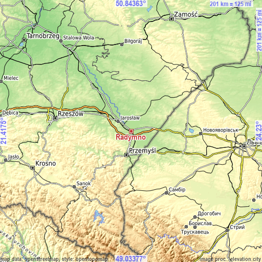
| \ | Map #1 | Map #2 | Topo.Map |
| Scale [m] | 174..213 m | 174..258 m | × |
| Scale [ft] | 571..699 ft | 571..846 ft | × |
| Average | 189.6 m = 622 ft | 192.5 m = 632 ft | × |
| Width | 6.29 km = 3.9 mi | 12.58 km = 7.8 mi | 201.2 km = 125 mi |
| Height | 6.29 km = 3.9 mi | 12.58 km = 7.8 mi | 201.2 km = 125 mi |
| ↑Max Latitude | 49.97547° | 50.003724° | 50.84363° |
| Latitude at center | 49.9472° | 49.9472° | 49.9472° |
| ↓Min Latitude | 49.918913° | 49.89061° | 49.03377° |
| ← Min Longitude | 22.779805° | 22.735859° | 21.4175° |
| Longitude center | 22.82375° | 22.82375° | 22.82375° |
| →Max Longitude | 22.867695° | 22.911641° | 24.23° |
Nearby cities:
Cities around Radymno sort by population:
• Przemyśl elevation 193 m
18.5 km,  192°
192°
• Jarosław 215 m
13 km,  306°
306°
• Żurawica 218 m
14 km, 190°
• Medyka 191 m
17.3 km,  155°
155°
• Rokietnica 239 m
14.1 km,  247°
247°
• Laszki 186 m
9.8 km,  33°
33°
• Pawłosiów 208 m
13.7 km,  293°
293°
• Ostrów 187 m
3.5 km, 311°
• Wiązownica 180 m
17 km,  330°
330°
• Sośnica 199 m
6.3 km,  144°
144°
• Stubno 188 m
10.9 km,  119°
119°
• Orły 220 m
8.6 km, 189°
Multilingual:
 En español:
Radymno elevación 197 m.
 En France:
Radymno élévation 197 m.


Sources and notes:
- [note 1] Map square and city borders are not equal. Map elevation data is calculated only from area inside that square.
- [src 1] Elevation data from geonames database provided with same terms of usage.
- [src 2] The elevation map of Radymno is generated using elevation data from NASA's 3 arcsec (90m) resolution SRTM data.
- [src 3] Base (background) map © OpenStreetMap contributors tiles are generated by Geofabrik and OpenTopoMap.
Copyright & License:
This Radymno Elevation Map is licensed under CC BY-SA. You may reuse any part from this page, if you give a proper credit by linking to this URL:
 More info on terms of use page.