Rzeszów elevation
Rzeszów (Subcarpathian), Poland elevation is 209 meters and Rzeszów elevation in feet is 686 ft above sea level [src 1]. Rzeszów is a seat of a first-order administrative division (feature code) with elevation that is 18 meters (59 ft) bigger than average city elevation in Poland.
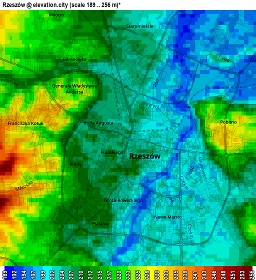
Below is the Elevation map of Rzeszów, which displays elevation range with different colors. Scale of the first map is from 189 to 256 m (620 to 840 ft) with average elevation of 210.2 meters (=690 ft) [note 1]
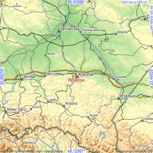
These maps also provides idea of topography and contour of this city, they are displayed at different zoom levels. More info about maps, scale and edge coordinates you can find below images.
| \ | Map #1 | Map #2 | Topo.Map |
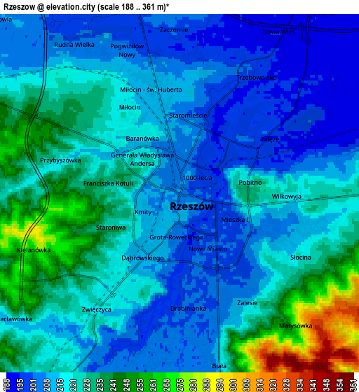
| Scale [m] | 189..256 m | 188..361 m | × |
| Scale [ft] | 620..840 ft | 617..1184 ft | × |
| Average | 210.2 m = 690 ft | 220.5 m = 723 ft | × |
| Width | 6.28 km = 3.9 mi | 12.55 km = 7.8 mi | 200.8 km = 124.8 mi |
| Height | 6.28 km = 3.9 mi | 12.55 km = 7.8 mi | 200.8 km = 124.8 mi |
| ↑Max Latitude | 50.069535° | 50.097733° | 50.93598° |
| Latitude at center | 50.04132° | 50.04132° | 50.04132° |
| ↓Min Latitude | 50.013088° | 49.98484° | 49.12967° |
| ← Min Longitude | 21.955065° | 21.911119° | 20.59276° |
| Longitude center | 21.99901° | 21.99901° | 21.99901° |
| →Max Longitude | 22.042955° | 22.086901° | 23.40526° |
Nearby cities:
Cities around Rzeszów sort by population:
• Boguchwała elevation 222 m
7.4 km,  211°
211°
• Krasne 196 m
6.5 km,  75°
75°
• Tyczyn 228 m
9 km,  163°
163°
• Trzebownisko 198 m
4.9 km,  33°
33°
• Świlcza 219 m
8 km,  295°
295°
• Niechobrz 229 m
10.1 km,  239°
239°
• Przybyszówka 227 m
5.3 km,  277°
277°
• Siedliska 210 m
10.4 km,  200°
200°
• Lutoryż 227 m
10.3 km,  216°
216°
• Rudna Wielka 203 m
6.4 km,  324°
324°
• Kielanówka 287 m
5.3 km,  251°
251°
• Rudna Mała 205 m
7 km,  336°
336°
Multilingual:
 En español:
Rzeszów elevación 209 m.
 En France:
Rzeszów élévation 209 m.


Sources and notes:
- [note 1] Map square and city borders are not equal. Map elevation data is calculated only from area inside that square.
- [src 1] Elevation data from geonames database provided with same terms of usage.
- [src 2] The elevation map of Rzeszów is generated using elevation data from NASA's 3 arcsec (90m) resolution SRTM data.
- [src 3] Base (background) map © OpenStreetMap contributors tiles are generated by Geofabrik and OpenTopoMap.
Copyright & License:
This Rzeszów Elevation Map is licensed under CC BY-SA. You may reuse any part from this page, if you give a proper credit by linking to this URL:
 More info on terms of use page.