Stanisławów elevation
Stanisławów (Mazovia, Powiat miński), Poland elevation is 147 meters and Stanisławów elevation in feet is 482 ft above sea level [src 1]. Stanisławów is a seat of a third-order administrative division (feature code) with elevation that is 44 meters (144 ft) smaller than average city elevation in Poland.
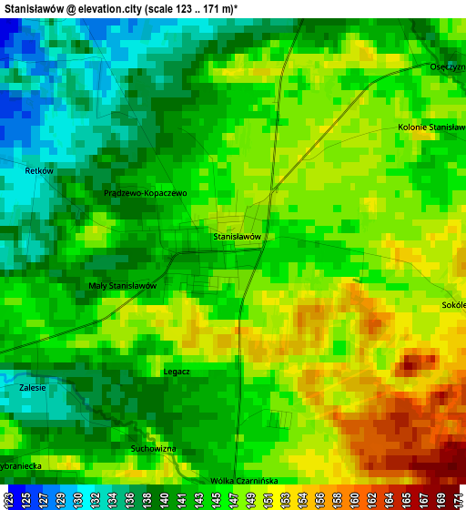
Below is the Elevation map of Stanisławów, which displays elevation range with different colors. Scale of the first map is from 123 to 171 m (404 to 561 ft) with average elevation of 144.8 meters (=475 ft) [note 1]
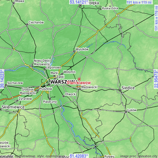
These maps also provides idea of topography and contour of this city, they are displayed at different zoom levels. More info about maps, scale and edge coordinates you can find below images.
| \ | Map #1 | Topo.Map |
| Scale [m] | 123..171 m | × |
| Scale [ft] | 404..561 ft | × |
| Average | 144.8 m = 475 ft | × |
| Width | 5.98 km = 3.7 mi | 191.3 km = 118.9 mi |
| Height | 5.98 km = 3.7 mi | 191.3 km = 118.9 mi |
| ↑Max Latitude | 52.316242° | 53.14121° |
| Latitude at center | 52.28937° | 52.28937° |
| ↓Min Latitude | 52.262482° | 51.42083° |
| ← Min Longitude | 21.504535° | 20.14223° |
| Longitude center | 21.54848° | 21.54848° |
| →Max Longitude | 21.592425° | 22.95473° |
Nearby cities:
Cities around Stanisławów sort by population:
• Mińsk Mazowiecki elevation 150 m
12.3 km,  172°
172°
• Sulejówek 104 m
19.5 km,  257°
257°
• Tłuszcz 101 m
17.5 km,  333°
333°
• Halinów 113 m
14.8 km,  242°
242°
• Dębe Wielkie 126 m
12.3 km,  215°
215°
• Duczki 97 m
19.3 km,  294°
294°
• Jasienica 98 m
16.7 km, 326°
• Ostrówek 98 m
16.6 km,  312°
312°
• Dobre 159 m
9.5 km,  68°
68°
• Jakubów 181 m
11.9 km,  130°
130°
• Strachówka 112 m
16.4 km,  21°
21°
• Poświętne 112 m
9.7 km,  297°
297°
Multilingual:
 En español:
Stanisławów elevación 147 m.
 En France:
Stanisławów élévation 147 m.
 Auf Deutsch:
Stanisławów höhe über dem Meeresspiegel ist 147 m.

Sources and notes:
- [note 1] Map square and city borders are not equal. Map elevation data is calculated only from area inside that square.
- [src 1] Elevation data from geonames database provided with same terms of usage.
- [src 2] The elevation map of Stanisławów is generated using elevation data from NASA's 3 arcsec (90m) resolution SRTM data.
- [src 3] Base (background) map © OpenStreetMap contributors tiles are generated by Geofabrik and OpenTopoMap.
Copyright & License:
This Stanisławów Elevation Map is licensed under CC BY-SA. You may reuse any part from this page, if you give a proper credit by linking to this URL:
 More info on terms of use page.