Tarnobrzeg elevation
Tarnobrzeg (Subcarpathian), Poland elevation is 162 meters and Tarnobrzeg elevation in feet is 531 ft above sea level [src 1]. Tarnobrzeg is a seat of a second-order administrative division (feature code) with elevation that is 29 meters (95 ft) smaller than average city elevation in Poland.
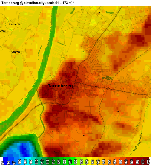
Below is the Elevation map of Tarnobrzeg, which displays elevation range with different colors. Scale of the first map is from 91 to 173 m (299 to 568 ft) with average elevation of 148 meters (=486 ft) [note 1]
These maps also provides idea of topography and contour of this city, they are displayed at different zoom levels. More info about maps, scale and edge coordinates you can find below images.
| \ | Map #1 | Map #2 | Topo.Map |
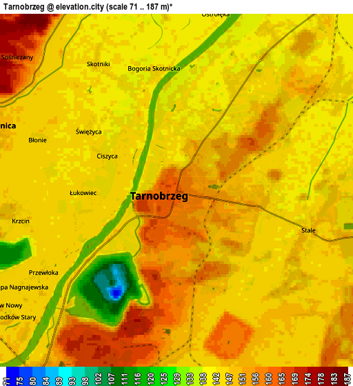
| Scale [m] | 91..173 m | 71..187 m | × |
| Scale [ft] | 299..568 ft | 233..614 ft | × |
| Average | 148 m = 486 ft | 146.8 m = 482 ft | × |
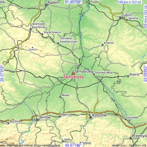
| Width | 6.21 km = 3.9 mi | 12.41 km = 7.7 mi | 198.6 km = 123.4 mi |
| Height | 6.21 km = 3.9 mi | 12.41 km = 7.7 mi | 198.6 km = 123.4 mi |
| ↑Max Latitude | 50.600941° | 50.628826° | 51.45769° |
| Latitude at center | 50.57304° | 50.57304° | 50.57304° |
| ↓Min Latitude | 50.545122° | 50.517188° | 49.67146° |
| ← Min Longitude | 21.635425° | 21.591479° | 20.27312° |
| Longitude center | 21.67937° | 21.67937° | 21.67937° |
| →Max Longitude | 21.723315° | 21.767261° | 23.08562° |
Nearby cities:
Cities around Tarnobrzeg sort by population:
• Sandomierz elevation 185 m
13.1 km,  21°
21°
• Nowa Dęba 162 m
16.7 km,  162°
162°
• Gorzyce 141 m
15.4 km,  47°
47°
• Grębów 150 m
13.8 km,  93°
93°
• Koprzywnica 165 m
7.1 km,  288°
288°
• Sokolniki 142 m
11.5 km, 51°
• Baranów Sandomierski 150 m
12.7 km,  229°
229°
• Kępie Żaleszańskie 142 m
16.1 km,  62°
62°
• Zaleszany 144 m
17.1 km, 60°
• Obrazów 194 m
13.5 km,  351°
351°
• Samborzec 152 m
8.5 km,  344°
344°
• Łoniów 172 m
10.9 km,  264°
264°
Multilingual:
 En español:
Tarnobrzeg elevación 162 m.
 En France:
Tarnobrzeg élévation 162 m.
 Auf Deutsch:
Tarnobrzeg höhe über dem Meeresspiegel ist 162 m.
 На русском:
Тарнобжеге, Тарнобжег высота над уровнем моря 162 м
Sources and notes:
- [note 1] Map square and city borders are not equal. Map elevation data is calculated only from area inside that square.
- [src 1] Elevation data from geonames database provided with same terms of usage.
- [src 2] The elevation map of Tarnobrzeg is generated using elevation data from NASA's 3 arcsec (90m) resolution SRTM data.
- [src 3] Base (background) map © OpenStreetMap contributors tiles are generated by Geofabrik and OpenTopoMap.
Copyright & License:
This Tarnobrzeg Elevation Map is licensed under CC BY-SA. You may reuse any part from this page, if you give a proper credit by linking to this URL:
 More info on terms of use page.