Tarnowiec elevation
Tarnowiec (Subcarpathian, Powiat jasielski), Poland elevation is 269 meters and Tarnowiec elevation in feet is 883 ft above sea level [src 1]. Tarnowiec is a seat of a third-order administrative division (feature code) with elevation that is 78 meters (256 ft) bigger than average city elevation in Poland.
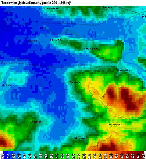
Below is the Elevation map of Tarnowiec, which displays elevation range with different colors. Scale of the first map is from 226 to 348 m (741 to 1142 ft) with average elevation of 257 meters (=843 ft) [note 1]
These maps also provides idea of topography and contour of this city, they are displayed at different zoom levels. More info about maps, scale and edge coordinates you can find below images.
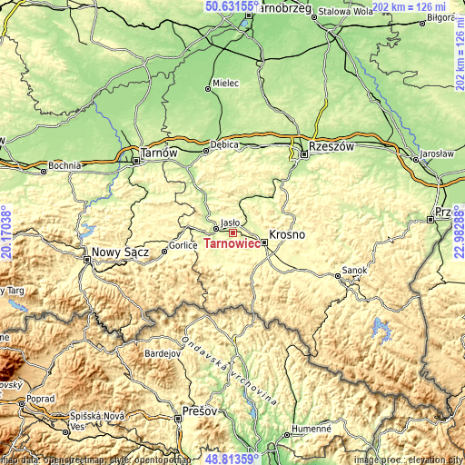
| \ | Map #1 | Topo.Map |
| Scale [m] | 226..348 m | × |
| Scale [ft] | 741..1142 ft | × |
| Average | 257 m = 843 ft | × |
| Width | 6.32 km = 3.9 mi | 202.1 km = 125.6 mi |
| Height | 6.32 km = 3.9 mi | 202.1 km = 125.6 mi |
| ↑Max Latitude | 49.759477° | 50.63155° |
| Latitude at center | 49.73108° | 49.73108° |
| ↓Min Latitude | 49.702666° | 48.81359° |
| ← Min Longitude | 21.532685° | 20.17038° |
| Longitude center | 21.57663° | 21.57663° |
| →Max Longitude | 21.620575° | 22.98288° |
Nearby cities:
Cities around Tarnowiec sort by population:
• Krosno elevation 278 m
14.7 km,  108°
108°
• Jasło 231 m
7.6 km,  281°
281°
• Jedlicze 263 m
5.4 km, 106°
• Odrzykoń 268 m
11.8 km,  84°
84°
• Trzcinica 250 m
11.5 km, 276°
• Dębowiec 285 m
9.9 km,  237°
237°
• Kołaczyce 224 m
13.3 km,  309°
309°
• Łęki 264 m
10.6 km,  34°
34°
• Frysztak 249 m
12.5 km,  10°
10°
• Chorkówka 298 m
11.6 km,  143°
143°
• Wojaszówka 256 m
8.5 km,  52°
52°
• Osiek Jasielski 258 m
12.2 km,  211°
211°
Multilingual:
 En español:
Tarnowiec elevación 269 m.
 En France:
Tarnowiec élévation 269 m.
 Auf Deutsch:
Tarnowiec höhe über dem Meeresspiegel ist 269 m.

Sources and notes:
- [note 1] Map square and city borders are not equal. Map elevation data is calculated only from area inside that square.
- [src 1] Elevation data from geonames database provided with same terms of usage.
- [src 2] The elevation map of Tarnowiec is generated using elevation data from NASA's 3 arcsec (90m) resolution SRTM data.
- [src 3] Base (background) map © OpenStreetMap contributors tiles are generated by Geofabrik and OpenTopoMap.
Copyright & License:
This Tarnowiec Elevation Map is licensed under CC BY-SA. You may reuse any part from this page, if you give a proper credit by linking to this URL:
 More info on terms of use page.