Wizna elevation
Wizna (Podlasie, Powiat łomżyński), Poland elevation is 119 meters and Wizna elevation in feet is 390 ft above sea level [src 1]. Wizna is a populated place (feature code) with elevation that is 72 meters (236 ft) smaller than average city elevation in Poland.
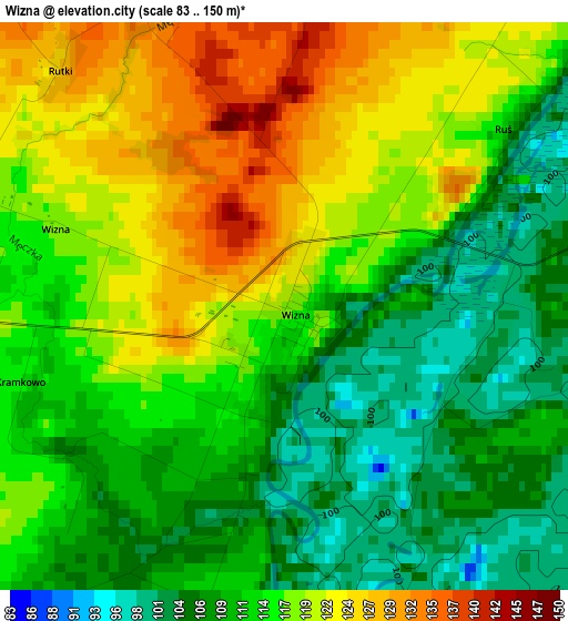
Below is the Elevation map of Wizna, which displays elevation range with different colors. Scale of the first map is from 83 to 150 m (272 to 492 ft) with average elevation of 114.7 meters (=376 ft) [note 1]
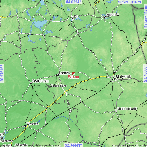
These maps also provides idea of topography and contour of this city, they are displayed at different zoom levels. More info about maps, scale and edge coordinates you can find below images.
| \ | Map #1 | Topo.Map |
| Scale [m] | 83..150 m | × |
| Scale [ft] | 272..492 ft | × |
| Average | 114.7 m = 376 ft | × |
| Width | 5.85 km = 3.6 mi | 187.4 km = 116.4 mi |
| Height | 5.85 km = 3.6 mi | 187.3 km = 116.4 mi |
| ↑Max Latitude | 53.221499° | 54.0294° |
| Latitude at center | 53.19518° | 53.19518° |
| ↓Min Latitude | 53.168845° | 52.34441° |
| ← Min Longitude | 22.338465° | 20.97616° |
| Longitude center | 22.38241° | 22.38241° |
| →Max Longitude | 22.426355° | 23.78866° |
Nearby cities:
Cities around Wizna sort by population:
• Łomża elevation 103 m
21.6 km,  264°
264°
• Zambrów 125 m
25.1 km,  201°
201°
• Stawiski 144 m
25.5 km,  323°
323°
• Jedwabne 163 m
11.3 km,  332°
332°
• Tykocin 110 m
26.1 km,  87°
87°
• Piątnica 104 m
19.1 km,  270°
270°
• Śniadowo 126 m
31.4 km,  236°
236°
• Sokoły 151 m
30.9 km,  136°
136°
• Radziłów 119 m
23.9 km,  4°
4°
• Rutki-Kossaki 142 m
12.4 km,  161°
161°
• Mały Płock 140 m
26.5 km,  297°
297°
• Rutki 117 m
11.1 km, 162°
Multilingual:
 En español:
Wizna elevación 119 m.
 En France:
Wizna élévation 119 m.


Sources and notes:
- [note 1] Map square and city borders are not equal. Map elevation data is calculated only from area inside that square.
- [src 1] Elevation data from geonames database provided with same terms of usage.
- [src 2] The elevation map of Wizna is generated using elevation data from NASA's 3 arcsec (90m) resolution SRTM data.
- [src 3] Base (background) map © OpenStreetMap contributors tiles are generated by Geofabrik and OpenTopoMap.
Copyright & License:
This Wizna Elevation Map is licensed under CC BY-SA. You may reuse any part from this page, if you give a proper credit by linking to this URL:
 More info on terms of use page.