Wojciechowice elevation
Wojciechowice (Świętokrzyskie, Powiat opatowski), Poland elevation is 189 meters and Wojciechowice elevation in feet is 620 ft above sea level [src 1]. Wojciechowice is a seat of a third-order administrative division (feature code) with elevation that is 2 meters (7 ft) smaller than average city elevation in Poland.
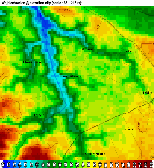
Below is the Elevation map of Wojciechowice, which displays elevation range with different colors. Scale of the first map is from 168 to 216 m (551 to 709 ft) with average elevation of 192 meters (=630 ft) [note 1]
These maps also provides idea of topography and contour of this city, they are displayed at different zoom levels. More info about maps, scale and edge coordinates you can find below images.
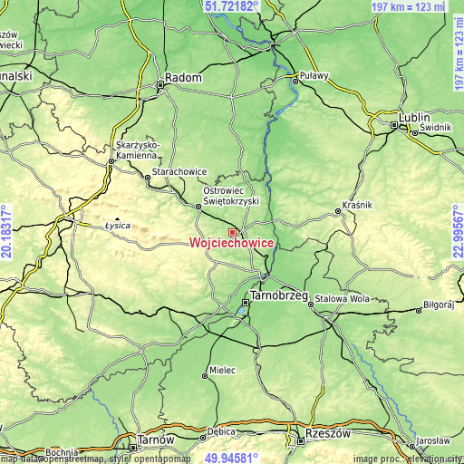
| \ | Map #1 | Topo.Map |
| Scale [m] | 168..216 m | × |
| Scale [ft] | 551..709 ft | × |
| Average | 192 m = 630 ft | × |
| Width | 6.17 km = 3.8 mi | 197.5 km = 122.7 mi |
| Height | 6.17 km = 3.8 mi | 197.5 km = 122.7 mi |
| ↑Max Latitude | 50.870001° | 51.72182° |
| Latitude at center | 50.84226° | 50.84226° |
| ↓Min Latitude | 50.814502° | 49.94581° |
| ← Min Longitude | 21.545475° | 20.18317° |
| Longitude center | 21.58942° | 21.58942° |
| →Max Longitude | 21.633365° | 22.99567° |
Nearby cities:
Cities around Wojciechowice sort by population:
• Ostrowiec Świętokrzyski elevation 176 m
17.3 km,  304°
304°
• Opatów 227 m
12.4 km,  248°
248°
• Ożarów 180 m
7.4 km,  46°
46°
• Ćmielów 166 m
7.5 km,  315°
315°
• Annopol 182 m
19.4 km,  75°
75°
• Zawichost 155 m
19 km,  101°
101°
• Dwikozy 148 m
18.3 km,  130°
130°
• Wilczyce 164 m
11.6 km,  155°
155°
• Sadowie 265 m
15.5 km,  274°
274°
• Obrazów 194 m
17.2 km,  165°
165°
• Lipnik 256 m
14.2 km,  208°
208°
• Bodzechów 167 m
12.9 km, 304°
Multilingual:
 En español:
Wojciechowice elevación 189 m.
 En France:
Wojciechowice élévation 189 m.
 Auf Deutsch:
Wojciechowice höhe über dem Meeresspiegel ist 189 m.

Sources and notes:
- [note 1] Map square and city borders are not equal. Map elevation data is calculated only from area inside that square.
- [src 1] Elevation data from geonames database provided with same terms of usage.
- [src 2] The elevation map of Wojciechowice is generated using elevation data from NASA's 3 arcsec (90m) resolution SRTM data.
- [src 3] Base (background) map © OpenStreetMap contributors tiles are generated by Geofabrik and OpenTopoMap.
Copyright & License:
This Wojciechowice Elevation Map is licensed under CC BY-SA. You may reuse any part from this page, if you give a proper credit by linking to this URL:
 More info on terms of use page.