Żabno elevation
Żabno (Lesser Poland, Powiat tarnowski), Poland elevation is 186 meters and Żabno elevation in feet is 610 ft above sea level [src 1]. Żabno is a seat of a third-order administrative division (feature code) with elevation that is 5 meters (16 ft) smaller than average city elevation in Poland.
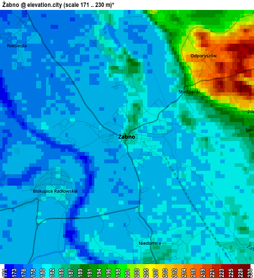
Below is the Elevation map of Żabno, which displays elevation range with different colors. Scale of the first map is from 171 to 230 m (561 to 755 ft) with average elevation of 183.1 meters (=601 ft) [note 1]
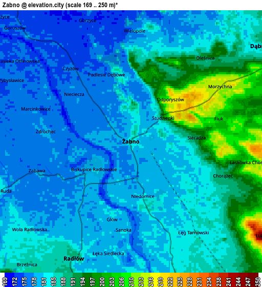
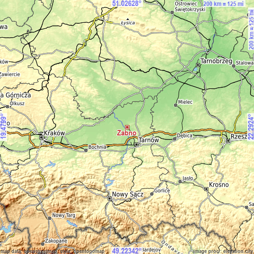
These maps also provides idea of topography and contour of this city, they are displayed at different zoom levels. More info about maps, scale and edge coordinates you can find below images.
| \ | Map #1 | Map #2 | Topo.Map |
| Scale [m] | 171..230 m | 169..250 m | × |
| Scale [ft] | 561..755 ft | 554..820 ft | × |
| Average | 183.1 m = 601 ft | 184.5 m = 605 ft | × |
| Width | 6.26 km = 3.9 mi | 12.53 km = 7.8 mi | 200.5 km = 124.6 mi |
| Height | 6.26 km = 3.9 mi | 12.53 km = 7.8 mi | 200.4 km = 124.5 mi |
| ↑Max Latitude | 50.161501° | 50.189645° | 51.02628° |
| Latitude at center | 50.13334° | 50.13334° | 50.13334° |
| ↓Min Latitude | 50.105163° | 50.076969° | 49.22342° |
| ← Min Longitude | 20.842205° | 20.798259° | 19.4799° |
| Longitude center | 20.88615° | 20.88615° | 20.88615° |
| →Max Longitude | 20.930095° | 20.974041° | 22.2924° |
Nearby cities:
Cities around Żabno sort by population:
• Dąbrowa Tarnowska elevation 208 m
8.5 km,  57°
57°
• Lisia Góra 244 m
12.7 km,  117°
117°
• Wierzchosławice 193 m
12.3 km,  189°
189°
• Radłów 187 m
6.1 km,  205°
205°
• Niedomice 184 m
3 km,  167°
167°
• Olesno 176 m
8.1 km,  20°
20°
• Łukowa 244 m
7.8 km,  125°
125°
• Gruszów Wielki 190 m
12.2 km, 57°
• Sieradza 190 m
3.1 km,  86°
86°
• Biskupice Radłowskie 181 m
2.4 km,  233°
233°
• Jadowniki Mokre 176 m
11.8 km,  287°
287°
• Wietrzychowice 176 m
10.7 km,  306°
306°
Multilingual:
 En español:
Żabno elevación 186 m.
 En France:
Żabno élévation 186 m.


Sources and notes:
- [note 1] Map square and city borders are not equal. Map elevation data is calculated only from area inside that square.
- [src 1] Elevation data from geonames database provided with same terms of usage.
- [src 2] The elevation map of Żabno is generated using elevation data from NASA's 3 arcsec (90m) resolution SRTM data.
- [src 3] Base (background) map © OpenStreetMap contributors tiles are generated by Geofabrik and OpenTopoMap.
Copyright & License:
This Żabno Elevation Map is licensed under CC BY-SA. You may reuse any part from this page, if you give a proper credit by linking to this URL:
 More info on terms of use page.