Sępolno elevation
Sępolno (Lower Silesia, Wrocław), Poland elevation is 119 meters and Sępolno elevation in feet is 390 ft above sea level [src 1]. Sępolno is a section of populated place (feature code) with elevation that is 72 meters (236 ft) smaller than average city elevation in Poland.
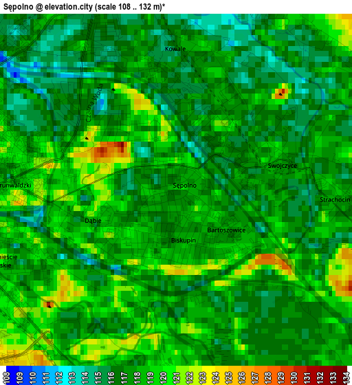
Below is the Elevation map of Sępolno, which displays elevation range with different colors. Scale of the first map is from 108 to 132 m (354 to 433 ft) with average elevation of 117.4 meters (=385 ft) [note 1]
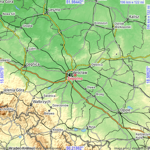
These maps also provides idea of topography and contour of this city, they are displayed at different zoom levels. More info about maps, scale and edge coordinates you can find below images.
| \ | Map #1 | Map #2 | Topo.Map |
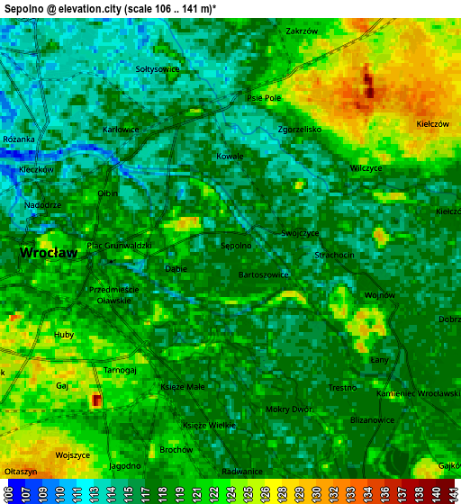
| Scale [m] | 108..132 m | 106..141 m | × |
| Scale [ft] | 354..433 ft | 348..463 ft | × |
| Average | 117.4 m = 385 ft | 118.9 m = 390 ft | × |
| Width | 6.14 km = 3.8 mi | 12.27 km = 7.6 mi | 196.3 km = 122 mi |
| Height | 6.14 km = 3.8 mi | 12.27 km = 7.6 mi | 196.3 km = 122 mi |
| ↑Max Latitude | 51.137532° | 51.165097° | 51.98442° |
| Latitude at center | 51.10995° | 51.10995° | 51.10995° |
| ↓Min Latitude | 51.082352° | 51.054737° | 50.21862° |
| ← Min Longitude | 17.058055° | 17.014109° | 15.69575° |
| Longitude center | 17.102° | 17.102° | 17.102° |
| →Max Longitude | 17.145945° | 17.189891° | 18.50825° |
Nearby cities:
Cities around Sępolno sort by population:
• Rejon placu Grunwaldzkiego elevation 119 m
2.9 km,  284°
284°
• Rejon ulicy Traugutta 117 m
3.8 km,  257°
257°
• Zgorzelisko 120 m
3.9 km,  34°
34°
• Biskupin 119 m
1 km,  170°
170°
• Osiedle Henrykowskie 120 m
4.1 km,  237°
237°
• Strachocin-Wojnów 118 m
3.4 km,  99°
99°
• Rejon alei Kromera 113 m
3.4 km,  320°
320°
• Kowale-Popiele 114 m
2.3 km,  359°
359°
• Zacisze 116 m
2.4 km,  307°
307°
• Zalesie i Stadion 117 m
1.3 km,  327°
327°
• Swojczyce 117 m
1.7 km,  68°
68°
• Dąbie 121 m
1.5 km,  252°
252°
Multilingual:
 En español:
Sępolno elevación 119 m.
 En France:
Sępolno élévation 119 m.


Sources and notes:
- [note 1] Map square and city borders are not equal. Map elevation data is calculated only from area inside that square.
- [src 1] Elevation data from geonames database provided with same terms of usage.
- [src 2] The elevation map of Sępolno is generated using elevation data from NASA's 3 arcsec (90m) resolution SRTM data.
- [src 3] Base (background) map © OpenStreetMap contributors tiles are generated by Geofabrik and OpenTopoMap.
Copyright & License:
This Sępolno Elevation Map is licensed under CC BY-SA. You may reuse any part from this page, if you give a proper credit by linking to this URL:
 More info on terms of use page.