Baruchowo elevation
Baruchowo (Kujawsko-Pomorskie, Powiat włocławski), Poland elevation is 75 meters and Baruchowo elevation in feet is 246 ft above sea level [src 1]. Baruchowo is a seat of a third-order administrative division (feature code) with elevation that is 116 meters (381 ft) smaller than average city elevation in Poland.
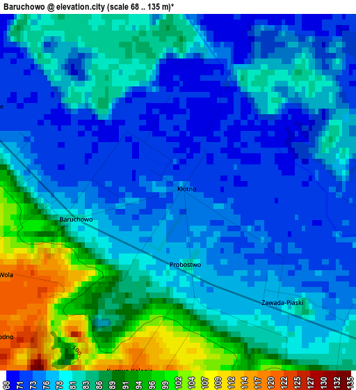
Below is the Elevation map of Baruchowo, which displays elevation range with different colors. Scale of the first map is from 68 to 135 m (223 to 443 ft) with average elevation of 81.2 meters (=266 ft) [note 1]
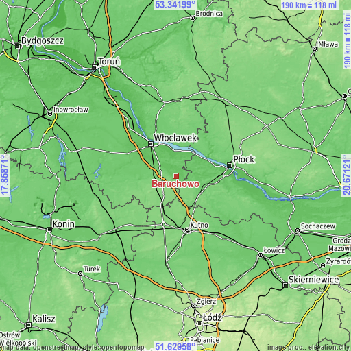
These maps also provides idea of topography and contour of this city, they are displayed at different zoom levels. More info about maps, scale and edge coordinates you can find below images.
| \ | Map #1 | Topo.Map |
| Scale [m] | 68..135 m | × |
| Scale [ft] | 223..443 ft | × |
| Average | 81.2 m = 266 ft | × |
| Width | 5.95 km = 3.7 mi | 190.4 km = 118.3 mi |
| Height | 5.95 km = 3.7 mi | 190.4 km = 118.3 mi |
| ↑Max Latitude | 52.520868° | 53.34199° |
| Latitude at center | 52.49412° | 52.49412° |
| ↓Min Latitude | 52.467356° | 51.62958° |
| ← Min Longitude | 19.221015° | 17.85871° |
| Longitude center | 19.26496° | 19.26496° |
| →Max Longitude | 19.308905° | 20.67121° |
Nearby cities:
Cities around Baruchowo sort by population:
• Włocławek elevation 58 m
21.7 km,  322°
322°
• Gostynin 89 m
15.2 km,  118°
118°
• Kowal 95 m
8.9 km,  296°
296°
• Dobrzyń nad Wisłą 97 m
16.4 km,  12°
12°
• Chodecz 129 m
18.9 km,  238°
238°
• Lubień Kujawski 126 m
12 km,  214°
214°
• Czerniewice 103 m
12.2 km,  279°
279°
• Choceń 100 m
17.1 km,  267°
267°
• Nowy Duninów 57 m
17.6 km,  55°
55°
• Strzelce 132 m
22.1 km,  154°
154°
• Łanięta 128 m
14.7 km,  175°
175°
• Nowe Ostrowy 117 m
21.8 km,  193°
193°
Multilingual:
 En español:
Baruchowo elevación 75 m.
 En France:
Baruchowo élévation 75 m.
 Auf Deutsch:
Baruchowo höhe über dem Meeresspiegel ist 75 m.

Sources and notes:
- [note 1] Map square and city borders are not equal. Map elevation data is calculated only from area inside that square.
- [src 1] Elevation data from geonames database provided with same terms of usage.
- [src 2] The elevation map of Baruchowo is generated using elevation data from NASA's 3 arcsec (90m) resolution SRTM data.
- [src 3] Base (background) map © OpenStreetMap contributors tiles are generated by Geofabrik and OpenTopoMap.
Copyright & License:
This Baruchowo Elevation Map is licensed under CC BY-SA. You may reuse any part from this page, if you give a proper credit by linking to this URL:
 More info on terms of use page.