Włocławek elevation
Włocławek (Kujawsko-Pomorskie), Poland elevation is 58 meters and Włocławek elevation in feet is 190 ft above sea level [src 1]. Włocławek is a seat of a second-order administrative division (feature code) with elevation that is 133 meters (436 ft) smaller than average city elevation in Poland.
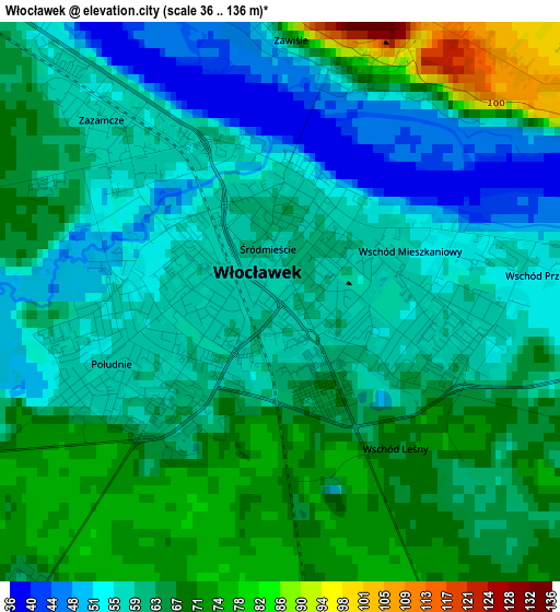
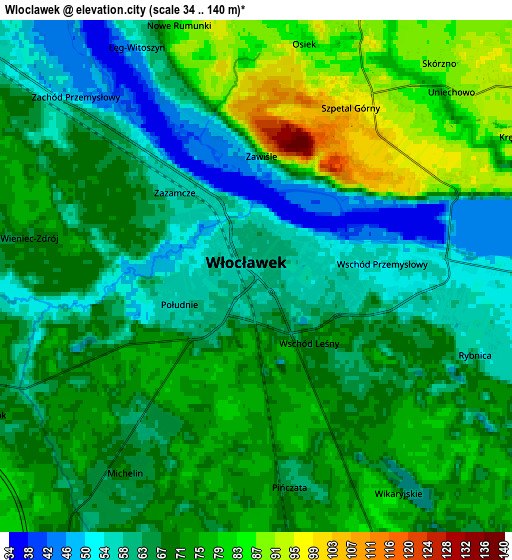
Below is the Elevation map of Włocławek, which displays elevation range with different colors. Scale of the first map is from 36 to 136 m (118 to 446 ft) with average elevation of 62.3 meters (=204 ft) [note 1]
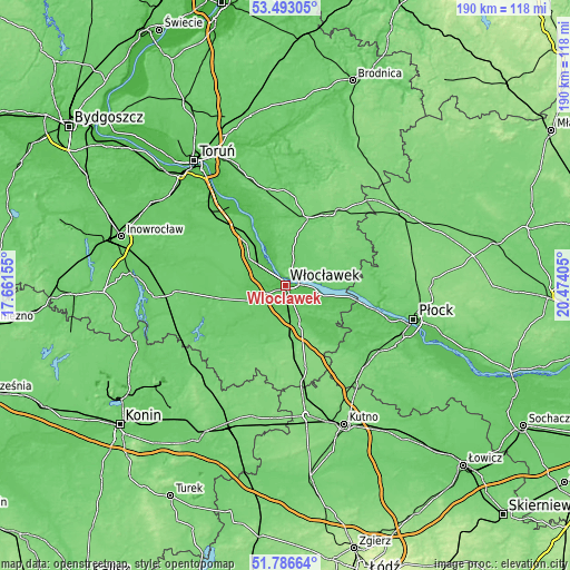
These maps also provides idea of topography and contour of this city, they are displayed at different zoom levels. More info about maps, scale and edge coordinates you can find below images.
| \ | Map #1 | Map #2 | Topo.Map |
| Scale [m] | 36..136 m | 34..140 m | × |
| Scale [ft] | 118..446 ft | 112..459 ft | × |
| Average | 62.3 m = 204 ft | 69 m = 226 ft | × |
| Width | 5.93 km = 3.7 mi | 11.86 km = 7.4 mi | 189.7 km = 117.9 mi |
| Height | 5.93 km = 3.7 mi | 11.86 km = 7.4 mi | 189.7 km = 117.9 mi |
| ↑Max Latitude | 52.674824° | 52.701461° | 53.49305° |
| Latitude at center | 52.64817° | 52.64817° | 52.64817° |
| ↓Min Latitude | 52.6215° | 52.594814° | 51.78664° |
| ← Min Longitude | 19.023855° | 18.979909° | 17.66155° |
| Longitude center | 19.0678° | 19.0678° | 19.0678° |
| →Max Longitude | 19.111745° | 19.155691° | 20.47405° |
Nearby cities:
Cities around Włocławek sort by population:
• Brześć Kujawski elevation 78 m
12.2 km,  246°
246°
• Kowal 95 m
14.2 km,  157°
157°
• Lubraniec 81 m
19.8 km,  233°
233°
• Dobrzyń nad Wisłą 97 m
17 km,  93°
93°
• Waganiec 85 m
21.4 km,  322°
322°
• Wielgie 115 m
16.7 km,  52°
52°
• Czerniewice 103 m
15.2 km,  175°
175°
• Choceń 100 m
18.4 km,  191°
191°
• Bobrowniki 59 m
16.4 km,  333°
333°
• Lubanie 77 m
14.8 km, 317°
• Fabianki 85 m
8.4 km,  19°
19°
• Baruchowo 75 m
21.7 km,  142°
142°
Multilingual:
 En español:
Włocławek elevación 58 m.
 En France:
Włocławek élévation 58 m.
 Auf Deutsch:
Włocławek höhe über dem Meeresspiegel ist 58 m.

Sources and notes:
- [note 1] Map square and city borders are not equal. Map elevation data is calculated only from area inside that square.
- [src 1] Elevation data from geonames database provided with same terms of usage.
- [src 2] The elevation map of Włocławek is generated using elevation data from NASA's 3 arcsec (90m) resolution SRTM data.
- [src 3] Base (background) map © OpenStreetMap contributors tiles are generated by Geofabrik and OpenTopoMap.
Copyright & License:
This Włocławek Elevation Map is licensed under CC BY-SA. You may reuse any part from this page, if you give a proper credit by linking to this URL:
 More info on terms of use page.