Brzeźnio elevation
Brzeźnio (Łódź Voivodeship, Powiat sieradzki), Poland elevation is 169 meters and Brzeźnio elevation in feet is 554 ft above sea level [src 1]. Brzeźnio is a seat of a third-order administrative division (feature code) with elevation that is 22 meters (72 ft) smaller than average city elevation in Poland.
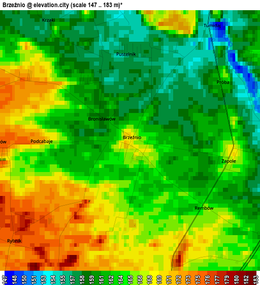
Below is the Elevation map of Brzeźnio, which displays elevation range with different colors. Scale of the first map is from 147 to 183 m (482 to 600 ft) with average elevation of 163.8 meters (=537 ft) [note 1]
These maps also provides idea of topography and contour of this city, they are displayed at different zoom levels. More info about maps, scale and edge coordinates you can find below images.
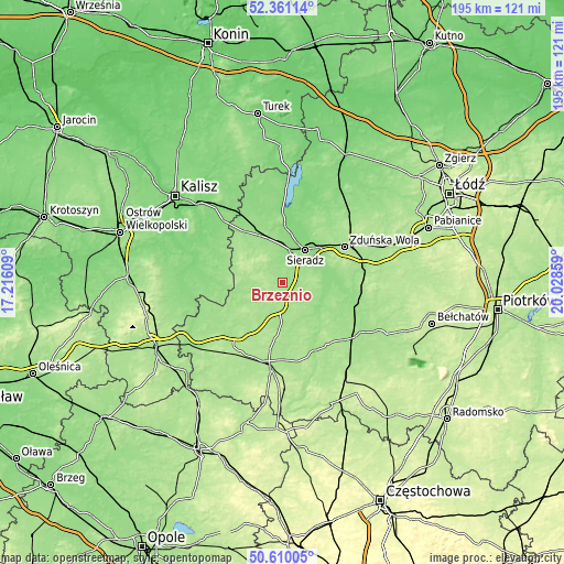
| \ | Map #1 | Topo.Map |
| Scale [m] | 147..183 m | × |
| Scale [ft] | 482..600 ft | × |
| Average | 163.8 m = 537 ft | × |
| Width | 6.08 km = 3.8 mi | 194.7 km = 121 mi |
| Height | 6.08 km = 3.8 mi | 194.7 km = 121 mi |
| ↑Max Latitude | 51.521352° | 52.36114° |
| Latitude at center | 51.494° | 51.494° |
| ↓Min Latitude | 51.466632° | 50.61005° |
| ← Min Longitude | 18.578395° | 17.21609° |
| Longitude center | 18.62234° | 18.62234° |
| →Max Longitude | 18.666285° | 20.02859° |
Nearby cities:
Cities around Brzeźnio sort by population:
• Sieradz elevation 137 m
13.6 km,  33°
33°
• Złoczew 181 m
8.6 km,  188°
188°
• Błaszki 150 m
21.8 km,  323°
323°
• Lututów 171 m
18.9 km,  223°
223°
• Zapolice 172 m
18.9 km,  73°
73°
• Czarnożyły 188 m
23.6 km, 190°
• Widawa 150 m
23.1 km,  105°
105°
• Czajków 146 m
20.4 km,  269°
269°
• Burzenin 144 m
15 km,  104°
104°
• Brąszewice 170 m
12 km, 272°
• Klonowa 163 m
16.4 km,  239°
239°
• Wróblew 152 m
13.1 km,  357°
357°
Multilingual:
 En español:
Brzeźnio elevación 169 m.
 En France:
Brzeźnio élévation 169 m.
 Auf Deutsch:
Brzeźnio höhe über dem Meeresspiegel ist 169 m.

Sources and notes:
- [note 1] Map square and city borders are not equal. Map elevation data is calculated only from area inside that square.
- [src 1] Elevation data from geonames database provided with same terms of usage.
- [src 2] The elevation map of Brzeźnio is generated using elevation data from NASA's 3 arcsec (90m) resolution SRTM data.
- [src 3] Base (background) map © OpenStreetMap contributors tiles are generated by Geofabrik and OpenTopoMap.
Copyright & License:
This Brzeźnio Elevation Map is licensed under CC BY-SA. You may reuse any part from this page, if you give a proper credit by linking to this URL:
 More info on terms of use page.