Ciechocinek elevation
Ciechocinek (Kujawsko-Pomorskie, Powiat aleksandrowski), Poland elevation is 46 meters and Ciechocinek elevation in feet is 151 ft above sea level [src 1]. Ciechocinek is a seat of a third-order administrative division (feature code) with elevation that is 145 meters (476 ft) smaller than average city elevation in Poland.
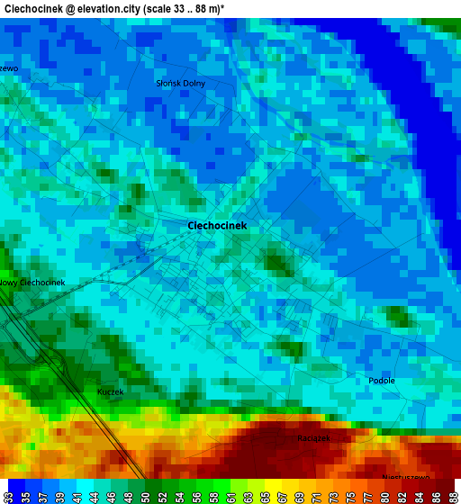
Below is the Elevation map of Ciechocinek, which displays elevation range with different colors. Scale of the first map is from 33 to 88 m (108 to 289 ft) with average elevation of 46.3 meters (=152 ft) [note 1]
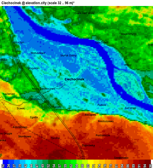
These maps also provides idea of topography and contour of this city, they are displayed at different zoom levels. More info about maps, scale and edge coordinates you can find below images.
| \ | Map #1 | Map #2 | Topo.Map |
| Scale [m] | 33..88 m | 32..96 m | × |
| Scale [ft] | 108..289 ft | 105..315 ft | × |
| Average | 46.3 m = 152 ft | 59.3 m = 195 ft | × |
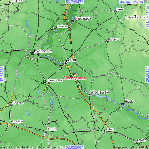
| Width | 5.9 km = 3.7 mi | 11.8 km = 7.3 mi | 188.7 km = 117.3 mi |
| Height | 5.9 km = 3.7 mi | 11.8 km = 7.3 mi | 188.7 km = 117.3 mi |
| ↑Max Latitude | 52.905593° | 52.932089° | 53.71947° |
| Latitude at center | 52.87908° | 52.87908° | 52.87908° |
| ↓Min Latitude | 52.852551° | 52.826006° | 52.02208° |
| ← Min Longitude | 18.751105° | 18.707159° | 17.3888° |
| Longitude center | 18.79505° | 18.79505° | 18.79505° |
| →Max Longitude | 18.838995° | 18.882941° | 20.2013° |
Nearby cities:
Cities around Ciechocinek sort by population:
• Toruń elevation 51 m
20 km,  318°
318°
• Aleksandrów Kujawski 72 m
6.8 km,  267°
267°
• Lubicz Górny 71 m
16.5 km,  354°
354°
• Czernikowo 95 m
12.2 km,  51°
51°
• Lubicz Dolny 63 m
17.3 km, 348°
• Nieszawa 57 m
8.6 km,  125°
125°
• Raciążek 83 m
2.8 km,  153°
153°
• Obrowo 90 m
11.7 km,  28°
28°
• Waganiec 85 m
10.2 km, 147°
• Osiek 56 m
5.3 km,  9°
9°
• Bobrowniki 59 m
15.6 km, 134°
• Lubanie 77 m
16.9 km, 150°
Multilingual:
 En español:
Ciechocinek elevación 46 m.
 En France:
Ciechocinek élévation 46 m.
 Auf Deutsch:
Hermannsbad höhe über dem Meeresspiegel ist 46 m.

Sources and notes:
- [note 1] Map square and city borders are not equal. Map elevation data is calculated only from area inside that square.
- [src 1] Elevation data from geonames database provided with same terms of usage.
- [src 2] The elevation map of Ciechocinek is generated using elevation data from NASA's 3 arcsec (90m) resolution SRTM data.
- [src 3] Base (background) map © OpenStreetMap contributors tiles are generated by Geofabrik and OpenTopoMap.
Copyright & License:
This Ciechocinek Elevation Map is licensed under CC BY-SA. You may reuse any part from this page, if you give a proper credit by linking to this URL:
 More info on terms of use page.