Dalachów elevation
Dalachów (Opole Voivodeship, Powiat oleski), Poland elevation is 199 meters and Dalachów elevation in feet is 653 ft above sea level [src 1]. Dalachów is a populated place (feature code) with elevation that is 8 meters (26 ft) bigger than average city elevation in Poland.
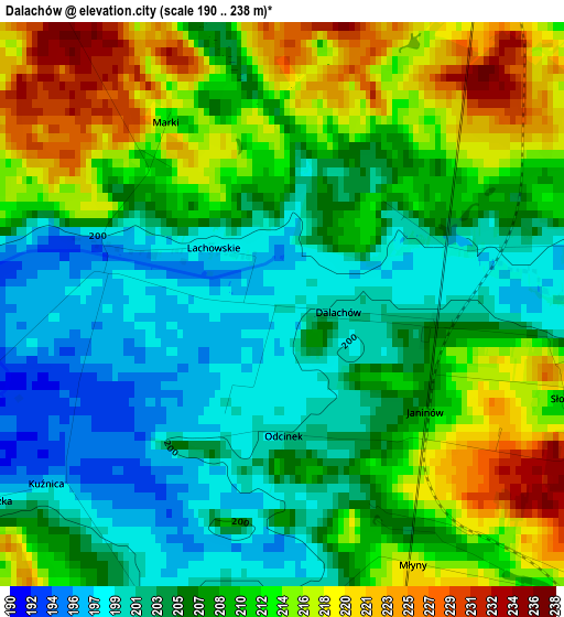
Below is the Elevation map of Dalachów, which displays elevation range with different colors. Scale of the first map is from 190 to 238 m (623 to 781 ft) with average elevation of 208.4 meters (=684 ft) [note 1]
These maps also provides idea of topography and contour of this city, they are displayed at different zoom levels. More info about maps, scale and edge coordinates you can find below images.
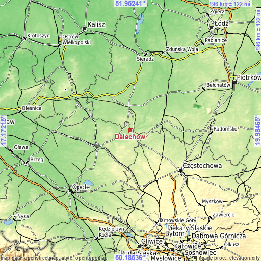
| \ | Map #1 | Topo.Map |
| Scale [m] | 190..238 m | × |
| Scale [ft] | 623..781 ft | × |
| Average | 208.4 m = 684 ft | × |
| Width | 6.14 km = 3.8 mi | 196.5 km = 122.1 mi |
| Height | 6.14 km = 3.8 mi | 196.5 km = 122.1 mi |
| ↑Max Latitude | 51.104921° | 51.95241° |
| Latitude at center | 51.07732° | 51.07732° |
| ↓Min Latitude | 51.049702° | 50.18536° |
| ← Min Longitude | 18.534455° | 17.17215° |
| Longitude center | 18.5784° | 18.5784° |
| →Max Longitude | 18.622345° | 19.98465° |
Nearby cities:
Cities around Dalachów sort by population:
• Wieluń elevation 180 m
16 km,  357°
357°
• Praszka 190 m
9.1 km,  253°
253°
• Działoszyn 182 m
20.5 km,  77°
77°
• Krzepice 224 m
15.9 km,  138°
138°
• Gorzów Śląski 193 m
12.1 km,  243°
243°
• Wierzchlas 205 m
15.4 km,  23°
23°
• Skomlin 185 m
16.9 km,  307°
307°
• Mokrsko 212 m
12.9 km,  331°
331°
• Pątnów 211 m
7.9 km, 19°
• Starokrzepice 223 m
15.2 km,  159°
159°
• Lipie 221 m
16.9 km,  115°
115°
• Ożarów 239 m
8.9 km, 327°
Multilingual:
 En español:
Dalachów elevación 199 m.
 En France:
Dalachów élévation 199 m.
 Auf Deutsch:
Dalachów höhe über dem Meeresspiegel ist 199 m.

Sources and notes:
- [note 1] Map square and city borders are not equal. Map elevation data is calculated only from area inside that square.
- [src 1] Elevation data from geonames database provided with same terms of usage.
- [src 2] The elevation map of Dalachów is generated using elevation data from NASA's 3 arcsec (90m) resolution SRTM data.
- [src 3] Base (background) map © OpenStreetMap contributors tiles are generated by Geofabrik and OpenTopoMap.
Copyright & License:
This Dalachów Elevation Map is licensed under CC BY-SA. You may reuse any part from this page, if you give a proper credit by linking to this URL:
 More info on terms of use page.