Elbląg elevation
Elbląg (Warmia-Masuria), Poland elevation is 8 meters and Elbląg elevation in feet is 26 ft above sea level [src 1]. Elbląg is a seat of a second-order administrative division (feature code) with elevation that is 183 meters (600 ft) smaller than average city elevation in Poland.
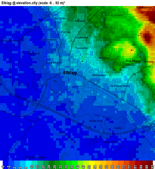
Below is the Elevation map of Elbląg, which displays elevation range with different colors. Scale of the first map is from -6 to 92 m (-20 to 302 ft) with average elevation of 8.1 meters (=27 ft) [note 1]
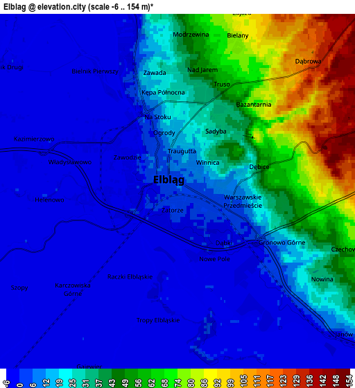
These maps also provides idea of topography and contour of this city, they are displayed at different zoom levels. More info about maps, scale and edge coordinates you can find below images.
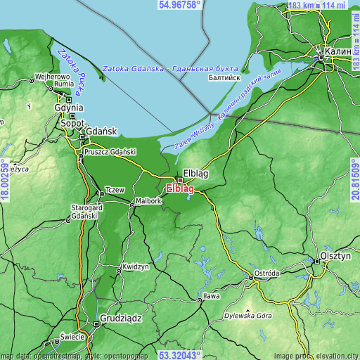
| \ | Map #1 | Map #2 | Topo.Map |
| Scale [m] | -6..92 m | -6..154 m | × |
| Scale [ft] | -20..302 ft | -20..505 ft | × |
| Average | 8.1 m = 27 ft | 22.3 m = 73 ft | × |
| Width | 5.72 km = 3.6 mi | 11.45 km = 7.1 mi | 183.1 km = 113.8 mi |
| Height | 5.72 km = 3.6 mi | 11.45 km = 7.1 mi | 183.1 km = 113.8 mi |
| ↑Max Latitude | 54.177928° | 54.20364° | 54.96758° |
| Latitude at center | 54.1522° | 54.1522° | 54.1522° |
| ↓Min Latitude | 54.126456° | 54.100696° | 53.32043° |
| ← Min Longitude | 19.364895° | 19.320949° | 18.00259° |
| Longitude center | 19.40884° | 19.40884° | 19.40884° |
| →Max Longitude | 19.452785° | 19.496731° | 20.81509° |
Nearby cities:
Cities around Elbląg sort by population:
• Pasłęk elevation 39 m
19.2 km,  121°
121°
• Nowy Dwór Gdański 2 m
20.1 km,  289°
289°
• Dzierzgoń 14 m
25.9 km,  188°
188°
• Nowy Staw 7 m
26.1 km,  266°
266°
• Sztutowo 2 m
24.5 km,  322°
322°
• Tolkmicko 3 m
20.2 km,  22°
22°
• Stegna 3 m
27.3 km, 315°
• Stare Pole 2 m
16.8 km,  230°
230°
• Młynary 54 m
20.7 km,  79°
79°
• Gronowo Elbląskie 0 m
10 km,  222°
222°
• Krynica Morska 3 m
25.5 km,  5°
5°
• Gronowo Górne 18 m
3.7 km,  114°
114°
Multilingual:
 En español:
Elbląg elevación 8 m.
 En France:
Elbląg élévation 8 m.


Sources and notes:
- [note 1] Map square and city borders are not equal. Map elevation data is calculated only from area inside that square.
- [src 1] Elevation data from geonames database provided with same terms of usage.
- [src 2] The elevation map of Elbląg is generated using elevation data from NASA's 3 arcsec (90m) resolution SRTM data.
- [src 3] Base (background) map © OpenStreetMap contributors tiles are generated by Geofabrik and OpenTopoMap.
Copyright & License:
This Elbląg Elevation Map is licensed under CC BY-SA. You may reuse any part from this page, if you give a proper credit by linking to this URL:
 More info on terms of use page.