Młynary elevation
Młynary (Warmia-Masuria, Powiat elbląski), Poland elevation is 54 meters and Młynary elevation in feet is 177 ft above sea level [src 1]. Młynary is a seat of a third-order administrative division (feature code) with elevation that is 137 meters (449 ft) smaller than average city elevation in Poland.
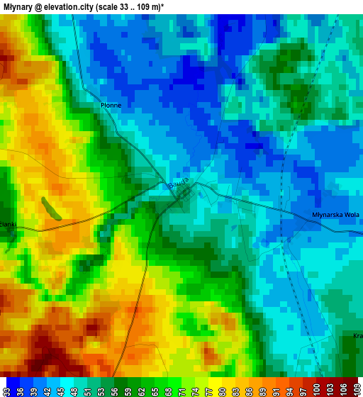
Below is the Elevation map of Młynary, which displays elevation range with different colors. Scale of the first map is from 33 to 109 m (108 to 358 ft) with average elevation of 59 meters (=194 ft) [note 1]
These maps also provides idea of topography and contour of this city, they are displayed at different zoom levels. More info about maps, scale and edge coordinates you can find below images.
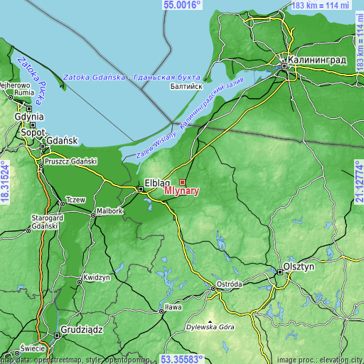
| \ | Map #1 | Topo.Map |
| Scale [m] | 33..109 m | × |
| Scale [ft] | 108..358 ft | × |
| Average | 59 m = 194 ft | × |
| Width | 5.72 km = 3.6 mi | 183 km = 113.7 mi |
| Height | 5.72 km = 3.6 mi | 183 km = 113.7 mi |
| ↑Max Latitude | 54.212606° | 55.0016° |
| Latitude at center | 54.1869° | 54.1869° |
| ↓Min Latitude | 54.161178° | 53.35583° |
| ← Min Longitude | 19.677545° | 18.31524° |
| Longitude center | 19.72149° | 19.72149° |
| →Max Longitude | 19.765435° | 21.12774° |
Nearby cities:
Cities around Młynary sort by population:
• Elbląg elevation 8 m
20.7 km,  259°
259°
• Braniewo 17 m
22.4 km,  16°
16°
• Pasłęk 39 m
14.5 km,  196°
196°
• Orneta 59 m
28 km,  106°
106°
• Pieniężno 77 m
27 km,  78°
78°
• Tolkmicko 3 m
19.5 km,  319°
319°
• Miłakowo 88 m
30.2 km,  130°
130°
• Frombork 6 m
19.2 km,  351°
351°
• Gronowo Elbląskie 0 m
29.3 km,  247°
247°
• Małdyty 111 m
29.7 km,  177°
177°
• Krynica Morska 3 m
28.1 km, 320°
• Gronowo Górne 18 m
17.9 km, 252°
Multilingual:
 En español:
Młynary elevación 54 m.
 En France:
Młynary élévation 54 m.


Sources and notes:
- [note 1] Map square and city borders are not equal. Map elevation data is calculated only from area inside that square.
- [src 1] Elevation data from geonames database provided with same terms of usage.
- [src 2] The elevation map of Młynary is generated using elevation data from NASA's 3 arcsec (90m) resolution SRTM data.
- [src 3] Base (background) map © OpenStreetMap contributors tiles are generated by Geofabrik and OpenTopoMap.
Copyright & License:
This Młynary Elevation Map is licensed under CC BY-SA. You may reuse any part from this page, if you give a proper credit by linking to this URL:
 More info on terms of use page.