Fordon elevation
Fordon (Kujawsko-Pomorskie, Bydgoszcz), Poland elevation is 39 meters and Fordon elevation in feet is 128 ft above sea level [src 1]. Fordon is a populated place (feature code) with elevation that is 152 meters (499 ft) smaller than average city elevation in Poland.
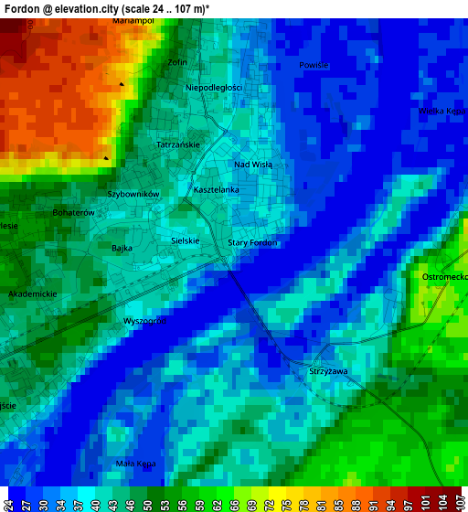
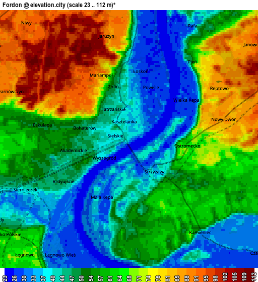
Below is the Elevation map of Fordon, which displays elevation range with different colors. Scale of the first map is from 24 to 107 m (79 to 351 ft) with average elevation of 43.6 meters (=143 ft) [note 1]
These maps also provides idea of topography and contour of this city, they are displayed at different zoom levels. More info about maps, scale and edge coordinates you can find below images.
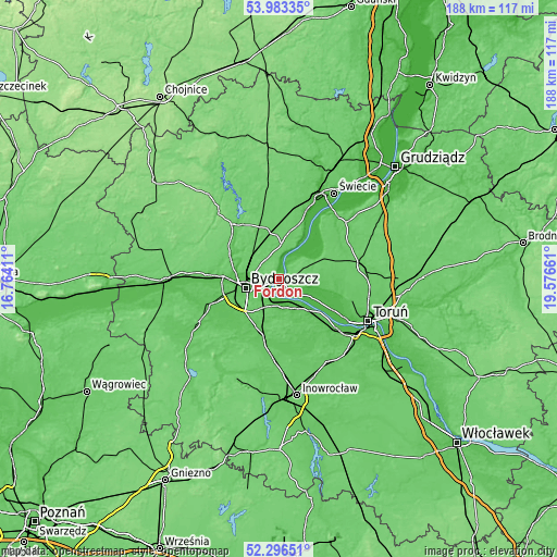
| \ | Map #1 | Map #2 | Topo.Map |
| Scale [m] | 24..107 m | 23..112 m | × |
| Scale [ft] | 79..351 ft | 75..367 ft | × |
| Average | 43.6 m = 143 ft | 57.2 m = 188 ft | × |
| Width | 5.86 km = 3.6 mi | 11.72 km = 7.3 mi | 187.6 km = 116.6 mi |
| Height | 5.86 km = 3.6 mi | 11.72 km = 7.3 mi | 187.5 km = 116.5 mi |
| ↑Max Latitude | 53.174558° | 53.20089° | 53.98335° |
| Latitude at center | 53.14821° | 53.14821° | 53.14821° |
| ↓Min Latitude | 53.121846° | 53.095465° | 52.29651° |
| ← Min Longitude | 18.126415° | 18.082469° | 16.76411° |
| Longitude center | 18.17036° | 18.17036° | 18.17036° |
| →Max Longitude | 18.214305° | 18.258251° | 19.57661° |
Nearby cities:
Cities around Fordon sort by population:
• Bydgoszcz elevation 37 m
11.2 km,  255°
255°
• Solec Kujawski 36 m
8.1 km,  152°
152°
• Koronowo 65 m
24.1 km,  319°
319°
• Białe Błota 70 m
18 km,  250°
250°
• Osielsko 93 m
7.1 km,  305°
305°
• Unisław 89 m
16.1 km,  63°
63°
• Pruszcz 95 m
20.3 km,  5°
5°
• Nowa Wieś Wielka 71 m
20.4 km,  195°
195°
• Dąbrowa Chełmińska 96 m
9.5 km,  71°
71°
• Łubianka 76 m
20.8 km,  92°
92°
• Sicienko 103 m
25.4 km,  284°
284°
• Zławieś Wielka 34 m
12.1 km,  118°
118°
Multilingual:
 En español:
Fordon elevación 39 m.
 En France:
Fordon élévation 39 m.


Sources and notes:
- [note 1] Map square and city borders are not equal. Map elevation data is calculated only from area inside that square.
- [src 1] Elevation data from geonames database provided with same terms of usage.
- [src 2] The elevation map of Fordon is generated using elevation data from NASA's 3 arcsec (90m) resolution SRTM data.
- [src 3] Base (background) map © OpenStreetMap contributors tiles are generated by Geofabrik and OpenTopoMap.
Copyright & License:
This Fordon Elevation Map is licensed under CC BY-SA. You may reuse any part from this page, if you give a proper credit by linking to this URL:
 More info on terms of use page.