Hel elevation
Hel (Pomerania, Powiat pucki), Poland elevation is 1 meters and Hel elevation in feet is 3 ft above sea level [src 1]. Hel is a seat of a third-order administrative division (feature code) with elevation that is 190 meters (623 ft) smaller than average city elevation in Poland.
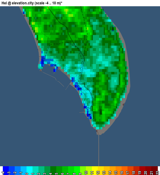
Below is the Elevation map of Hel, which displays elevation range with different colors. Scale of the first map is from -4 to 10 m (-13 to 33 ft) with average elevation of 3.7 meters (=12 ft) [note 1]
These maps also provides idea of topography and contour of this city, they are displayed at different zoom levels. More info about maps, scale and edge coordinates you can find below images.
| \ | Map #1 | Map #2 | Topo.Map |
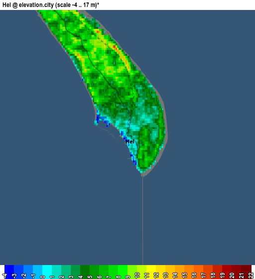
| Scale [m] | -4..10 m | -4..17 m | × |
| Scale [ft] | -13..33 ft | -13..56 ft | × |
| Average | 3.7 m = 12 ft | 5.2 m = 17 ft | × |
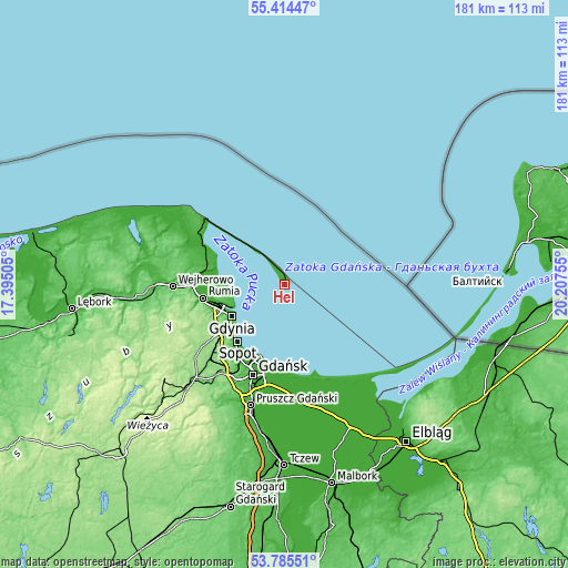
| Width | 5.66 km = 3.5 mi | 11.32 km = 7 mi | 181.1 km = 112.5 mi |
| Height | 5.66 km = 3.5 mi | 11.32 km = 7 mi | 181.1 km = 112.5 mi |
| ↑Max Latitude | 54.633584° | 54.659011° | 55.41447° |
| Latitude at center | 54.60814° | 54.60814° | 54.60814° |
| ↓Min Latitude | 54.58268° | 54.557205° | 53.78551° |
| ← Min Longitude | 18.757355° | 18.713409° | 17.39505° |
| Longitude center | 18.8013° | 18.8013° | 18.8013° |
| →Max Longitude | 18.845245° | 18.889191° | 20.20755° |
Nearby cities:
Cities around Hel sort by population:
• Gdynia elevation 14 m
20 km,  240°
240°
• Rumia 23 m
26.9 km,  261°
261°
• Sopot 20 m
24.2 km,  220°
220°
• Puck 14 m
28.1 km,  295°
295°
• Wielki Kack 134 m
25.5 km,  232°
232°
• Jastarnia 26 m
12.6 km,  321°
321°
• Żelistrzewo 25 m
25.9 km,  287°
287°
• Mrzezino 46 m
24.4 km,  281°
281°
• Mosty 4 m
19.6 km,  271°
271°
• Rekowo Dolne 8 m
28.3 km, 275°
• Pogórze 77 m
21.1 km, 256°
• Kosakowo 36 m
20.5 km, 264°


Sources and notes:
- [note 1] Map square and city borders are not equal. Map elevation data is calculated only from area inside that square.
- [src 1] Elevation data from geonames database provided with same terms of usage.
- [src 2] The elevation map of Hel is generated using elevation data from NASA's 3 arcsec (90m) resolution SRTM data.
- [src 3] Base (background) map © OpenStreetMap contributors tiles are generated by Geofabrik and OpenTopoMap.
Copyright & License:
This Hel Elevation Map is licensed under CC BY-SA. You may reuse any part from this page, if you give a proper credit by linking to this URL:
 More info on terms of use page.