Kobylnica elevation
Kobylnica (Greater Poland, Powiat poznański), Poland elevation is 89 meters and Kobylnica elevation in feet is 292 ft above sea level [src 1]. Kobylnica is a populated place (feature code) with elevation that is 102 meters (335 ft) smaller than average city elevation in Poland.
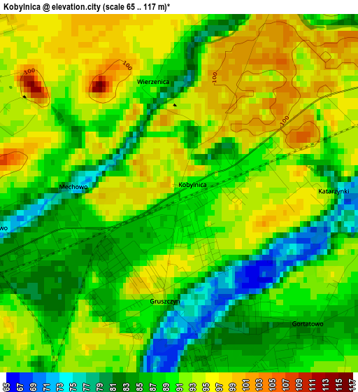
Below is the Elevation map of Kobylnica, which displays elevation range with different colors. Scale of the first map is from 65 to 117 m (213 to 384 ft) with average elevation of 89.9 meters (=295 ft) [note 1]
These maps also provides idea of topography and contour of this city, they are displayed at different zoom levels. More info about maps, scale and edge coordinates you can find below images.
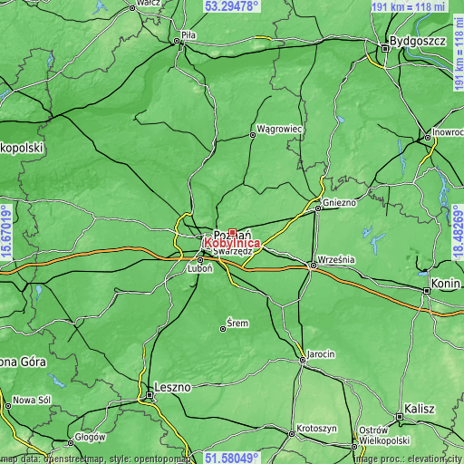
| \ | Map #1 | Topo.Map |
| Scale [m] | 65..117 m | × |
| Scale [ft] | 213..384 ft | × |
| Average | 89.9 m = 295 ft | × |
| Width | 5.96 km = 3.7 mi | 190.6 km = 118.4 mi |
| Height | 5.96 km = 3.7 mi | 190.6 km = 118.4 mi |
| ↑Max Latitude | 52.472747° | 53.29478° |
| Latitude at center | 52.44597° | 52.44597° |
| ↓Min Latitude | 52.419177° | 51.58049° |
| ← Min Longitude | 17.032495° | 15.67019° |
| Longitude center | 17.07644° | 17.07644° |
| →Max Longitude | 17.120385° | 18.48269° |
Nearby cities:
Cities around Kobylnica sort by population:
• Poznań elevation 69 m
10.8 km,  246°
246°
• Swarzędz 92 m
3.7 km,  171°
171°
• Luboń 60 m
16.6 km,  228°
228°
• Murowana Goślina 78 m
15 km,  342°
342°
• Kostrzyn 101 m
11.6 km,  117°
117°
• Pobiedziska 109 m
14.7 km,  76°
76°
• Czerwonak 61 m
6.7 km,  287°
287°
• Suchy Las 102 m
13.8 km,  282°
282°
• Daszewice 71 m
18.1 km,  206°
206°
• Czapury 60 m
18.1 km,  217°
217°
• Złotniki 103 m
16.6 km, 288°
• Kleszczewo 87 m
14 km,  152°
152°
Multilingual:
 En español:
Kobylnica elevación 89 m.
 En France:
Kobylnica élévation 89 m.
 Auf Deutsch:
Kobylnica höhe über dem Meeresspiegel ist 89 m.

Sources and notes:
- [note 1] Map square and city borders are not equal. Map elevation data is calculated only from area inside that square.
- [src 1] Elevation data from geonames database provided with same terms of usage.
- [src 2] The elevation map of Kobylnica is generated using elevation data from NASA's 3 arcsec (90m) resolution SRTM data.
- [src 3] Base (background) map © OpenStreetMap contributors tiles are generated by Geofabrik and OpenTopoMap.
Copyright & License:
This Kobylnica Elevation Map is licensed under CC BY-SA. You may reuse any part from this page, if you give a proper credit by linking to this URL:
 More info on terms of use page.