Lubomia elevation
Lubomia (Silesia, Powiat wodzisławski), Poland elevation is 202 meters and Lubomia elevation in feet is 663 ft above sea level [src 1]. Lubomia is a seat of a third-order administrative division (feature code) with elevation that is 11 meters (36 ft) bigger than average city elevation in Poland.
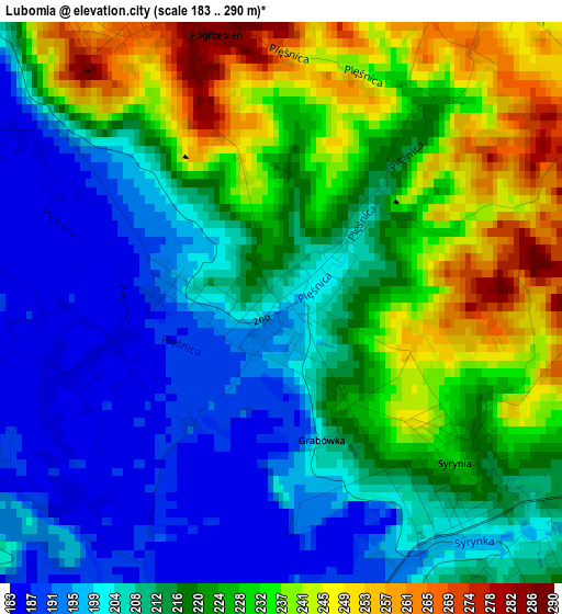
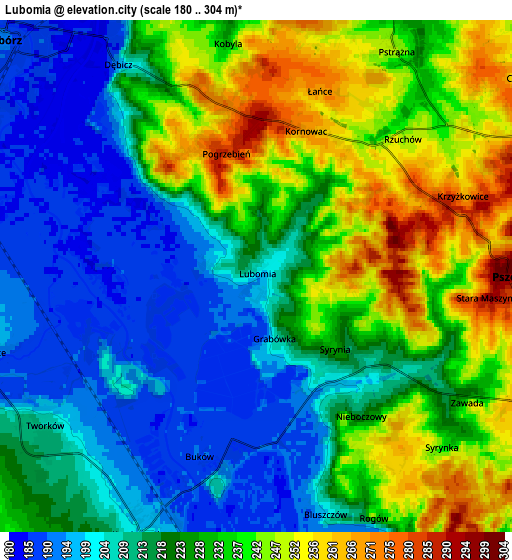
Below is the Elevation map of Lubomia, which displays elevation range with different colors. Scale of the first map is from 183 to 290 m (600 to 951 ft) with average elevation of 217.7 meters (=714 ft) [note 1]
These maps also provides idea of topography and contour of this city, they are displayed at different zoom levels. More info about maps, scale and edge coordinates you can find below images.
| \ | Map #1 | Map #2 | Topo.Map |
| Scale [m] | 183..290 m | 180..304 m | × |
| Scale [ft] | 600..951 ft | 591..997 ft | × |
| Average | 217.7 m = 714 ft | 223.2 m = 732 ft | × |
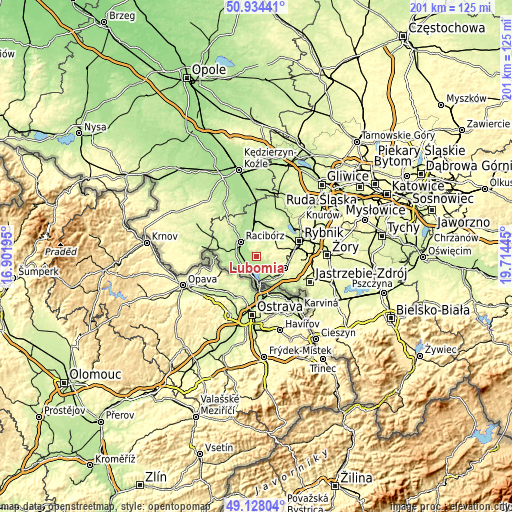
| Width | 6.28 km = 3.9 mi | 12.55 km = 7.8 mi | 200.8 km = 124.8 mi |
| Height | 6.28 km = 3.9 mi | 12.55 km = 7.8 mi | 200.8 km = 124.8 mi |
| ↑Max Latitude | 50.067936° | 50.096135° | 50.93441° |
| Latitude at center | 50.03972° | 50.03972° | 50.03972° |
| ↓Min Latitude | 50.011488° | 49.983238° | 49.12804° |
| ← Min Longitude | 18.264255° | 18.220309° | 16.90195° |
| Longitude center | 18.3082° | 18.3082° | 18.3082° |
| →Max Longitude | 18.352145° | 18.396091° | 19.71445° |
Nearby cities:
Cities around Lubomia sort by population:
• Racibórz elevation 195 m
8.6 km,  312°
312°
• Rydułtowy 284 m
8 km,  74°
74°
• Pszów 300 m
6.2 km,  89°
89°
• Syrynia 208 m
3.5 km,  129°
129°
• Czyżowice 266 m
9.2 km, 131°
• Rogów 249 m
6.2 km,  150°
150°
• Tworków 209 m
6.4 km,  233°
233°
• Czernica 250 m
8.2 km,  53°
53°
• Krzyżanowice 199 m
7 km,  204°
204°
• Pogrzebień 284 m
3.1 km,  347°
347°
• Bełsznica 216 m
7.9 km, 150°
• Kornowac 265 m
3.8 km,  22°
22°
Multilingual:
 En español:
Lubomia elevación 202 m.
 En France:
Lubomia élévation 202 m.


Sources and notes:
- [note 1] Map square and city borders are not equal. Map elevation data is calculated only from area inside that square.
- [src 1] Elevation data from geonames database provided with same terms of usage.
- [src 2] The elevation map of Lubomia is generated using elevation data from NASA's 3 arcsec (90m) resolution SRTM data.
- [src 3] Base (background) map © OpenStreetMap contributors tiles are generated by Geofabrik and OpenTopoMap.
Copyright & License:
This Lubomia Elevation Map is licensed under CC BY-SA. You may reuse any part from this page, if you give a proper credit by linking to this URL:
 More info on terms of use page.