Pszów elevation
Pszów (Silesia, Powiat wodzisławski), Poland elevation is 300 meters and Pszów elevation in feet is 984 ft above sea level [src 1]. Pszów is a seat of a third-order administrative division (feature code) with elevation that is 109 meters (358 ft) bigger than average city elevation in Poland.
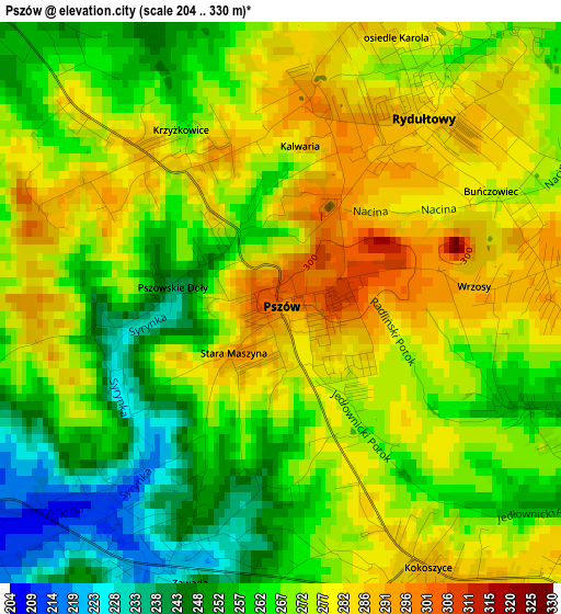
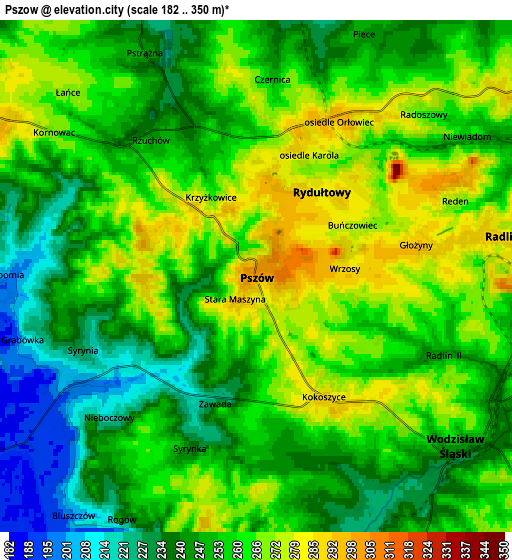
Below is the Elevation map of Pszów, which displays elevation range with different colors. Scale of the first map is from 204 to 330 m (669 to 1083 ft) with average elevation of 269.2 meters (=883 ft) [note 1]
These maps also provides idea of topography and contour of this city, they are displayed at different zoom levels. More info about maps, scale and edge coordinates you can find below images.
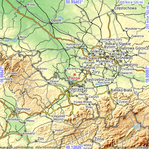
| \ | Map #1 | Map #2 | Topo.Map |
| Scale [m] | 204..330 m | 182..350 m | × |
| Scale [ft] | 669..1083 ft | 597..1148 ft | × |
| Average | 269.2 m = 883 ft | 254.9 m = 836 ft | × |
| Width | 6.28 km = 3.9 mi | 12.55 km = 7.8 mi | 200.8 km = 124.8 mi |
| Height | 6.28 km = 3.9 mi | 12.55 km = 7.8 mi | 200.8 km = 124.8 mi |
| ↑Max Latitude | 50.068156° | 50.096355° | 50.93463° |
| Latitude at center | 50.03994° | 50.03994° | 50.03994° |
| ↓Min Latitude | 50.011708° | 49.983459° | 49.12826° |
| ← Min Longitude | 18.350775° | 18.306829° | 16.98847° |
| Longitude center | 18.39472° | 18.39472° | 18.39472° |
| →Max Longitude | 18.438665° | 18.482611° | 19.80097° |
Nearby cities:
Cities around Pszów sort by population:
• Wodzisław Śląski elevation 246 m
6.8 km,  126°
126°
• Rydułtowy 284 m
2.6 km,  37°
37°
• Radlin 287 m
5.9 km,  78°
78°
• Lubomia 202 m
6.2 km,  269°
269°
• Syrynia 208 m
4.1 km,  237°
237°
• Czyżowice 266 m
6.2 km,  173°
173°
• Rogów 249 m
6.3 km,  209°
209°
• Szczerbice 242 m
7.2 km,  32°
32°
• Czernica 250 m
4.9 km,  4°
4°
• Pogrzebień 284 m
7.5 km,  293°
293°
• Bełsznica 216 m
7.2 km,  198°
198°
• Kornowac 265 m
5.9 km,  306°
306°
Multilingual:
 En español:
Pszów elevación 300 m.
 En France:
Pszów élévation 300 m.


Sources and notes:
- [note 1] Map square and city borders are not equal. Map elevation data is calculated only from area inside that square.
- [src 1] Elevation data from geonames database provided with same terms of usage.
- [src 2] The elevation map of Pszów is generated using elevation data from NASA's 3 arcsec (90m) resolution SRTM data.
- [src 3] Base (background) map © OpenStreetMap contributors tiles are generated by Geofabrik and OpenTopoMap.
Copyright & License:
This Pszów Elevation Map is licensed under CC BY-SA. You may reuse any part from this page, if you give a proper credit by linking to this URL:
 More info on terms of use page.