Lubsza elevation
Lubsza (Opole Voivodeship, Powiat brzeski), Poland elevation is 136 meters and Lubsza elevation in feet is 446 ft above sea level [src 1]. Lubsza is a seat of a third-order administrative division (feature code) with elevation that is 55 meters (180 ft) smaller than average city elevation in Poland.
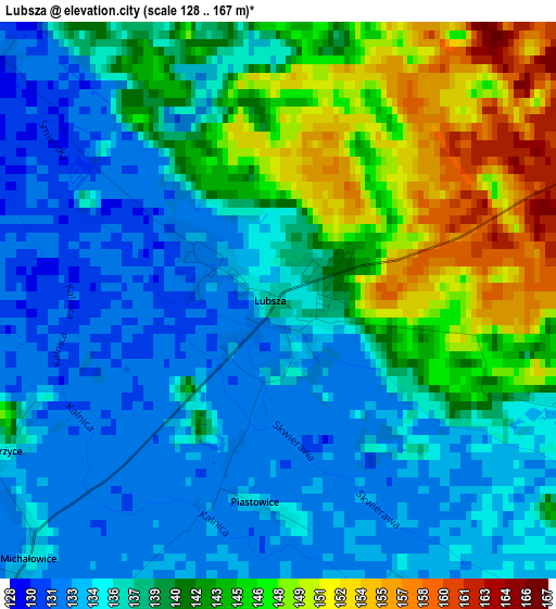
Below is the Elevation map of Lubsza, which displays elevation range with different colors. Scale of the first map is from 128 to 167 m (420 to 548 ft) with average elevation of 138.8 meters (=455 ft) [note 1]
These maps also provides idea of topography and contour of this city, they are displayed at different zoom levels. More info about maps, scale and edge coordinates you can find below images.
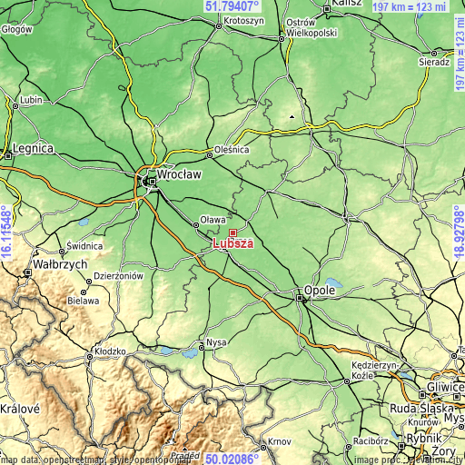
| \ | Map #1 | Topo.Map |
| Scale [m] | 128..167 m | × |
| Scale [ft] | 420..548 ft | × |
| Average | 138.8 m = 455 ft | × |
| Width | 6.16 km = 3.8 mi | 197.2 km = 122.5 mi |
| Height | 6.16 km = 3.8 mi | 197.1 km = 122.5 mi |
| ↑Max Latitude | 50.943608° | 51.79407° |
| Latitude at center | 50.91591° | 50.91591° |
| ↓Min Latitude | 50.888196° | 50.02086° |
| ← Min Longitude | 17.477785° | 16.11548° |
| Longitude center | 17.52173° | 17.52173° |
| →Max Longitude | 17.565675° | 18.92798° |
Nearby cities:
Cities around Lubsza sort by population:
• Brzeg elevation 147 m
7.2 km,  211°
211°
• Oława 129 m
16.4 km,  281°
281°
• Jelcz Laskowice 128 m
18.5 km,  309°
309°
• Jelcz 128 m
18.3 km, 309°
• Lewin Brzeski 149 m
19.8 km,  160°
160°
• Popielów 144 m
18.5 km,  122°
122°
• Bystrzyca 142 m
10 km,  299°
299°
• Skarbimierz Osiedle 154 m
10.6 km,  222°
222°
• Łosiów 161 m
14.2 km,  167°
167°
• Skorogoszcz 145 m
20.7 km,  147°
147°
• Świerczów 156 m
17.3 km,  73°
73°
• Olszanka 159 m
13.8 km,  192°
192°
Multilingual:
 En español:
Lubsza elevación 136 m.
 En France:
Lubsza élévation 136 m.


Sources and notes:
- [note 1] Map square and city borders are not equal. Map elevation data is calculated only from area inside that square.
- [src 1] Elevation data from geonames database provided with same terms of usage.
- [src 2] The elevation map of Lubsza is generated using elevation data from NASA's 3 arcsec (90m) resolution SRTM data.
- [src 3] Base (background) map © OpenStreetMap contributors tiles are generated by Geofabrik and OpenTopoMap.
Copyright & License:
This Lubsza Elevation Map is licensed under CC BY-SA. You may reuse any part from this page, if you give a proper credit by linking to this URL:
 More info on terms of use page.