Lutomiersk elevation
Lutomiersk (Łódź Voivodeship, Powiat pabianicki), Poland elevation is 161 meters and Lutomiersk elevation in feet is 528 ft above sea level [src 1]. Lutomiersk is a seat of a third-order administrative division (feature code) with elevation that is 30 meters (98 ft) smaller than average city elevation in Poland.
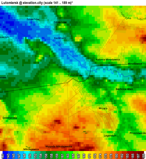
Below is the Elevation map of Lutomiersk, which displays elevation range with different colors. Scale of the first map is from 141 to 189 m (463 to 620 ft) with average elevation of 163.3 meters (=536 ft) [note 1]
These maps also provides idea of topography and contour of this city, they are displayed at different zoom levels. More info about maps, scale and edge coordinates you can find below images.
| \ | Map #1 | Topo.Map |
| Scale [m] | 141..189 m | × |
| Scale [ft] | 463..620 ft | × |
| Average | 163.3 m = 536 ft | × |
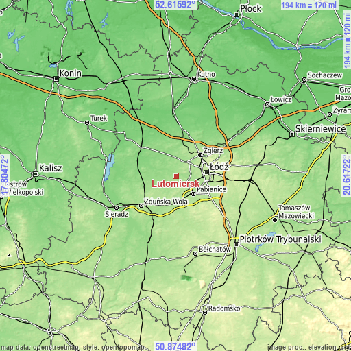
| Width | 6.05 km = 3.8 mi | 193.6 km = 120.3 mi |
| Height | 6.05 km = 3.8 mi | 193.6 km = 120.3 mi |
| ↑Max Latitude | 51.780956° | 52.61592° |
| Latitude at center | 51.75376° | 51.75376° |
| ↓Min Latitude | 51.726548° | 50.87482° |
| ← Min Longitude | 19.167025° | 17.80472° |
| Longitude center | 19.21097° | 19.21097° |
| →Max Longitude | 19.254915° | 20.61722° |
Nearby cities:
Cities around Lutomiersk sort by population:
• Łódź elevation 223 m
18.2 km,  84°
84°
• Pabianice 179 m
14 km,  135°
135°
• Zgierz 187 m
17.6 km,  49°
49°
• Aleksandrów Łódzki 195 m
9.7 km,  41°
41°
• Łask 171 m
18.9 km,  196°
196°
• Konstantynów Łódzki 167 m
7.9 km,  94°
94°
• Ksawerów 184 m
15.4 km,  120°
120°
• Szadek 162 m
17.6 km,  246°
246°
• Starowa Góra 188 m
20 km,  110°
110°
• Dobroń 182 m
13 km,  169°
169°
• Dalików 141 m
15.9 km,  336°
336°
• Wodzierady 161 m
5.7 km,  226°
226°
Multilingual:
 En español:
Lutomiersk elevación 161 m.
 En France:
Lutomiersk élévation 161 m.
 Auf Deutsch:
Lutomiersk höhe über dem Meeresspiegel ist 161 m.

Sources and notes:
- [note 1] Map square and city borders are not equal. Map elevation data is calculated only from area inside that square.
- [src 1] Elevation data from geonames database provided with same terms of usage.
- [src 2] The elevation map of Lutomiersk is generated using elevation data from NASA's 3 arcsec (90m) resolution SRTM data.
- [src 3] Base (background) map © OpenStreetMap contributors tiles are generated by Geofabrik and OpenTopoMap.
Copyright & License:
This Lutomiersk Elevation Map is licensed under CC BY-SA. You may reuse any part from this page, if you give a proper credit by linking to this URL:
 More info on terms of use page.