Parzęczew elevation
Parzęczew (Łódź Voivodeship, Powiat zgierski), Poland elevation is 133 meters and Parzęczew elevation in feet is 436 ft above sea level [src 1]. Parzęczew is a seat of a third-order administrative division (feature code) with elevation that is 58 meters (190 ft) smaller than average city elevation in Poland.
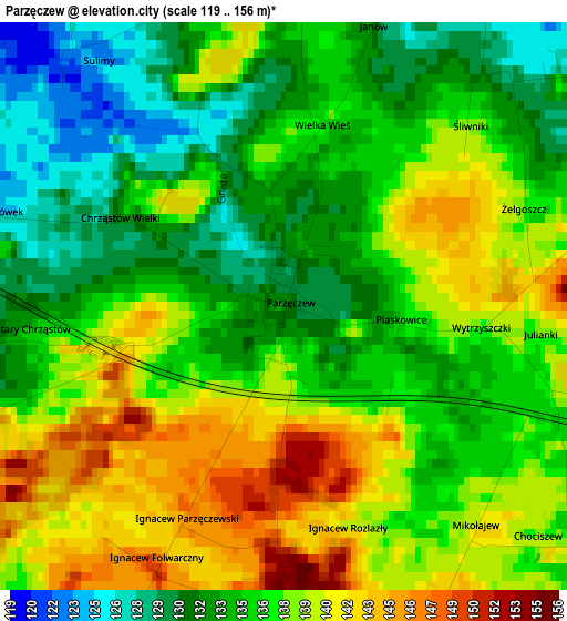
Below is the Elevation map of Parzęczew, which displays elevation range with different colors. Scale of the first map is from 119 to 156 m (390 to 512 ft) with average elevation of 136.4 meters (=448 ft) [note 1]
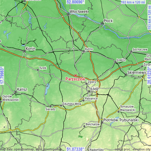
These maps also provides idea of topography and contour of this city, they are displayed at different zoom levels. More info about maps, scale and edge coordinates you can find below images.
| \ | Map #1 | Topo.Map |
| Scale [m] | 119..156 m | × |
| Scale [ft] | 390..512 ft | × |
| Average | 136.4 m = 448 ft | × |
| Width | 6.02 km = 3.7 mi | 192.8 km = 119.8 mi |
| Height | 6.02 km = 3.7 mi | 192.7 km = 119.7 mi |
| ↑Max Latitude | 51.975628° | 52.80696° |
| Latitude at center | 51.94855° | 51.94855° |
| ↓Min Latitude | 51.921455° | 51.07338° |
| ← Min Longitude | 19.162135° | 17.79983° |
| Longitude center | 19.20608° | 19.20608° |
| →Max Longitude | 19.250025° | 20.61233° |
Nearby cities:
Cities around Parzęczew sort by population:
• Zgierz elevation 187 m
17.2 km,  126°
126°
• Ozorków 124 m
6.1 km,  74°
74°
• Aleksandrów Łódzki 195 m
15.8 km,  154°
154°
• Łęczyca 112 m
12.4 km,  357°
357°
• Poddębice 126 m
18.1 km,  250°
250°
• Piątek 100 m
23 km,  54°
54°
• Świnice Warckie 103 m
22.2 km,  297°
297°
• Lutomiersk 161 m
21.7 km,  179°
179°
• Witonia 102 m
22.9 km,  16°
16°
• Wartkowice 111 m
14.3 km,  282°
282°
• Dalików 141 m
9.3 km,  220°
220°
• Góra Świętej Małgorzaty 114 m
14.4 km,  32°
32°
Multilingual:
 En español:
Parzęczew elevación 133 m.
 En France:
Parzęczew élévation 133 m.
 Auf Deutsch:
Parzęczew höhe über dem Meeresspiegel ist 133 m.

Sources and notes:
- [note 1] Map square and city borders are not equal. Map elevation data is calculated only from area inside that square.
- [src 1] Elevation data from geonames database provided with same terms of usage.
- [src 2] The elevation map of Parzęczew is generated using elevation data from NASA's 3 arcsec (90m) resolution SRTM data.
- [src 3] Base (background) map © OpenStreetMap contributors tiles are generated by Geofabrik and OpenTopoMap.
Copyright & License:
This Parzęczew Elevation Map is licensed under CC BY-SA. You may reuse any part from this page, if you give a proper credit by linking to this URL:
 More info on terms of use page.