Radostowice elevation
Radostowice (Silesia, Powiat pszczyński), Poland elevation is 267 meters and Radostowice elevation in feet is 876 ft above sea level [src 1]. Radostowice is a populated place (feature code) with elevation that is 76 meters (249 ft) bigger than average city elevation in Poland.
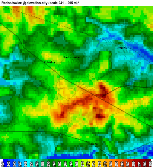
Below is the Elevation map of Radostowice, which displays elevation range with different colors. Scale of the first map is from 241 to 295 m (791 to 968 ft) with average elevation of 263.4 meters (=864 ft) [note 1]
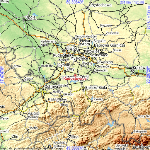
These maps also provides idea of topography and contour of this city, they are displayed at different zoom levels. More info about maps, scale and edge coordinates you can find below images.
| \ | Map #1 | Topo.Map |
| Scale [m] | 241..295 m | × |
| Scale [ft] | 791..968 ft | × |
| Average | 263.4 m = 864 ft | × |
| Width | 6.28 km = 3.9 mi | 201 km = 124.9 mi |
| Height | 6.28 km = 3.9 mi | 201 km = 124.9 mi |
| ↑Max Latitude | 50.031347° | 50.89849° |
| Latitude at center | 50.00311° | 50.00311° |
| ↓Min Latitude | 49.974856° | 49.09074° |
| ← Min Longitude | 18.837085° | 17.47478° |
| Longitude center | 18.88103° | 18.88103° |
| →Max Longitude | 18.924975° | 20.28728° |
Nearby cities:
Cities around Radostowice sort by population:
• Pszczyna elevation 242 m
5.8 km,  115°
115°
• Goczałkowice Zdrój 250 m
9.1 km,  135°
135°
• Kobiór 248 m
7.5 km,  30°
30°
• Suszec 265 m
7 km,  294°
294°
• Piasek 252 m
4.9 km,  80°
80°
• Gostyń 254 m
11.4 km,  0°
0°
• Zabrzeg 246 m
10.6 km,  155°
155°
• Jankowice 247 m
7.7 km,  91°
91°
• Studzionka 256 m
9 km,  239°
239°
• Czarków 252 m
2.5 km,  47°
47°
• Kryry 267 m
5.6 km, 285°
• Rudziczka 268 m
9.2 km, 293°
Multilingual:
 En español:
Radostowice elevación 267 m.
 En France:
Radostowice élévation 267 m.
 Auf Deutsch:
Radostowice höhe über dem Meeresspiegel ist 267 m.

Sources and notes:
- [note 1] Map square and city borders are not equal. Map elevation data is calculated only from area inside that square.
- [src 1] Elevation data from geonames database provided with same terms of usage.
- [src 2] The elevation map of Radostowice is generated using elevation data from NASA's 3 arcsec (90m) resolution SRTM data.
- [src 3] Base (background) map © OpenStreetMap contributors tiles are generated by Geofabrik and OpenTopoMap.
Copyright & License:
This Radostowice Elevation Map is licensed under CC BY-SA. You may reuse any part from this page, if you give a proper credit by linking to this URL:
 More info on terms of use page.