Radzionków elevation
Radzionków (Silesia, Powiat tarnogórski), Poland elevation is 298 meters and Radzionków elevation in feet is 978 ft above sea level [src 1]. Radzionków is a populated place (feature code) with elevation that is 107 meters (351 ft) bigger than average city elevation in Poland.
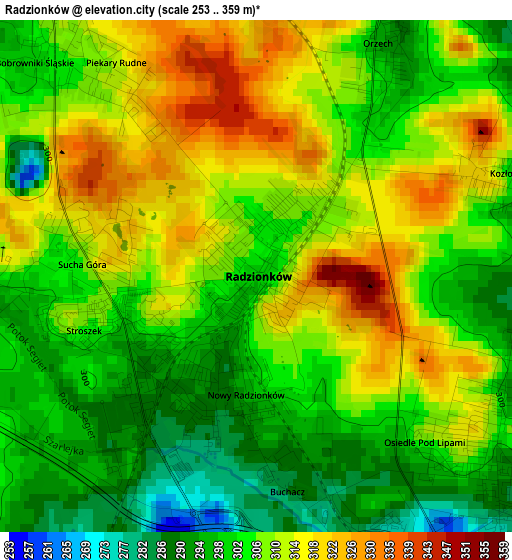
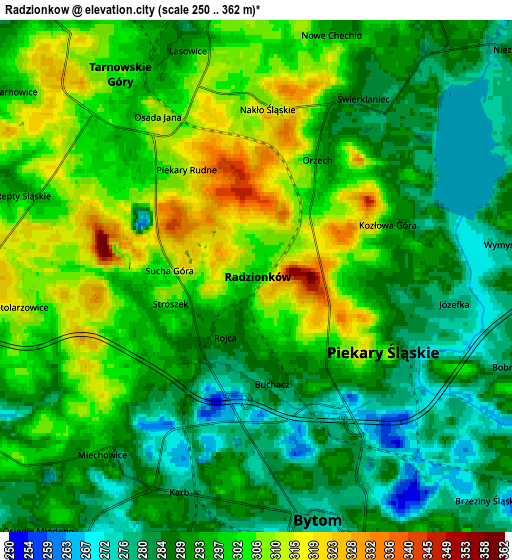
Below is the Elevation map of Radzionków, which displays elevation range with different colors. Scale of the first map is from 253 to 359 m (830 to 1178 ft) with average elevation of 306.5 meters (=1006 ft) [note 1]
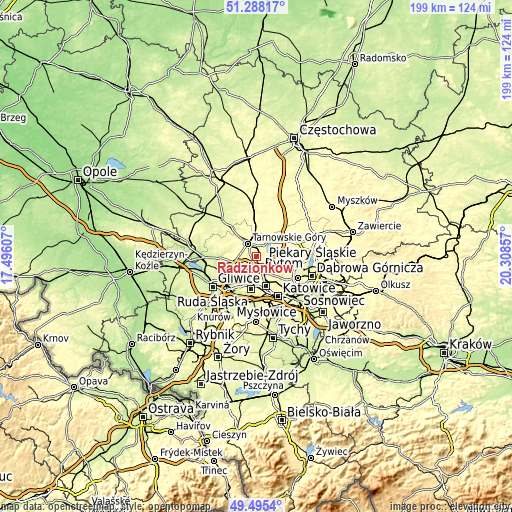
These maps also provides idea of topography and contour of this city, they are displayed at different zoom levels. More info about maps, scale and edge coordinates you can find below images.
| \ | Map #1 | Map #2 | Topo.Map |
| Scale [m] | 253..359 m | 250..362 m | × |
| Scale [ft] | 830..1178 ft | 820..1188 ft | × |
| Average | 306.5 m = 1006 ft | 295.1 m = 968 ft | × |
| Width | 6.23 km = 3.9 mi | 12.46 km = 7.7 mi | 199.3 km = 123.8 mi |
| Height | 6.23 km = 3.9 mi | 12.46 km = 7.7 mi | 199.3 km = 123.8 mi |
| ↑Max Latitude | 50.428263° | 50.45625° | 51.28817° |
| Latitude at center | 50.40026° | 50.40026° | 50.40026° |
| ↓Min Latitude | 50.37224° | 50.344204° | 49.4954° |
| ← Min Longitude | 18.858375° | 18.814429° | 17.49607° |
| Longitude center | 18.90232° | 18.90232° | 18.90232° |
| →Max Longitude | 18.946265° | 18.990211° | 20.30857° |
Nearby cities:
Cities around Radzionków sort by population:
• Bytom elevation 285 m
6.2 km,  159°
159°
• Tarnowskie Góry 297 m
5.8 km,  330°
330°
• Piekary Śląskie 290 m
2.8 km,  142°
142°
• Wojkowice 289 m
10.3 km,  112°
112°
• Brzeziny Śląskie 285 m
7.6 km,  132°
132°
• Nakło 313 m
4.1 km,  8°
8°
• Świerklaniec 287 m
5.3 km,  27°
27°
• Bobrowniki 279 m
6.4 km, 110°
• Rogoźnik 301 m
9.7 km,  96°
96°
• Orzech 299 m
3.4 km, 25°
• Dobieszowice 282 m
7.9 km,  92°
92°
• Sączów 306 m
9.9 km,  66°
66°
Multilingual:
 En español:
Radzionków elevación 298 m.
 En France:
Radzionków élévation 298 m.
 Auf Deutsch:
Radzionków höhe über dem Meeresspiegel ist 298 m.

Sources and notes:
- [note 1] Map square and city borders are not equal. Map elevation data is calculated only from area inside that square.
- [src 1] Elevation data from geonames database provided with same terms of usage.
- [src 2] The elevation map of Radzionków is generated using elevation data from NASA's 3 arcsec (90m) resolution SRTM data.
- [src 3] Base (background) map © OpenStreetMap contributors tiles are generated by Geofabrik and OpenTopoMap.
Copyright & License:
This Radzionków Elevation Map is licensed under CC BY-SA. You may reuse any part from this page, if you give a proper credit by linking to this URL:
 More info on terms of use page.