Tuchola elevation
Tuchola (Kujawsko-Pomorskie, Powiat tucholski), Poland elevation is 109 meters and Tuchola elevation in feet is 358 ft above sea level [src 1]. Tuchola is a seat of a second-order administrative division (feature code) with elevation that is 82 meters (269 ft) smaller than average city elevation in Poland.
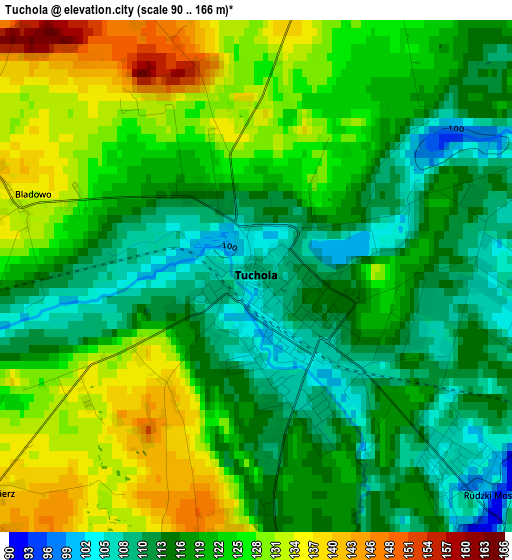
Below is the Elevation map of Tuchola, which displays elevation range with different colors. Scale of the first map is from 90 to 166 m (295 to 545 ft) with average elevation of 120.7 meters (=396 ft) [note 1]
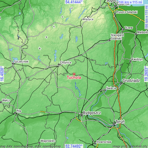
These maps also provides idea of topography and contour of this city, they are displayed at different zoom levels. More info about maps, scale and edge coordinates you can find below images.
| \ | Map #1 | Map #2 | Topo.Map |
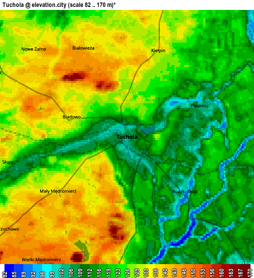
| Scale [m] | 90..166 m | 82..170 m | × |
| Scale [ft] | 295..545 ft | 269..558 ft | × |
| Average | 120.7 m = 396 ft | 124.6 m = 409 ft | × |
| Width | 5.8 km = 3.6 mi | 11.6 km = 7.2 mi | 185.6 km = 115.3 mi |
| Height | 5.8 km = 3.6 mi | 11.6 km = 7.2 mi | 185.6 km = 115.3 mi |
| ↑Max Latitude | 53.613997° | 53.640059° | 54.41444° |
| Latitude at center | 53.58792° | 53.58792° | 53.58792° |
| ↓Min Latitude | 53.561827° | 53.535717° | 52.74492° |
| ← Min Longitude | 17.815105° | 17.771159° | 16.4528° |
| Longitude center | 17.85905° | 17.85905° | 17.85905° |
| →Max Longitude | 17.902995° | 17.946941° | 19.2653° |
Nearby cities:
Cities around Tuchola sort by population:
• Chojnice elevation 152 m
23.2 km,  301°
301°
• Czersk 130 m
24.4 km,  18°
18°
• Śliwice 113 m
24.7 km,  57°
57°
• Kamień Krajeński 130 m
23.2 km,  254°
254°
• Gostycyn 111 m
11.3 km,  196°
196°
• Cekcyn 112 m
10.2 km,  99°
99°
• Szlachta 123 m
26.1 km,  39°
39°
• Lniano 104 m
24.3 km,  105°
105°
• Świekatowo 104 m
24.5 km,  140°
140°
• Lubiewo 105 m
17.7 km, 140°
• Sośno 130 m
24.8 km,  207°
207°
• Kęsowo 120 m
10 km, 251°
Multilingual:
 En español:
Tuchola elevación 109 m.
 En France:
Tuchola élévation 109 m.


Sources and notes:
- [note 1] Map square and city borders are not equal. Map elevation data is calculated only from area inside that square.
- [src 1] Elevation data from geonames database provided with same terms of usage.
- [src 2] The elevation map of Tuchola is generated using elevation data from NASA's 3 arcsec (90m) resolution SRTM data.
- [src 3] Base (background) map © OpenStreetMap contributors tiles are generated by Geofabrik and OpenTopoMap.
Copyright & License:
This Tuchola Elevation Map is licensed under CC BY-SA. You may reuse any part from this page, if you give a proper credit by linking to this URL:
 More info on terms of use page.