Gambat elevation
Gambat (Sindh), Pakistan elevation is 53 meters and Gambat elevation in feet is 174 ft above sea level [src 1]. Gambat is a populated place (feature code) with elevation that is 293 meters (961 ft) smaller than average city elevation in Pakistan.
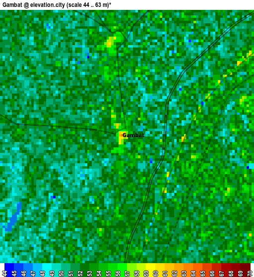
Below is the Elevation map of Gambat, which displays elevation range with different colors. Scale of the first map is from 44 to 63 m (144 to 207 ft) with average elevation of 51.6 meters (=169 ft) [note 1]
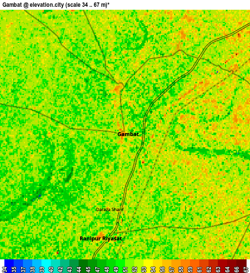
These maps also provides idea of topography and contour of this city, they are displayed at different zoom levels. More info about maps, scale and edge coordinates you can find below images.
| \ | Map #1 | Map #2 | Topo.Map |
| Scale [m] | 44..63 m | 34..67 m | × |
| Scale [ft] | 144..207 ft | 112..220 ft | × |
| Average | 51.6 m = 169 ft | 51.8 m = 170 ft | × |
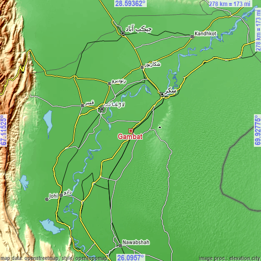
| Width | 8.68 km = 5.4 mi | 17.36 km = 10.8 mi | 277.7 km = 172.6 mi |
| Height | 8.68 km = 5.4 mi | 17.36 km = 10.8 mi | 277.8 km = 172.6 mi |
| ↑Max Latitude | 27.390725° | 27.429737° | 28.59362° |
| Latitude at center | 27.3517° | 27.3517° | 27.3517° |
| ↓Min Latitude | 27.312661° | 27.273608° | 26.0957° |
| ← Min Longitude | 68.477555° | 68.433609° | 67.11525° |
| Longitude center | 68.5215° | 68.5215° | 68.5215° |
| →Max Longitude | 68.565445° | 68.609391° | 69.92775° |
Nearby cities:
Cities around Gambat sort by population:
• Larkana elevation 52 m
38.3 km,  307°
307°
• Khairpur Mir’s 60 m
30.7 km,  49°
49°
• Pir Jo Goth 63 m
28.4 km,  19°
19°
• Naudero 57 m
38.5 km,  335°
335°
• Setharja Old 54 m
16.3 km,  198°
198°
• Kandiaro 51 m
44.8 km,  223°
223°
• Kot Diji 57 m
18.5 km,  93°
93°
• Ranipur 54 m
7.3 km,  191°
191°
• Hingorja 55 m
18.8 km,  213°
213°
• Dokri 54 m
42 km,  273°
273°
• Sobhodero 55 m
13.3 km,  246°
246°
• Bozdar Wada 54 m
21.9 km,  148°
148°
Multilingual:
 En español:
Gambat elevación 53 m.
 En France:
Gambat élévation 53 m.


Sources and notes:
- [note 1] Map square and city borders are not equal. Map elevation data is calculated only from area inside that square.
- [src 1] Elevation data from geonames database provided with same terms of usage.
- [src 2] The elevation map of Gambat is generated using elevation data from NASA's 3 arcsec (90m) resolution SRTM data.
- [src 3] Base (background) map © OpenStreetMap contributors tiles are generated by Geofabrik and OpenTopoMap.
Copyright & License:
This Gambat Elevation Map is licensed under CC BY-SA. You may reuse any part from this page, if you give a proper credit by linking to this URL:
 More info on terms of use page.