Mamu Kanjan elevation
Mamu Kanjan (Punjab), Pakistan elevation is 167 meters and Mamu Kanjan elevation in feet is 548 ft above sea level [src 1]. Mamu Kanjan is a populated place (feature code) with elevation that is 179 meters (587 ft) smaller than average city elevation in Pakistan.
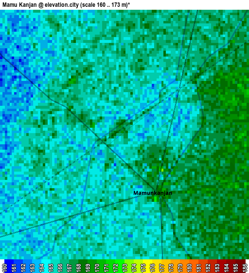
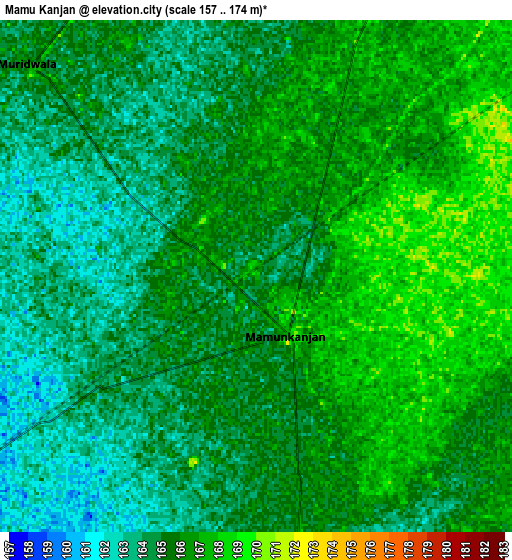
Below is the Elevation map of Mamu Kanjan, which displays elevation range with different colors. Scale of the first map is from 160 to 173 m (525 to 568 ft) with average elevation of 165.4 meters (=543 ft) [note 1]
These maps also provides idea of topography and contour of this city, they are displayed at different zoom levels. More info about maps, scale and edge coordinates you can find below images.
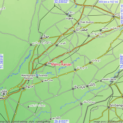
| \ | Map #1 | Map #2 | Topo.Map |
| Scale [m] | 160..173 m | 157..174 m | × |
| Scale [ft] | 525..568 ft | 515..571 ft | × |
| Average | 165.4 m = 543 ft | 165 m = 541 ft | × |
| Width | 8.39 km = 5.2 mi | 16.78 km = 10.4 mi | 268.5 km = 166.8 mi |
| Height | 8.39 km = 5.2 mi | 16.78 km = 10.4 mi | 268.5 km = 166.8 mi |
| ↑Max Latitude | 30.868168° | 30.905881° | 32.03032° |
| Latitude at center | 30.83044° | 30.83044° | 30.83044° |
| ↓Min Latitude | 30.792697° | 30.75494° | 29.61537° |
| ← Min Longitude | 72.755485° | 72.711539° | 71.39318° |
| Longitude center | 72.79943° | 72.79943° | 72.79943° |
| →Max Longitude | 72.843375° | 72.887321° | 74.20568° |
Nearby cities:
Cities around Mamu Kanjan sort by population:
• Sahiwal elevation 173 m
34.2 km,  122°
122°
• Gojra 169 m
37.1 km,  342°
342°
• Kamalia 160 m
18.6 km,  231°
231°
• Chichawatni 165 m
35 km,  197°
197°
• Mian Channun 154 m
60.6 km,  224°
224°
• Toba Tek Singh 161 m
34 km,  297°
297°
• Chak Thirty-one -Eleven Left 154 m
46.2 km,  192°
192°
• Tandlianwala 184 m
39 km,  54°
54°
• Chak Azam Sahu 170 m
23.5 km,  111°
111°
• Pir Mahal 158 m
35.6 km,  258°
258°
• Dijkot 179 m
46.9 km,  23°
23°
• Chak One Hundred Twenty Nine Left 162 m
50.4 km,  152°
152°
Multilingual:
 En español:
Mamu Kanjan elevación 167 m.
 En France:
Mamu Kanjan élévation 167 m.
 Auf Deutsch:
Mamu Kanjan höhe über dem Meeresspiegel ist 167 m.

Sources and notes:
- [note 1] Map square and city borders are not equal. Map elevation data is calculated only from area inside that square.
- [src 1] Elevation data from geonames database provided with same terms of usage.
- [src 2] The elevation map of Mamu Kanjan is generated using elevation data from NASA's 3 arcsec (90m) resolution SRTM data.
- [src 3] Base (background) map © OpenStreetMap contributors tiles are generated by Geofabrik and OpenTopoMap.
Copyright & License:
This Mamu Kanjan Elevation Map is licensed under CC BY-SA. You may reuse any part from this page, if you give a proper credit by linking to this URL:
 More info on terms of use page.