Mustafābād elevation
Mustafābād (Punjab), Pakistan elevation is 178 meters and Mustafābād elevation in feet is 584 ft above sea level [src 1]. Mustafābād is a populated place (feature code) with elevation that is 168 meters (551 ft) smaller than average city elevation in Pakistan.
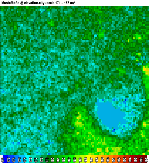
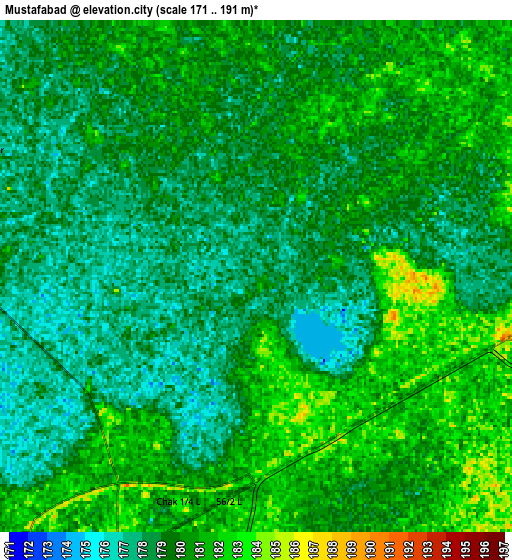
Below is the Elevation map of Mustafābād, which displays elevation range with different colors. Scale of the first map is from 171 to 187 m (561 to 614 ft) with average elevation of 178.1 meters (=584 ft) [note 1]
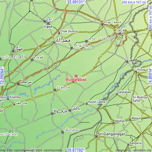
These maps also provides idea of topography and contour of this city, they are displayed at different zoom levels. More info about maps, scale and edge coordinates you can find below images.
| \ | Map #1 | Map #2 | Topo.Map |
| Scale [m] | 171..187 m | 171..191 m | × |
| Scale [ft] | 561..614 ft | 561..627 ft | × |
| Average | 178.1 m = 584 ft | 179.3 m = 588 ft | × |
| Width | 8.39 km = 5.2 mi | 16.77 km = 10.4 mi | 268.3 km = 166.7 mi |
| Height | 8.39 km = 5.2 mi | 16.77 km = 10.4 mi | 268.3 km = 166.7 mi |
| ↑Max Latitude | 30.929924° | 30.967612° | 32.09131° |
| Latitude at center | 30.89222° | 30.89222° | 30.89222° |
| ↓Min Latitude | 30.854502° | 30.816768° | 29.67792° |
| ← Min Longitude | 73.454945° | 73.410999° | 72.09264° |
| Longitude center | 73.49889° | 73.49889° | 73.49889° |
| →Max Longitude | 73.542835° | 73.586781° | 74.90514° |
Nearby cities:
Cities around Mustafābād sort by population:
• Sahiwal elevation 173 m
45.5 km,  236°
236°
• Okara 181 m
10.2 km,  206°
206°
• Bahawalnagar 165 m
39.3 km,  195°
195°
• Jaranwala 193 m
49.6 km,  351°
351°
• Dipalpur 176 m
28.8 km,  149°
149°
• Pattoki 197 m
36.7 km,  67°
67°
• Hujra Shah Muqim 183 m
35.2 km,  118°
118°
• Chunian 195 m
46.5 km,  79°
79°
• Basirpur 181 m
47.8 km,  137°
137°
• Tandlianwala 184 m
38.3 km,  294°
294°
• Chak Azam Sahu 170 m
47.6 km,  250°
250°
• Renala Khurd 189 m
9.6 km,  98°
98°
Multilingual:
 En español:
Mustafābād elevación 178 m.
 En France:
Mustafābād élévation 178 m.
 Auf Deutsch:
Mustafābād höhe über dem Meeresspiegel ist 178 m.

Sources and notes:
- [note 1] Map square and city borders are not equal. Map elevation data is calculated only from area inside that square.
- [src 1] Elevation data from geonames database provided with same terms of usage.
- [src 2] The elevation map of Mustafābād is generated using elevation data from NASA's 3 arcsec (90m) resolution SRTM data.
- [src 3] Base (background) map © OpenStreetMap contributors tiles are generated by Geofabrik and OpenTopoMap.
Copyright & License:
This Mustafābād Elevation Map is licensed under CC BY-SA. You may reuse any part from this page, if you give a proper credit by linking to this URL:
 More info on terms of use page.